ملف:Taipei 101 scheme.jpg
حجم هذه المعاينة: 361 × 599 بكسل. البعد الآخر: 1٬225 × 2٬033 بكسل.
الملف الأصلي (1٬225 × 2٬033 بكسل حجم الملف: 549 كيلوبايت، نوع MIME: image/jpeg)
وصف قصير
| ⧼wm-license-information-description⧽ |
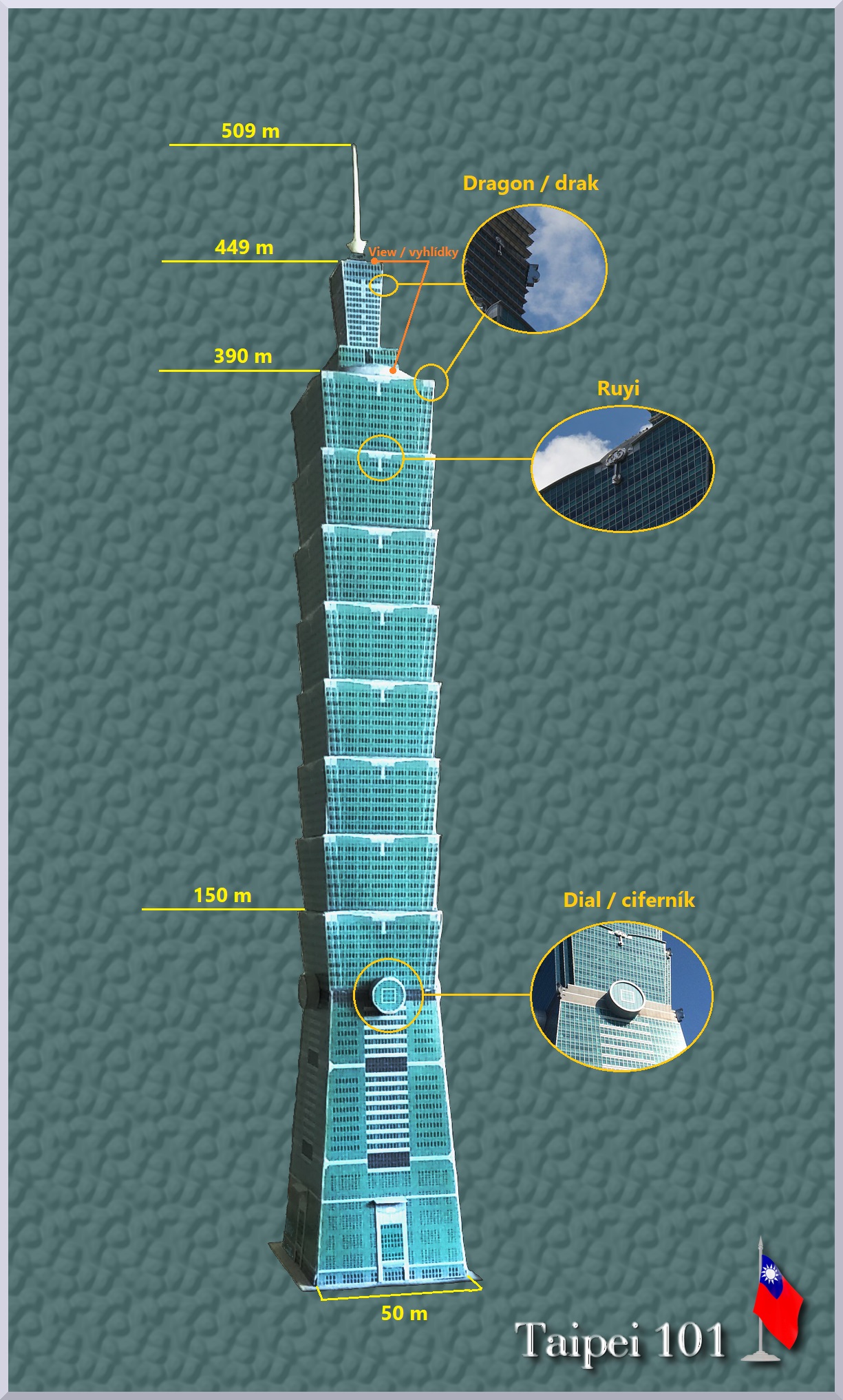
(بالتشيكية) English: Scheme of the building: individual heights, segments, symbolic facades
|
| ⧼wm-license-information-date⧽ | 2021, {{time}} – invalid date format 20 (help) |
| ⧼wm-license-information-source⧽ | ⧼Wm-license-own-work⧽ |
| ⧼wm-license-information-author⧽ | Tobartos |
50°39′04″N 14°44′14″E / 50.651046°N 14.737124°E
ترخيص
|
تاريخ الملف
اضغط على زمن/تاريخ لرؤية الملف كما بدا في هذا الزمن.
| زمن/تاريخ | صورة مصغرة | الأبعاد | مستخدم | تعليق | |
|---|---|---|---|---|---|
| حالي | ★ مراجعة معتمدة 12:01، 26 يناير 2024 | | 1٬225 × 2٬033 (549 كيلوبايت) | Pastakhov (نقاش | مساهمات) | Upload https://upload.wikimedia.org/wikipedia/commons/e/e3/Taipei_101_scheme.jpg |
لا يمكنك استبدال هذا الملف.
وصلات
لا يوجد صفحات تصل لهذه الصورة.