ملف:TT Assen.svg

حجم معاينة PNG لذلك الملف ذي الامتداد SVG: 800 × 505 بكسل. البعد الآخر: 2٬560 × 1٬616 بكسل.
الملف الأصلي (ملف SVG، أبعاده 1٬381 × 872 بكسل، حجم الملف: 59 كيلوبايت)
وصف قصير
| ⧼wm-license-information-description⧽ |
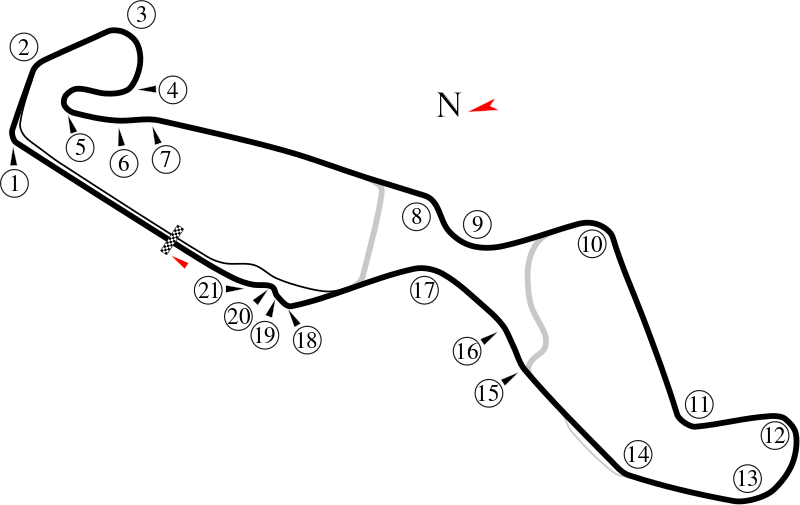
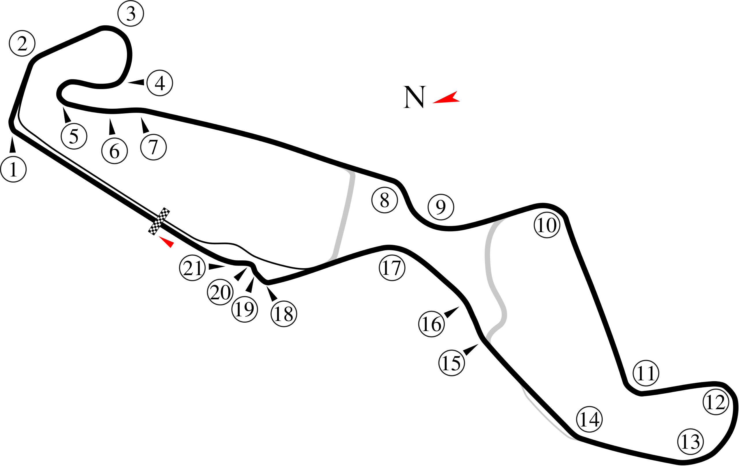
English: Track map of TT Assen. All turn numbers were assigned by the image author as no such information was available.
|
| ⧼wm-license-information-date⧽ | 8-5-2008 |
| ⧼wm-license-information-source⧽ | ⧼Wm-license-own-work⧽ |
| ⧼wm-license-information-author⧽ | Will Pittenger |
| ⧼wm-license-information-other-versions⧽ |
|
|
|
This image was created with Inkscape. |
52°57′31″N 6°31′16.5″E / 52.95861°N 6.521250°E
ترخيص
|
تاريخ الملف
اضغط على زمن/تاريخ لرؤية الملف كما بدا في هذا الزمن.
| زمن/تاريخ | صورة مصغرة | الأبعاد | مستخدم | تعليق | |
|---|---|---|---|---|---|
| حالي | ★ مراجعة معتمدة 08:36، 7 أكتوبر 2023 | | 1٬381 × 872 (59 كيلوبايت) | Pastakhov (نقاش | مساهمات) | Upload https://upload.wikimedia.org/wikipedia/commons/2/26/TT_Assen.svg |
لا يمكنك استبدال هذا الملف.
وصلات
لا يوجد صفحات تصل لهذه الصورة.