ملف:Sunningwell - geograph.org.uk - 871485.jpg
لا توجد دقة أعلى متوفرة.
Sunningwell_-_geograph.org.uk_-_871485.jpg (640 × 454 بكسل حجم الملف: 87 كيلوبايت، نوع MIME: image/jpeg)
وصف قصير
| ⧼wm-license-information-description⧽ |
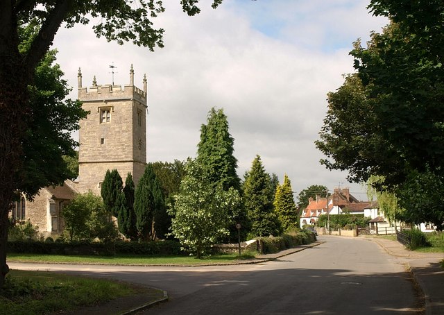
English: Sunningwell, Oxfordshire (formerly Berkshire): Sunningwell Road, the main village street, with the Church of England parish church of St Leonard on the left.
|
| ⧼wm-license-information-date⧽ | 2008 |
| ⧼wm-license-information-source⧽ | From geograph.org.uk |
| ⧼wm-license-information-author⧽ | Derek Harper |
| ⧼wm-license-cc-attribution⧽ (قالب:I18n/Credit line) |
Derek Harper / Sunningwell / |
51°42′07″N 1°17′00″W / 51.70182°N 1.2833°W قالب:Object location
_heading:247)
ترخيص
تاريخ الملف
اضغط على زمن/تاريخ لرؤية الملف كما بدا في هذا الزمن.
| زمن/تاريخ | صورة مصغرة | الأبعاد | مستخدم | تعليق | |
|---|---|---|---|---|---|
| حالي | ★ مراجعة معتمدة 20:09، 24 ديسمبر 2023 | | 640 × 454 (87 كيلوبايت) | Pastakhov (نقاش | مساهمات) | Upload https://upload.wikimedia.org/wikipedia/commons/1/16/Sunningwell_-_geograph.org.uk_-_871485.jpg |
لا يمكنك استبدال هذا الملف.
وصلات
لا يوجد صفحات تصل لهذه الصورة.