ملف:Sunda-sahul-wallacea.png
حجم هذه المعاينة: 662 × 600 بكسل.
الملف الأصلي (800 × 725 بكسل حجم الملف: 53 كيلوبايت، نوع MIME: image/png)
وصف قصير
| ⧼wm-license-information-description⧽ |
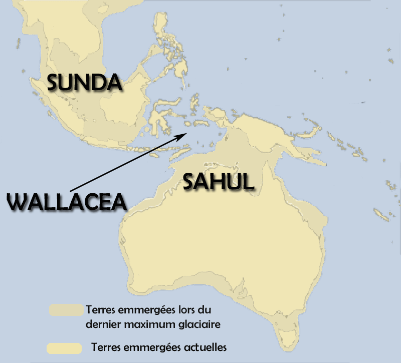
Français : Le sahul est la bande de terre emmergée lors du dernier maximum glaciaire, quand la mer était 100 m plus basse qu'aujourd'hui, et qui reliait en une masse unique la nouvelle guinnée, l'Australie et la Tasmanie.
Le Sunda regroupait la malaisie et l'ouest de l'actuelle Indonésie. Le Wallacea était la mer qui les séparait. English: Sahul (Tasmania+Australia+New-Guinea) when the sea was 100 metres under the present level.
|
| ⧼wm-license-information-date⧽ | |
| ⧼wm-license-information-source⧽ | ⧼Wm-license-own-work⧽ |
| ⧼wm-license-information-author⧽ | Christophe cagé |
| ⧼wm-license-information-other-versions⧽ |
|


ترخيص
|

تاريخ الملف
اضغط على زمن/تاريخ لرؤية الملف كما بدا في هذا الزمن.
| زمن/تاريخ | صورة مصغرة | الأبعاد | مستخدم | تعليق | |
|---|---|---|---|---|---|
| حالي | ★ مراجعة معتمدة 22:23، 16 نوفمبر 2023 | | 800 × 725 (53 كيلوبايت) | Pastakhov (نقاش | مساهمات) | Upload https://upload.wikimedia.org/wikipedia/commons/7/76/Sunda-sahul-wallacea.png |
لا يمكنك استبدال هذا الملف.
وصلات
الصفحات التالية تحتوي على وصلة لهذه الصورة: