ملف:Sub-Saharan Africa with borders.svg

حجم معاينة PNG لذلك الملف ذي الامتداد SVG: 341 × 341 بكسل. البعد الآخر: 2٬048 × 2٬048 بكسل.
الملف الأصلي (ملف SVG، أبعاده 341 × 341 بكسل، حجم الملف: 65 كيلوبايت)
وصف قصير
| ⧼wm-license-information-description⧽ |
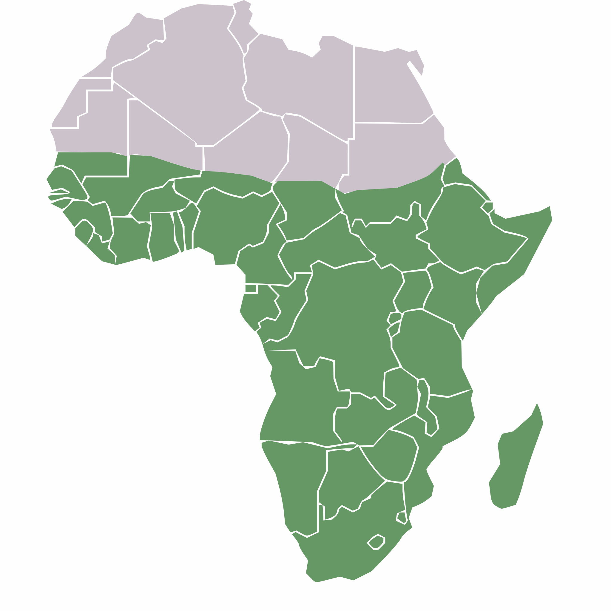
Map of sub-saharan Africa |
| ⧼wm-license-information-date⧽ | 2012-01-06 11:55 (UTC) |
| ⧼wm-license-information-source⧽ | |
| ⧼wm-license-information-author⧽ |
|
| ⧼wm-license-information-permission⧽ (⧼wm-license-information-permission-reusing-text⧽) |
Public Domain |
| [This is a retouched picture, which means that it has been digitally altered from its original version. Modifications: Converted to SVG. The original can be viewed here: Sub-Saharan-Africa.png. Modifications made by Lew Palm.] Error: {{Lang}}: text has italic markup (help)
|
ترخيص
قالب:Original upload log
This image is a derivative work of the following images:
- File:Sub-Saharan-Africa.png licensed with PD-user
- 2011-07-09T21:40:56Z Maphobbyist 341x341 (6098 Bytes) South Sudan has become independent on July 9, 2011. Sudan and South Sudan are shown with the new international border between them.
- 2007-04-08T16:20:00Z Ezeu 341x341 (3253 Bytes)
- 2006-05-29T22:21:33Z Ezeu 341x341 (3868 Bytes) == Summary == Map of Sub [[Sub-Saharan Africa]]. Mod of [[:Image:BlankMap-Africa.png]]. == Licensing == {{self2|GFDL|cc-by-sa-2.5,2.0,1.0}} [[Category:Maps of Africa]]
تاريخ الملف
اضغط على زمن/تاريخ لرؤية الملف كما بدا في هذا الزمن.
| زمن/تاريخ | صورة مصغرة | الأبعاد | مستخدم | تعليق | |
|---|---|---|---|---|---|
| حالي | ★ مراجعة معتمدة 16:53، 1 نوفمبر 2023 | | 341 × 341 (65 كيلوبايت) | Pastakhov (نقاش | مساهمات) | Upload https://upload.wikimedia.org/wikipedia/commons/f/fa/Sub-Saharan_Africa_with_borders.svg |
لا يمكنك استبدال هذا الملف.
وصلات
لا يوجد صفحات تصل لهذه الصورة.