ملف:Stevens Bridge image 6 (cropped).jpg
حجم هذه المعاينة: 798 × 114 بكسل. البعد الآخر: 3٬500 × 500 بكسل.
الملف الأصلي (3٬500 × 500 بكسل حجم الملف: 431 كيلوبايت، نوع MIME: image/jpeg)
وصف قصير
| ⧼wm-license-information-description⧽ |
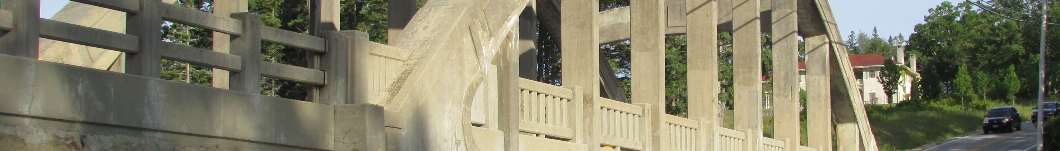
English: Stevens Bridge on state routes 172 & 175, Blue Hill, Maine. It was erected in 1926 and was named in honor of A.T. Stevens, a former selectman of Blue Hill. This bridge is located where the waters of Blue Hill Harbor and Salt Pond meet. It crosses a unique natural feature known as Blue Hill Falls. This is an unusual set of reversing falls. According to DeLorme's Maine Atlas and Gazetteer, "Insurging tide funneled by narrow channel creates high standing waves: reverse eddy along opposite side, 200 yards, runnable by raft, inner tube, canoe."
|
| ⧼wm-license-information-date⧽ | 2018, 3:11 am UTC+05:00 [refresh] |
| ⧼wm-license-information-source⧽ | ⧼Wm-license-own-work⧽ |
| ⧼wm-license-information-author⧽ | DrStew82 |
| ⧼wm-license-information-other-versions⧽ |
.jpg&action=purge)
ترخيص
|
تاريخ الملف
اضغط على زمن/تاريخ لرؤية الملف كما بدا في هذا الزمن.
| زمن/تاريخ | صورة مصغرة | الأبعاد | مستخدم | تعليق | |
|---|---|---|---|---|---|
| حالي | ★ مراجعة معتمدة 21:03، 15 يناير 2024 | 3٬500 × 500 (431 كيلوبايت) | Pastakhov (نقاش | مساهمات) | Upload https://upload.wikimedia.org/wikipedia/commons/7/75/Stevens_Bridge_image_6_%28cropped%29.jpg |
لا يمكنك استبدال هذا الملف.
وصلات
لا يوجد صفحات تصل لهذه الصورة.
.jpg&oldid=3886440)