ملف:St Andrews Road, Lhanbryde - geograph.org.uk - 389302.jpg
لا توجد دقة أعلى متوفرة.
St_Andrews_Road,_Lhanbryde_-_geograph.org.uk_-_389302.jpg (640 × 366 بكسل حجم الملف: 226 كيلوبايت، نوع MIME: image/jpeg)
وصف قصير
| ⧼wm-license-information-description⧽ |
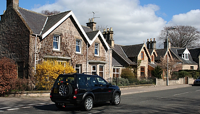
English: St Andrews Road, Lhanbryde Until the Lhanbryde bypass was opened in 1995, the occupants of these Victorian villas in the village's main street, which was the main trunk road between Aberdeen and Inverness, suffered greatly from traffic noise and pollution. Now they enjoy peace and quite close to the centre of the old village.
|
| ⧼wm-license-information-date⧽ | 2007 |
| ⧼wm-license-information-source⧽ | From geograph.org.uk |
| ⧼wm-license-information-author⧽ | Anne Burgess |
| ⧼wm-license-cc-attribution⧽ (قالب:I18n/Credit line) |
Anne Burgess / St Andrews Road, Lhanbryde / |
57°38′07″N 3°13′13″W / 57.63534°N 3.2203°W قالب:Object location
_heading:67)
ترخيص
تاريخ الملف
اضغط على زمن/تاريخ لرؤية الملف كما بدا في هذا الزمن.
| زمن/تاريخ | صورة مصغرة | الأبعاد | مستخدم | تعليق | |
|---|---|---|---|---|---|
| حالي | ★ مراجعة معتمدة 15:56، 23 يناير 2024 | | 640 × 366 (226 كيلوبايت) | Pastakhov (نقاش | مساهمات) | Upload https://upload.wikimedia.org/wikipedia/commons/1/19/St_Andrews_Road%2C_Lhanbryde_-_geograph.org.uk_-_389302.jpg |
لا يمكنك استبدال هذا الملف.
وصلات
لا يوجد صفحات تصل لهذه الصورة.