ملف:South Hampstead, Quex Road, NW6 - geograph.org.uk - 532028.jpg
لا توجد دقة أعلى متوفرة.
South_Hampstead,_Quex_Road,_NW6_-_geograph.org.uk_-_532028.jpg (640 × 480 بكسل حجم الملف: 94 كيلوبايت، نوع MIME: image/jpeg)
وصف قصير
| ⧼wm-license-information-description⧽ |
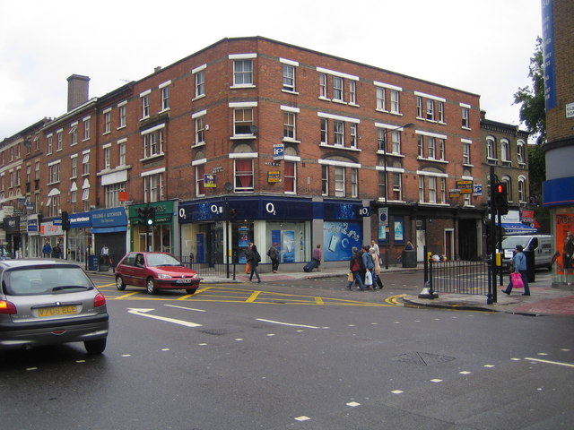
English: South Hampstead: Quex Road, NW6 In the foreground is the A5 Kilburn High Road with the intriguingly named Quex Road leading off into South Hampstead on the right.
Why Quex? Well Quex Park (TR3068 & TR3168) near Birchington in Kent was the family seat of the Powell-Cotton family who were responsible in mid-Victorian times for the building of many of the estate houses in the immediate vicinity of this part of Kilburn.
|
| ⧼wm-license-information-date⧽ | 2007 |
| ⧼wm-license-information-source⧽ | From geograph.org.uk |
| ⧼wm-license-information-author⧽ | Nigel Cox |
| ⧼wm-license-cc-attribution⧽ (قالب:I18n/Credit line) |
Nigel Cox / South Hampstead: Quex Road, NW6 / |
51°32′23″N 0°11′42″W / 51.5397°N 0.195°W قالب:Object location
_heading:45)
ترخيص
تاريخ الملف
اضغط على زمن/تاريخ لرؤية الملف كما بدا في هذا الزمن.
| زمن/تاريخ | صورة مصغرة | الأبعاد | مستخدم | تعليق | |
|---|---|---|---|---|---|
| حالي | ★ مراجعة معتمدة 12:46، 16 أكتوبر 2023 | | 640 × 480 (94 كيلوبايت) | Pastakhov (نقاش | مساهمات) | Upload https://upload.wikimedia.org/wikipedia/commons/c/c2/South_Hampstead%2C_Quex_Road%2C_NW6_-_geograph.org.uk_-_532028.jpg |
لا يمكنك استبدال هذا الملف.
وصلات
لا يوجد صفحات تصل لهذه الصورة.