ملف:Sneinton Boundary.png
حجم هذه المعاينة: 800 × 547 بكسل. البعد الآخر: 1٬558 × 1٬066 بكسل.
الملف الأصلي (1٬558 × 1٬066 بكسل حجم الملف: 1٫3 ميجابايت، نوع MIME: image/png)
وصف قصير
| ⧼wm-license-information-description⧽ |
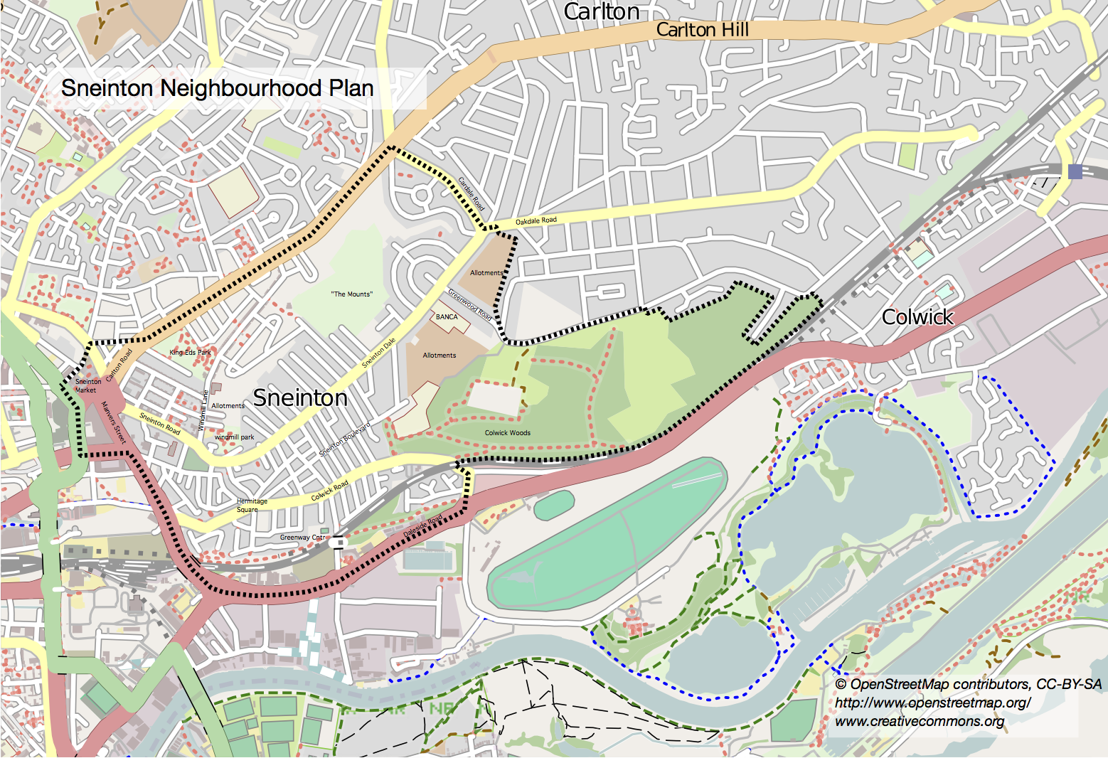
English: Sneinton (pronounced "Snenton") is a village and suburb of Nottingham, England. The area is bounded by Nottingham City Centre to the west, Bakersfield to the north, Colwick to the east, and the River Trent to the south. Sneinton now lies within the unitary authority of Nottingham, having been part of Nottinghamshire until 1877.
Sneinton has existed as a village since at least 1086, but remained relatively unchanged up until the industrial era, when the population dramatically expanded. Further social change in the post-war period left Sneinton with a multicultural character. Sneinton residents of note include William Booth, founder of The Salvation Army, and mathematician George Green, who worked Green's Mill at the top of Sneinton Hill.
|
| ⧼wm-license-information-date⧽ | 2014, {{time}} – invalid date format 14 (help) |
| ⧼wm-license-information-source⧽ | http://www.sneinton-alchemy.com/WhatWeDo/sneinton-vision/neighbourhoodplanboundary |
| ⧼wm-license-information-author⧽ | Sneinton Alchemy, OpenStreetMap contributors |
52°57′07″N 1°07′35″W / 52.9520°N 1.1265°W
ترخيص
تاريخ الملف
اضغط على زمن/تاريخ لرؤية الملف كما بدا في هذا الزمن.
| زمن/تاريخ | صورة مصغرة | الأبعاد | مستخدم | تعليق | |
|---|---|---|---|---|---|
| حالي | ★ مراجعة معتمدة 00:22، 5 أكتوبر 2023 | | 1٬558 × 1٬066 (1٫3 ميجابايت) | Pastakhov (نقاش | مساهمات) | Upload https://upload.wikimedia.org/wikipedia/commons/a/ad/Sneinton_Boundary.png |
لا يمكنك استبدال هذا الملف.
وصلات
لا يوجد صفحات تصل لهذه الصورة.