ملف:Silesia-map.svg

حجم معاينة PNG لذلك الملف ذي الامتداد SVG: 547 × 508 بكسل. البعد الآخر: 2٬205 × 2٬048 بكسل.
الملف الأصلي (ملف SVG، أبعاده 547 × 508 بكسل، حجم الملف: 306 كيلوبايت)
وصف قصير
| ⧼wm-license-information-description⧽ |
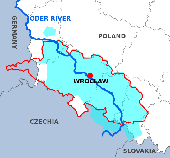
English:
Austrian Silesia before the annexation by Prussia in 1740
Prussian Silesia, 1871
Oder River
Base map is showing modern borders. |
| ⧼wm-license-information-date⧽ | 2017 |
| ⧼wm-license-information-source⧽ | ⧼Wm-license-own-work⧽ |
| ⧼wm-license-information-author⧽ | Lommes |
| ⧼wm-license-information-other-versions⧽ |
|
ترخيص
|
تاريخ الملف
اضغط على زمن/تاريخ لرؤية الملف كما بدا في هذا الزمن.
| زمن/تاريخ | صورة مصغرة | الأبعاد | مستخدم | تعليق | |
|---|---|---|---|---|---|
| حالي | ★ مراجعة معتمدة 12:44، 13 ديسمبر 2023 | | 547 × 508 (306 كيلوبايت) | Pastakhov (نقاش | مساهمات) | Upload https://upload.wikimedia.org/wikipedia/commons/0/01/Silesia-map.svg |
لا يمكنك استبدال هذا الملف.
وصلات
لا يوجد صفحات تصل لهذه الصورة.