ملف:SiegeOfQuebec1759ByDesBarres.jpg
حجم هذه المعاينة: 800 × 386 بكسل. البعدان الآخران: 2٬560 × 1٬234 بكسل | 6٬854 × 3٬304 بكسل.
الملف الأصلي (6٬854 × 3٬304 بكسل حجم الملف: 8٫58 ميجابايت، نوع MIME: image/jpeg)
وصف قصير
| ⧼wm-license-information-description⧽ |
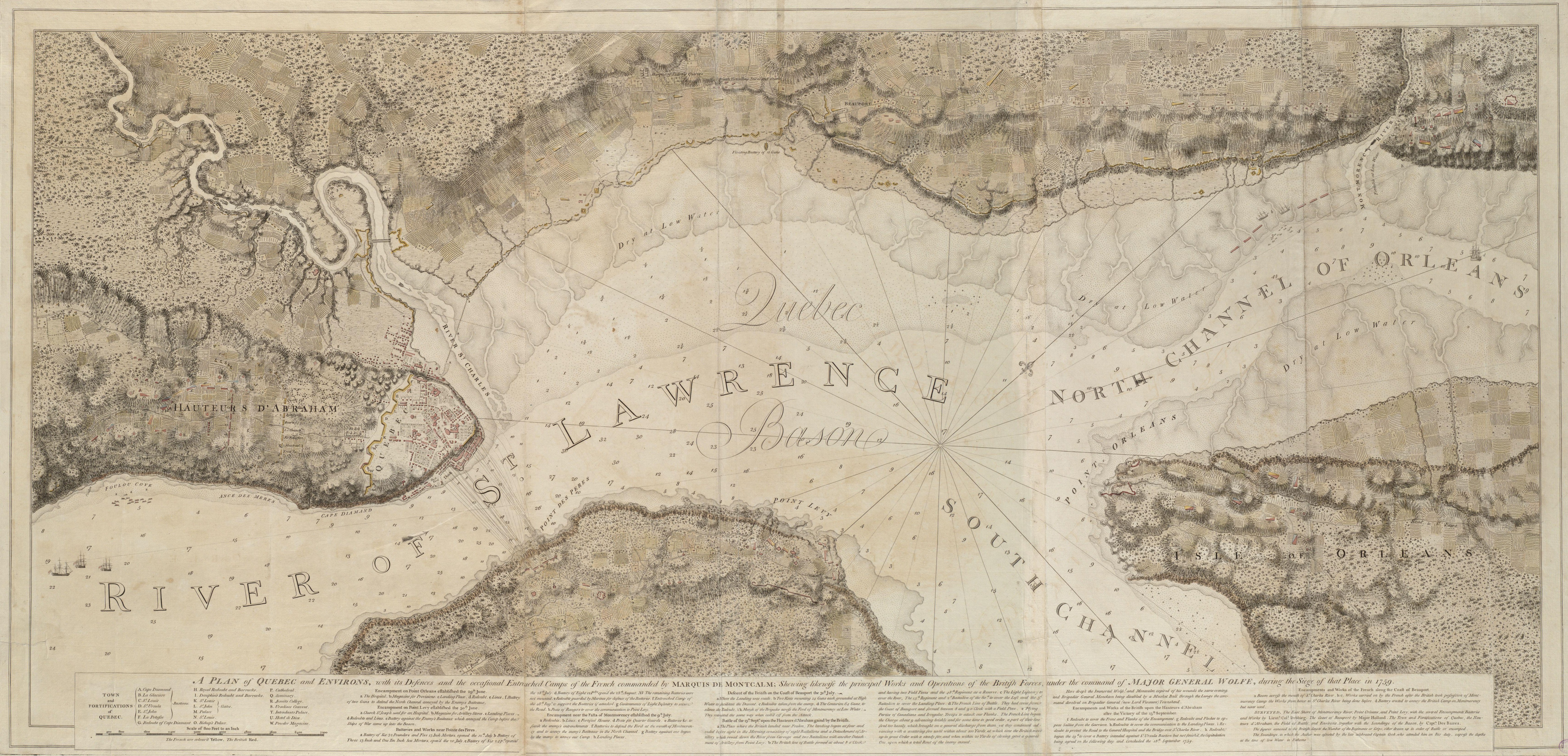
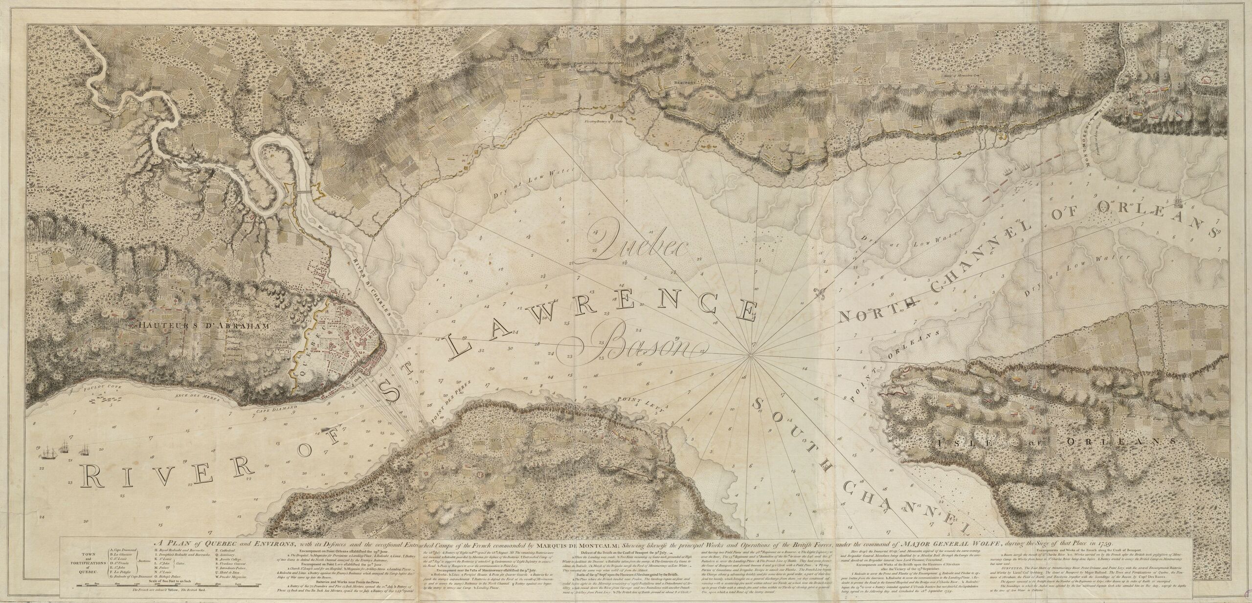
English: This is a map depicting the troop arrangements at the 1759 Siege of Quebec. The caption reads: A Plan of Quebec and Environs, with its Defenses and the occasional entrenched Camps of the French commanded by Marquis de Montcalme; shewing likewise the principal Works and Operations of the British Forces, under the command of Major General Wolfe, during the Siege of that Place in 1759.
Français : Cette carte montre la disposition des troupes durant le Siège de Québec de 1759.
|
| ⧼wm-license-information-date⧽ | قالب:Date context |
| ⧼wm-license-information-source⧽ | Boston Public Library Digital Maps Collection Call Number: G1106.P5 1777 .D4 |
| ⧼wm-license-information-author⧽ | Joseph F. W. Des Barres |
ترخيص
تاريخ الملف
اضغط على زمن/تاريخ لرؤية الملف كما بدا في هذا الزمن.
| زمن/تاريخ | صورة مصغرة | الأبعاد | مستخدم | تعليق | |
|---|---|---|---|---|---|
| حالي | ★ مراجعة معتمدة 00:45، 30 أكتوبر 2023 | | 6٬854 × 3٬304 (8٫58 ميجابايت) | Pastakhov (نقاش | مساهمات) | Upload https://upload.wikimedia.org/wikipedia/commons/a/a1/SiegeOfQuebec1759ByDesBarres.jpg |
لا يمكنك استبدال هذا الملف.
وصلات
لا يوجد صفحات تصل لهذه الصورة.