ملف:Shoreditch, Redchurch Street - geograph.org.uk - 1690177.jpg
حجم هذه المعاينة: 800 × 591 بكسل. البعدان الآخران: 2٬560 × 1٬892 بكسل | 3٬189 × 2٬357 بكسل.
الملف الأصلي (3٬189 × 2٬357 بكسل حجم الملف: 2٫36 ميجابايت، نوع MIME: image/jpeg)
وصف قصير
| ⧼wm-license-information-description⧽ |
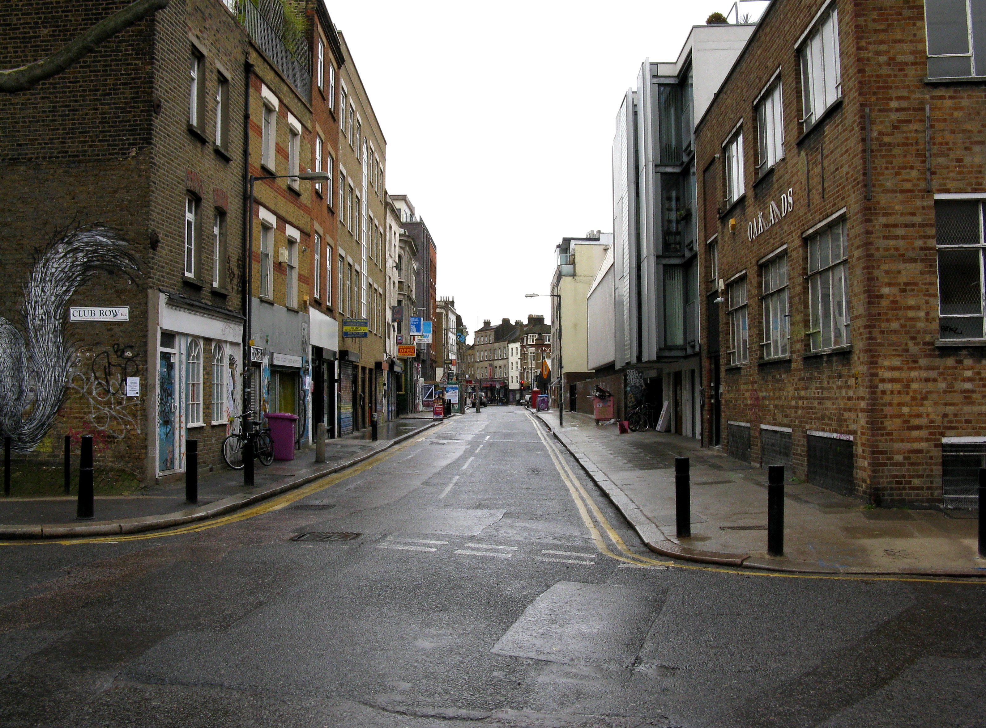
English: Shoreditch: Redchurch Street Looking west, from the Club Row junction to the junction with Shoreditch High Street. This narrow road, whose earlier name was Church Street, was, until 1879, the western outlet from Bethnal Green Road. But a new cut through was made, by demolishing what was largely slum property, from Bethnal Green Road at its junction with Church Street, to Sclater Street: the western end of the latter was widened, and with the new cut through, took the name Bethnal Green Road, which thus had acquired a new and much more practicable western outlet.
|
| ⧼wm-license-information-date⧽ | 2010 |
| ⧼wm-license-information-source⧽ | From geograph.org.uk |
| ⧼wm-license-information-author⧽ | Dr Neil Clifton |
| ⧼wm-license-cc-attribution⧽ (قالب:I18n/Credit line) |
Dr Neil Clifton / Shoreditch: Redchurch Street / |
51°31′28″N 0°04′26″W / 51.52438°N 0.0740°W قالب:Object location
_heading:247)
ترخيص
تاريخ الملف
اضغط على زمن/تاريخ لرؤية الملف كما بدا في هذا الزمن.
| زمن/تاريخ | صورة مصغرة | الأبعاد | مستخدم | تعليق | |
|---|---|---|---|---|---|
| حالي | ★ مراجعة معتمدة 02:32، 14 أكتوبر 2023 | | 3٬189 × 2٬357 (2٫36 ميجابايت) | Pastakhov (نقاش | مساهمات) | Upload https://upload.wikimedia.org/wikipedia/commons/7/71/Shoreditch%2C_Redchurch_Street_-_geograph.org.uk_-_1690177.jpg |
لا يمكنك استبدال هذا الملف.
وصلات
لا يوجد صفحات تصل لهذه الصورة.