ملف:Sharondale Road in Sharonville.jpg

حجم هذه المعاينة: 800 × 600 بكسل. البعد الآخر: 2٬272 × 1٬704 بكسل.
الملف الأصلي (2٬272 × 1٬704 بكسل حجم الملف: 2٫22 ميجابايت، نوع MIME: image/jpeg)
| ⧼wm-license-information-description⧽ |
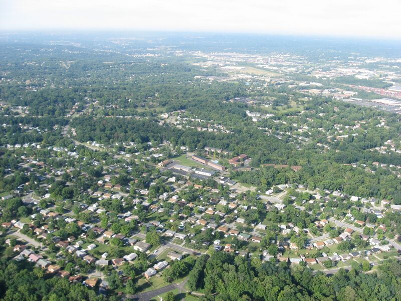
Aerial view of southern Sharonville, a city primarily in Hamilton County, Ohio, United States; although part of the city extends into Butler County, this picture is taken exclusively over Hamilton County. The church and parking lot in the center of the picture are located along Sharondale Road just north of its intersection with Elljay Drive. Picture taken from a Diamond Eclipse light airplane at an altitude of 1,740 feet MSL and a bearing of approximately 232º. |
||
| ⧼wm-license-information-date⧽ | قالب:Taken on | ||
| ⧼wm-license-information-source⧽ | ⧼Wm-license-own-work⧽ | ||
| ⧼wm-license-information-author⧽ | Nyttend | ||
| ⧼wm-license-information-permission⧽ (⧼wm-license-information-permission-reusing-text⧽) |
|
تاريخ الملف
اضغط على زمن/تاريخ لرؤية الملف كما بدا في هذا الزمن.
| زمن/تاريخ | صورة مصغرة | الأبعاد | مستخدم | تعليق | |
|---|---|---|---|---|---|
| حالي | ★ مراجعة معتمدة 07:16، 5 نوفمبر 2023 | | 2٬272 × 1٬704 (2٫22 ميجابايت) | Pastakhov (نقاش | مساهمات) | Upload https://upload.wikimedia.org/wikipedia/commons/b/b2/Sharondale_Road_in_Sharonville.jpg |
لا يمكنك استبدال هذا الملف.
وصلات
لا يوجد صفحات تصل لهذه الصورة.