ملف:Sauvie Island Bridge (second) from shoreline.jpg
حجم هذه المعاينة: 800 × 546 بكسل. البعدان الآخران: 2٬560 × 1٬746 بكسل | 3٬730 × 2٬544 بكسل.
الملف الأصلي (3٬730 × 2٬544 بكسل حجم الملف: 1٫97 ميجابايت، نوع MIME: image/jpeg)
وصف قصير
| ⧼wm-license-information-description⧽ |
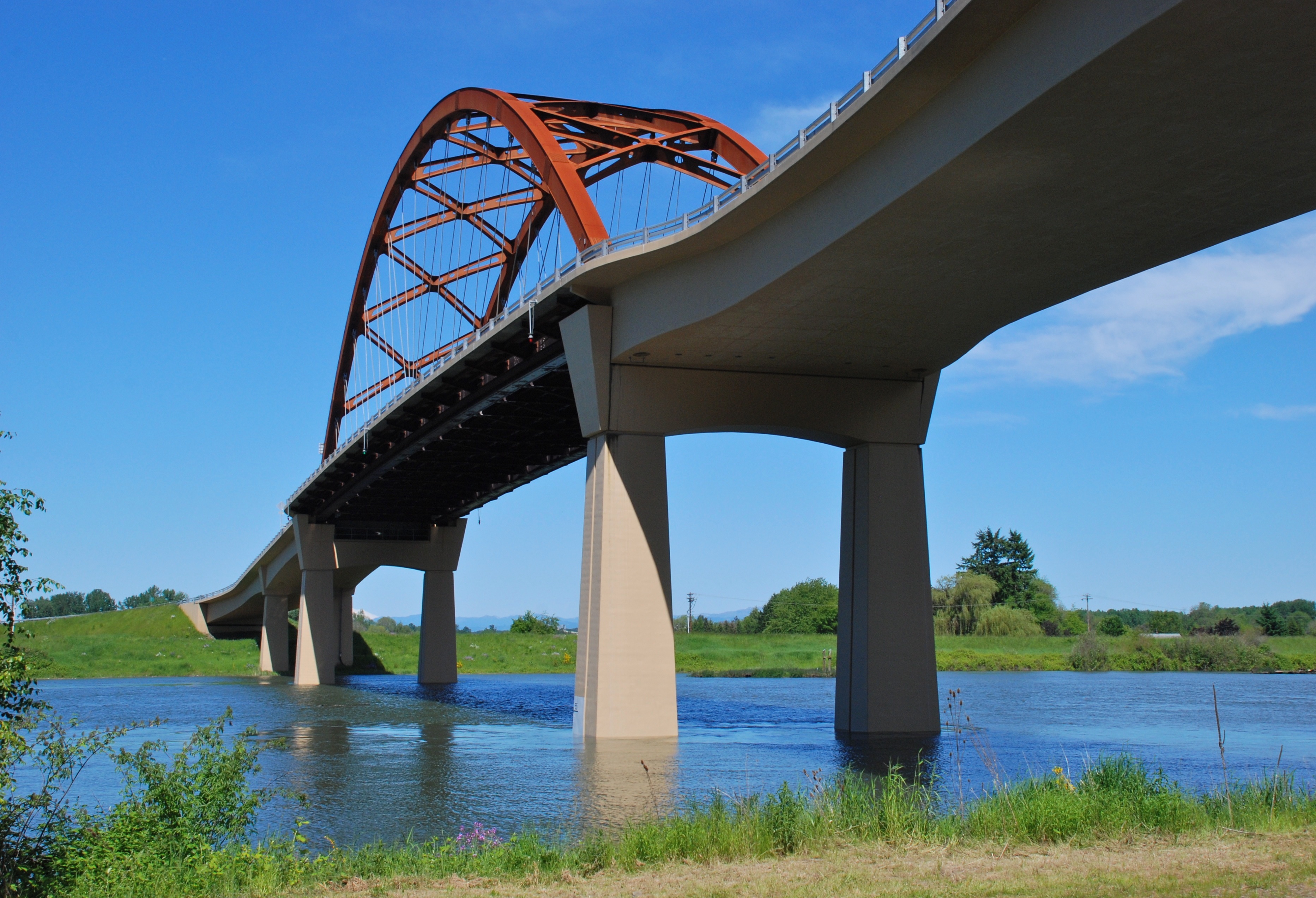
English: The second Sauvie Island Bridge (near Portland, Oregon) was built in 2008 and replaced a 1950 bridge. The bridge spans the Multnomah Channel, a distributary of the Willamette River, and this photo was taken from the channel's west bank, looking east.
|
| ⧼wm-license-information-date⧽ | 2011 |
| ⧼wm-license-information-source⧽ | ⧼Wm-license-own-work⧽ |
| ⧼wm-license-information-author⧽ | Steve Morgan |
| ⧼wm-license-information-permission⧽ (⧼wm-license-information-permission-reusing-text⧽) |
See below; user must attribute the photographer (Steve Morgan) on any reuse outside Wikipedia. |
45°37′38″N 122°49′4.2″W / 45.62722°N 122.817833°W
ترخيص
|

_from_shoreline.jpg¶ms=45_37_38_N_122_49_4.2_W_)
تاريخ الملف
اضغط على زمن/تاريخ لرؤية الملف كما بدا في هذا الزمن.
| زمن/تاريخ | صورة مصغرة | الأبعاد | مستخدم | تعليق | |
|---|---|---|---|---|---|
| حالي | ★ مراجعة معتمدة 13:50، 7 أكتوبر 2023 | | 3٬730 × 2٬544 (1٫97 ميجابايت) | Pastakhov (نقاش | مساهمات) | Upload https://upload.wikimedia.org/wikipedia/commons/e/e1/Sauvie_Island_Bridge_%28second%29_from_shoreline.jpg |
لا يمكنك استبدال هذا الملف.
وصلات
لا يوجد صفحات تصل لهذه الصورة.
_from_shoreline.jpg&oldid=3017781)