ملف:Sarasota-Bradenton-Punta Gorda CSA.png
لا توجد دقة أعلى متوفرة.
Sarasota-Bradenton-Punta_Gorda_CSA.png (511 × 499 بكسل حجم الملف: 25 كيلوبايت، نوع MIME: image/png)
| ⧼wm-license-information-description⧽ |
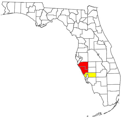
Locator map of the Sarasota-Bradenton-Punta Gorda Combined Statistical Area along the Gulf Coast of the U.S. state of Florida. The two components of the CSA are colored separately: |
||
| ⧼wm-license-information-date⧽ | 2008 | ||
| ⧼wm-license-information-source⧽ | Modified from this United States Census Bureau file, based on the following Census definitions lists: | ||
| ⧼wm-license-information-author⧽ | User:Nyttend | ||
| ⧼wm-license-information-permission⧽ (⧼wm-license-information-permission-reusing-text⧽) |
US Government work is public domain, and my work is |
تاريخ الملف
اضغط على زمن/تاريخ لرؤية الملف كما بدا في هذا الزمن.
| زمن/تاريخ | صورة مصغرة | الأبعاد | مستخدم | تعليق | |
|---|---|---|---|---|---|
| حالي | ★ مراجعة معتمدة 09:35، 15 ديسمبر 2023 | | 511 × 499 (25 كيلوبايت) | Pastakhov (نقاش | مساهمات) | Upload https://upload.wikimedia.org/wikipedia/commons/9/99/Sarasota-Bradenton-Punta_Gorda_CSA.png |
لا يمكنك استبدال هذا الملف.
وصلات
لا يوجد صفحات تصل لهذه الصورة.