ملف:Santa Cruz County Incorporated and Unincorporated areas Patagonia highlighted.svg

حجم معاينة PNG لذلك الملف ذي الامتداد SVG: 800 × 424 بكسل. البعد الآخر: 2٬560 × 1٬355 بكسل.
الملف الأصلي (ملف SVG، أبعاده 850 × 450 بكسل، حجم الملف: 42 كيلوبايت)
وصف قصير
| ⧼wm-license-information-description⧽ |
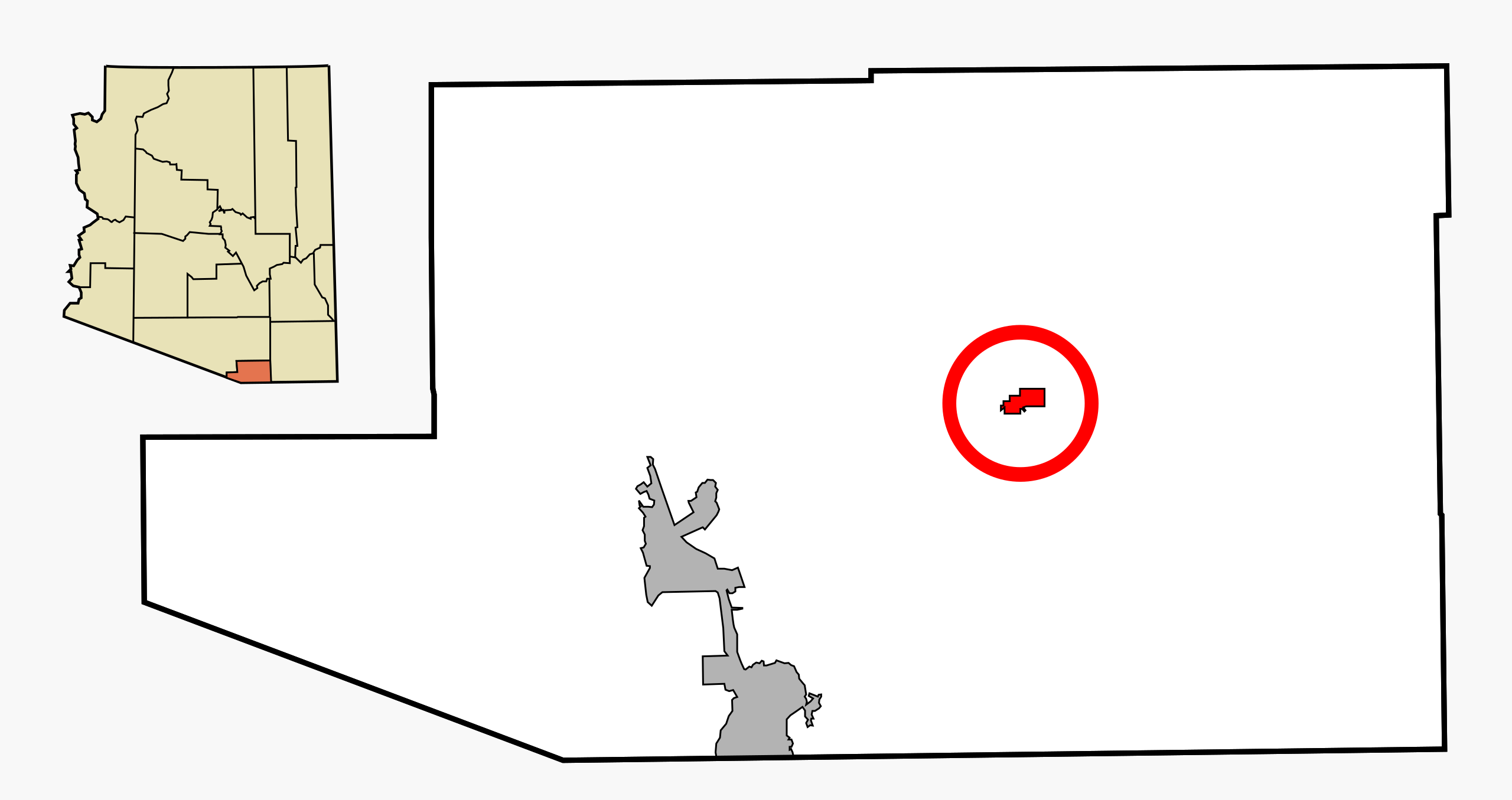
This map shows the incorporated areas and unincorporated areas in Santa Cruz County, Arizona. Patagonia is highlighted in red. Incorporated cities are shown in gray and unincorporated communities or CDPs are shown in white. Data for the borders and locations are based on files from the SouthEastern Arizona Governments Organization HPMS Maps and Records and maps from the US Census Bureau TIGER Map Server. I created this map in Inkscape. |
| ⧼wm-license-information-date⧽ | 2007 |
| ⧼wm-license-information-source⧽ | My own work, based on public domain information |
| ⧼wm-license-information-author⧽ | Ixnayonthetimmay |
| ⧼wm-license-information-permission⧽ (⧼wm-license-information-permission-reusing-text⧽) |
All rights not reserved. See below. |
| ⧼wm-license-information-other-versions⧽ |
See Category:Maps of Santa Cruz County for other versions of this image. |
ترخيص
تاريخ الملف
اضغط على زمن/تاريخ لرؤية الملف كما بدا في هذا الزمن.
| زمن/تاريخ | صورة مصغرة | الأبعاد | مستخدم | تعليق | |
|---|---|---|---|---|---|
| حالي | ★ مراجعة معتمدة 03:23، 2 نوفمبر 2023 | | 850 × 450 (42 كيلوبايت) | Pastakhov (نقاش | مساهمات) | Upload https://upload.wikimedia.org/wikipedia/commons/f/f9/Santa_Cruz_County_Incorporated_and_Unincorporated_areas_Patagonia_highlighted.svg |
لا يمكنك استبدال هذا الملف.
وصلات
لا يوجد صفحات تصل لهذه الصورة.