ملف:San Gorgonio Mountain.jpg

حجم هذه المعاينة: 640 × 600 بكسل. البعد الآخر: 2٬180 × 2٬043 بكسل.
الملف الأصلي (2٬180 × 2٬043 بكسل حجم الملف: 3٫65 ميجابايت، نوع MIME: image/jpeg)
| ⧼wm-license-information-description⧽ |
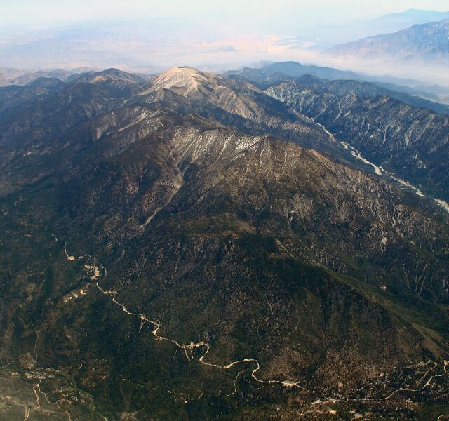
Mt. San Gorgonio, the highest mountain in Southern California. Its summit at 11,502 feet rises 8,282 above its surroundings, making it the 7th most topographically prominent mountain in the U.S. Highway 38 skrts its north side, on the left. Valley of the Falls marks its southern boundary. Snow-capped for much of the winter it still retained streaks of white when this shot was made on May 2, 2007. |
||
| ⧼wm-license-information-date⧽ | 2007, {{time}} – invalid date format 08 (help) | ||
| ⧼wm-license-information-source⧽ | originally posted to Flickr as 2007_05_01-2_lhr-lax_344.JPG | ||
| ⧼wm-license-information-author⧽ | Doc Searls | ||
| ⧼wm-license-information-permission⧽ (⧼wm-license-information-permission-reusing-text⧽) |
مستخدم:Flickr upload bot/upload |
تاريخ الملف
اضغط على زمن/تاريخ لرؤية الملف كما بدا في هذا الزمن.
| زمن/تاريخ | صورة مصغرة | الأبعاد | مستخدم | تعليق | |
|---|---|---|---|---|---|
| حالي | ★ مراجعة معتمدة 18:06، 17 نوفمبر 2023 | | 2٬180 × 2٬043 (3٫65 ميجابايت) | Pastakhov (نقاش | مساهمات) | Upload https://upload.wikimedia.org/wikipedia/commons/b/bb/San_Gorgonio_Mountain.jpg |
لا يمكنك استبدال هذا الملف.
وصلات
لا يوجد صفحات تصل لهذه الصورة.