ملف:Saadiens - Carte fin XVIe siècle (revised).jpg
حجم هذه المعاينة: 690 × 599 بكسل. البعد الآخر: 1٬575 × 1٬368 بكسل.
الملف الأصلي (1٬575 × 1٬368 بكسل حجم الملف: 192 كيلوبايت، نوع MIME: image/jpeg)
وصف قصير
| ⧼wm-license-information-description⧽ |
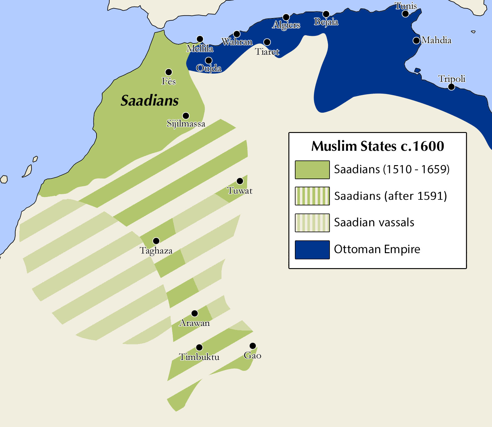
English: Extent of the Saadian empire during the reign of Ahmad al-Mansur.
Notes: Map is the same as earlier map uploaded to Commons (Saadiens - Carte fin XVIe siècle.jpg) by Askelaadden, but with minor revisions to clarify the legend and status of some areas, as per the original map in the cited source (Sluglett & Currie 2014).
|
| ⧼wm-license-information-date⧽ | 2021, {{time}} – invalid date format 45 (help) |
| ⧼wm-license-information-source⧽ | "Saadiens - Carte fin XVIe siècle.jpg" on Wiki Commons, based on the "Atlas of Islamic History" by Peter Sluglett and Andrew Currie (2014) (Map 33 on p.58) |
| ⧼wm-license-information-author⧽ | Askelaadden (minor revisions by R Prazeres) |
ترخيص
|
|
هذا العمل مرخّص تحت رخصة المشاع الإبداعي الملزمة بنسبة العمل لمؤلفه وبترخيص الأعمال المشتقة بالمثل 4.0. |
تاريخ الملف
اضغط على زمن/تاريخ لرؤية الملف كما بدا في هذا الزمن.
| زمن/تاريخ | صورة مصغرة | الأبعاد | مستخدم | تعليق | |
|---|---|---|---|---|---|
| حالي | ★ مراجعة معتمدة 07:15، 3 ديسمبر 2023 | | 1٬575 × 1٬368 (192 كيلوبايت) | Pastakhov (نقاش | مساهمات) | Upload https://upload.wikimedia.org/wikipedia/commons/e/e5/Saadiens_-_Carte_fin_XVIe_si%C3%A8cle_%28revised%29.jpg |
لا يمكنك استبدال هذا الملف.
وصلات
لا يوجد صفحات تصل لهذه الصورة.
.jpg&oldid=3676491)