ملف:Ruins of Leswalt Old Church - geograph.org.uk - 1725611.jpg
لا توجد دقة أعلى متوفرة.
Ruins_of_Leswalt_Old_Church_-_geograph.org.uk_-_1725611.jpg (640 × 477 بكسل حجم الملف: 377 كيلوبايت، نوع MIME: image/jpeg)
وصف قصير
| ⧼wm-license-information-description⧽ |
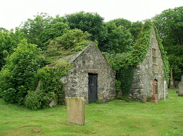
English: Ruins of Leswalt Old Church Not much of the medieval parish church remains standing. The main part, the nave, would have been just behind the building on the right, where a mass of vegetation is now growing. The taller gable is part of the Agnew aisle, added during the 17th century. The window was to the "Laird's Loft", a private gallery for the Agnew family of Lochnaw Castle. For more information see http://canmore.rcahms.gov.uk/en/site/60841/details/leswalt+old+parish+church+and+burial+ground/ .
|
| ⧼wm-license-information-date⧽ | 2008 |
| ⧼wm-license-information-source⧽ | From geograph.org.uk |
| ⧼wm-license-information-author⧽ | Rose and Trev Clough |
| ⧼wm-license-cc-attribution⧽ (قالب:I18n/Credit line) |
Rose and Trev Clough / Ruins of Leswalt Old Church / |
54°55′48″N 5°05′54″W / 54.93000°N 5.0982°W قالب:Object location
_heading:225)
ترخيص
تاريخ الملف
اضغط على زمن/تاريخ لرؤية الملف كما بدا في هذا الزمن.
| زمن/تاريخ | صورة مصغرة | الأبعاد | مستخدم | تعليق | |
|---|---|---|---|---|---|
| حالي | ★ مراجعة معتمدة 22:56، 26 أكتوبر 2023 | | 640 × 477 (377 كيلوبايت) | Pastakhov (نقاش | مساهمات) | Upload https://upload.wikimedia.org/wikipedia/commons/0/0e/Ruins_of_Leswalt_Old_Church_-_geograph.org.uk_-_1725611.jpg |
لا يمكنك استبدال هذا الملف.
وصلات
لا يوجد صفحات تصل لهذه الصورة.