ملف:Ruined houses - geograph.org.uk - 507482.jpg
لا توجد دقة أعلى متوفرة.
Ruined_houses_-_geograph.org.uk_-_507482.jpg (640 × 479 بكسل حجم الملف: 110 كيلوبايت، نوع MIME: image/jpeg)
وصف قصير
| ⧼wm-license-information-description⧽ |
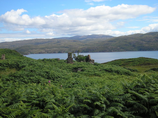
English: Ruined houses Ruined houses on largest island of the crowlin islands, chimney stack is still standing, about 5 other houses nearby, the house with the chimney is the largest. Bracken hides most houses in summer.
|
| ⧼wm-license-information-date⧽ | 2007 |
| ⧼wm-license-information-source⧽ | From geograph.org.uk |
| ⧼wm-license-information-author⧽ | Conor Bolas |
| ⧼wm-license-cc-attribution⧽ (قالب:I18n/Credit line) |
Conor Bolas / Ruined houses / |
57°20′51″N 5°49′59″W / 57.34760°N 5.8330°W قالب:Object location
_heading:45)
ترخيص
تاريخ الملف
اضغط على زمن/تاريخ لرؤية الملف كما بدا في هذا الزمن.
| زمن/تاريخ | صورة مصغرة | الأبعاد | مستخدم | تعليق | |
|---|---|---|---|---|---|
| حالي | ★ مراجعة معتمدة 09:18، 13 أكتوبر 2023 | | 640 × 479 (110 كيلوبايت) | Pastakhov (نقاش | مساهمات) | Upload https://upload.wikimedia.org/wikipedia/commons/9/9d/Ruined_houses_-_geograph.org.uk_-_507482.jpg |
لا يمكنك استبدال هذا الملف.
وصلات
لا يوجد صفحات تصل لهذه الصورة.