ملف:Route of the 1957 Tour de France.png
حجم هذه المعاينة: 598 × 599 بكسل. البعدان الآخران: 2٬044 × 2٬048 بكسل | 3٬198 × 3٬204 بكسل.
الملف الأصلي (3٬198 × 3٬204 بكسل حجم الملف: 2٫63 ميجابايت، نوع MIME: image/png)
وصف قصير
| ⧼wm-license-information-description⧽ |
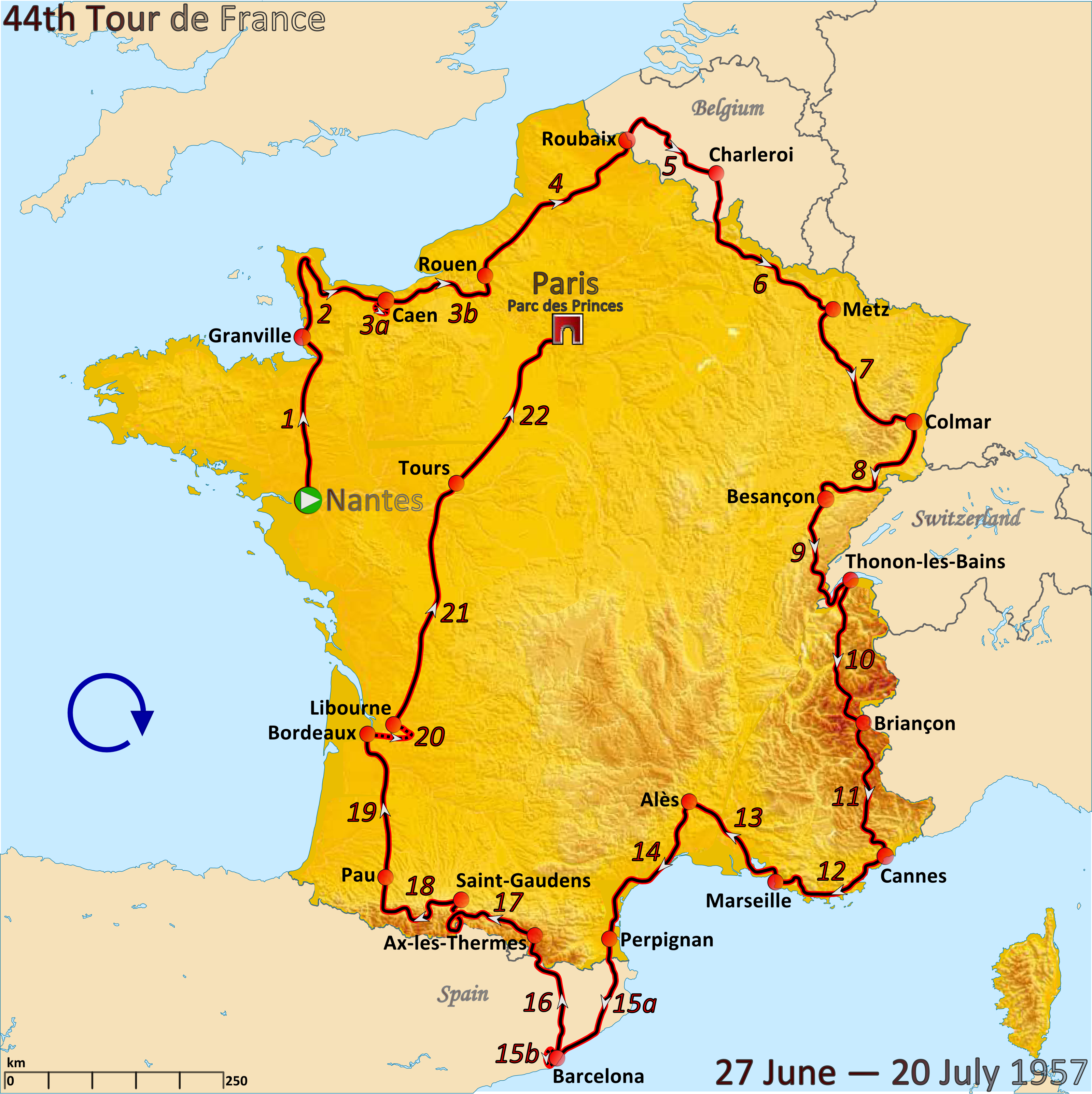
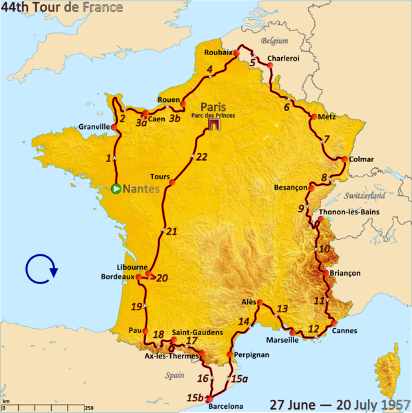
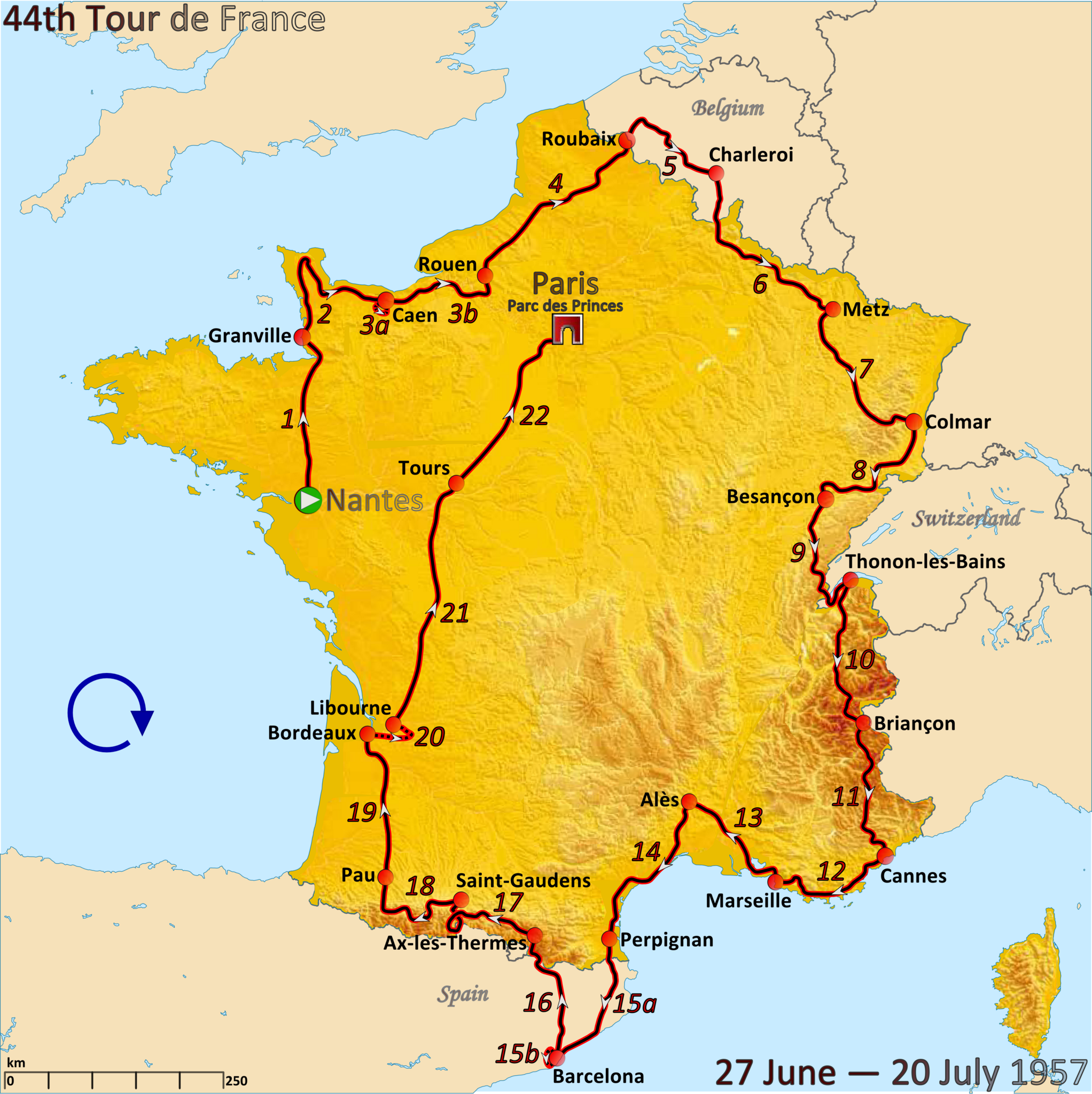
English: Map of the 1957 Tour de France created in Inkscape using accurate stage maps from touratlas.nl.
|
| ⧼wm-license-information-date⧽ | 2018 |
| ⧼wm-license-information-source⧽ | ⧼Wm-license-own-work⧽ |
| ⧼wm-license-information-author⧽ | Andrei Loas |
ترخيص
|
تاريخ الملف
اضغط على زمن/تاريخ لرؤية الملف كما بدا في هذا الزمن.
| زمن/تاريخ | صورة مصغرة | الأبعاد | مستخدم | تعليق | |
|---|---|---|---|---|---|
| حالي | ★ مراجعة معتمدة 22:06، 15 أكتوبر 2023 | | 3٬198 × 3٬204 (2٫63 ميجابايت) | Pastakhov (نقاش | مساهمات) | Upload https://upload.wikimedia.org/wikipedia/commons/4/45/Route_of_the_1957_Tour_de_France.png |
لا يمكنك استبدال هذا الملف.
وصلات
لا يوجد صفحات تصل لهذه الصورة.