ملف:Rodrigues Strassenkarte de.png
حجم هذه المعاينة: 637 × 600 بكسل. البعد الآخر: 1٬700 × 1٬600 بكسل.
الملف الأصلي (1٬700 × 1٬600 بكسل حجم الملف: 836 كيلوبايت، نوع MIME: image/png)
| ⧼wm-license-information-description⧽ |
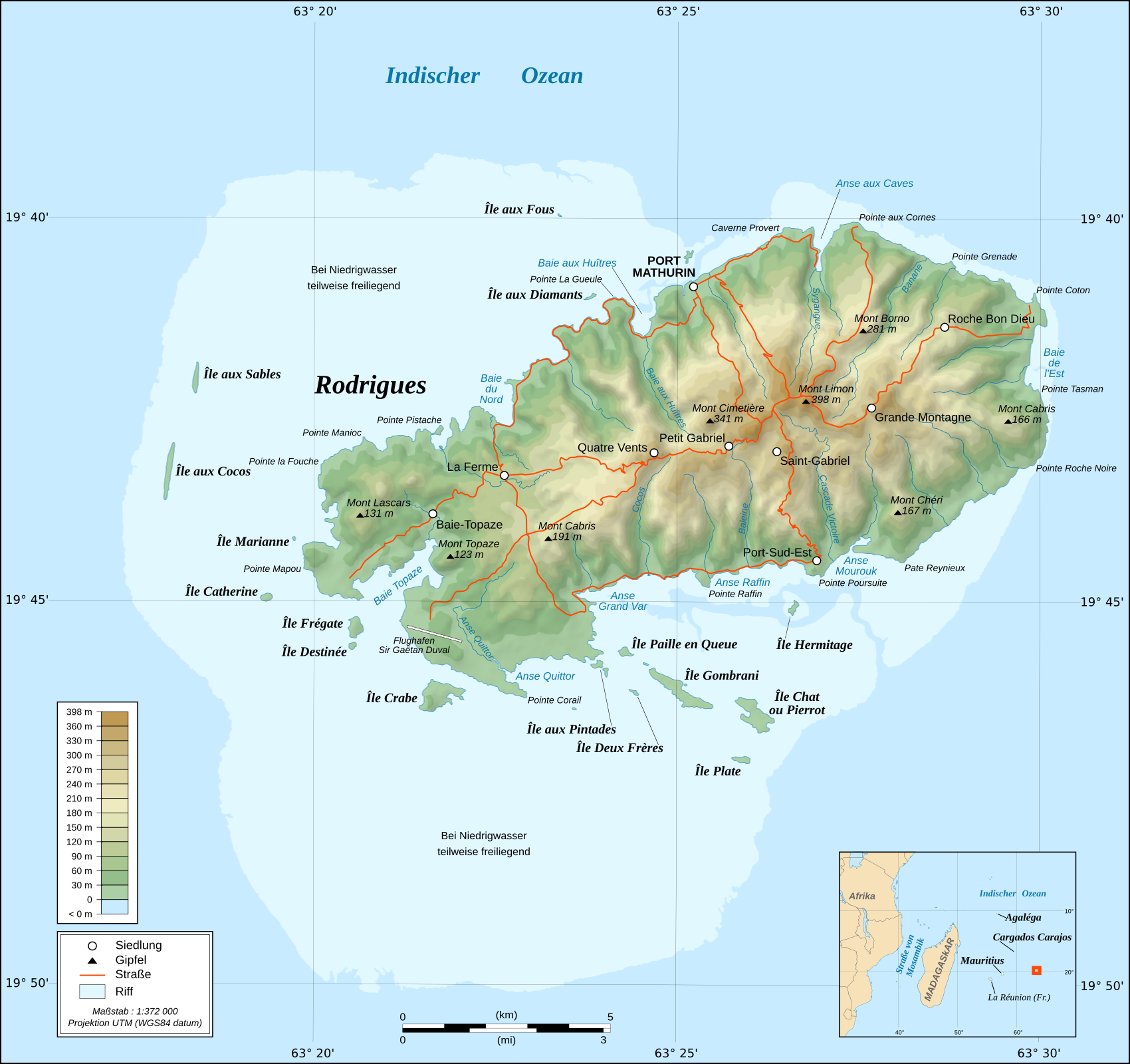
English: Topographic map in French of Rodrigues Island, Mauritius Scale : 1:372,000 (accuracy : about 93 m) ; Printing size : 7.79 x 7.33 cm ; Note : The background map is a raster image embedded in the SVG file. Français : Carte topographique en français de l'île de Rodrigues, Maurice ; UTM projection ; WGS84 datum ; shaded relief (composite image of N-W, W and N lightning positions) ;Échelle : 1:372 000 (précision : environ 93 m) ; Taille d'impression : 7,79 x 7,33 cm ; Note : Le fond de carte est une image bitmap embarquée dans le fichier SVG. Geographic limits of the map: *West : 63° 15' 34.66" E *East : 63° 31' 14.68" E *North : 19° 37' 09.97" S *South : 19° 51' 02.05" S |
| ⧼wm-license-information-date⧽ | 2010-06-29 09:33 (UTC) |
| ⧼wm-license-information-source⧽ | |
| ⧼wm-license-information-author⧽ |
|
|

قالب:Original upload log
This image is a derivative work of the following images:
- File:Rodrigues_Island_topographic_map-fr.svg licensed with Cc-by-sa-3.0,2.5,2.0,1.0, GFDL
- 2008-09-06T02:29:37Z Sting 1700x1600 (1025524 Bytes) Adding roads and other labels ; new standard colors
- 2008-05-14T03:46:05Z Sting 1700x1600 (782832 Bytes) == Summary == {{Location|19|43|00|S|63|25|00|E|scale:200000}} {{Information |Description={{en|Topographic map in French of [[:en:Rodrigues (island)|Rodrigues Island]], [[:en:Mauritius|Mauritius]]}} {{fr|Carte topographique e
تاريخ الملف
اضغط على زمن/تاريخ لرؤية الملف كما بدا في هذا الزمن.
| زمن/تاريخ | صورة مصغرة | الأبعاد | مستخدم | تعليق | |
|---|---|---|---|---|---|
| حالي | ★ مراجعة معتمدة 02:33، 20 يناير 2024 | | 1٬700 × 1٬600 (836 كيلوبايت) | Pastakhov (نقاش | مساهمات) | Upload https://upload.wikimedia.org/wikipedia/commons/8/82/Rodrigues_Strassenkarte_de.png |
لا يمكنك استبدال هذا الملف.
وصلات
لا يوجد صفحات تصل لهذه الصورة.