ملف:Rankin River.jpg

الملف الأصلي (1٬024 × 683 بكسل حجم الملف: 402 كيلوبايت، نوع MIME: image/jpeg)
وصف قصير
| ⧼wm-license-information-description⧽ |
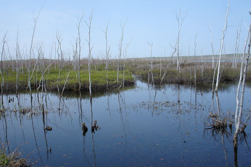
Located at the waist of the Bruce Peninsula, sections of the present day canoe route were utilized for hundreds of years by Indians traveling between Georgian Bay and Lake Huron. Missionaries and early settlers also used the route to avoid the long, perilous journey by water around the Bruce Peninsula. Lumbering reached the area in the 1860's. Square timber and saw logs were floated down the Rankin River to Lake Huron. Twenty years later, the steamer "Water Witch" towed rafts of saw logs from Sky, Isaac, and Boat Lakes towards the mill at Sauble Falls. In an attempt to reclaim possible agricultural land, a 1921 drainage project was abandoned when the soil was found to be unworkable. In 1961, the Sauble Valley Conservation Authority constructed a dam on the lower Rankin River to control the wildly fluctuating lake levels and to restore the valuable wetland habitat for increased wildlife potential. This trip is a must for anyone with an interest in viewing flora and fauna in its natural habitat. Basic canoeing or kayaking skill is recommended. |
| ⧼wm-license-information-date⧽ | 2007, {{time}} – invalid date format 54 (help) |
| ⧼wm-license-information-source⧽ | Rankin River
|
| ⧼wm-license-information-author⧽ | Jocelyn from Mississauga, Canada |
ترخيص
تاريخ الملف
اضغط على زمن/تاريخ لرؤية الملف كما بدا في هذا الزمن.
| زمن/تاريخ | صورة مصغرة | الأبعاد | مستخدم | تعليق | |
|---|---|---|---|---|---|
| حالي | ★ مراجعة معتمدة 02:15، 16 نوفمبر 2023 | | 1٬024 × 683 (402 كيلوبايت) | Pastakhov (نقاش | مساهمات) | Upload https://upload.wikimedia.org/wikipedia/commons/1/10/Rankin_River.jpg |
لا يمكنك استبدال هذا الملف.
وصلات
لا يوجد صفحات تصل لهذه الصورة.