ملف:Queen Elizabeth Islands 2009-08-27 (MODIS).jpg
الملف الأصلي (5٬600 × 4٬400 بكسل حجم الملف: 4٫33 ميجابايت، نوع MIME: image/jpeg)
| ⧼wm-license-information-description⧽ |
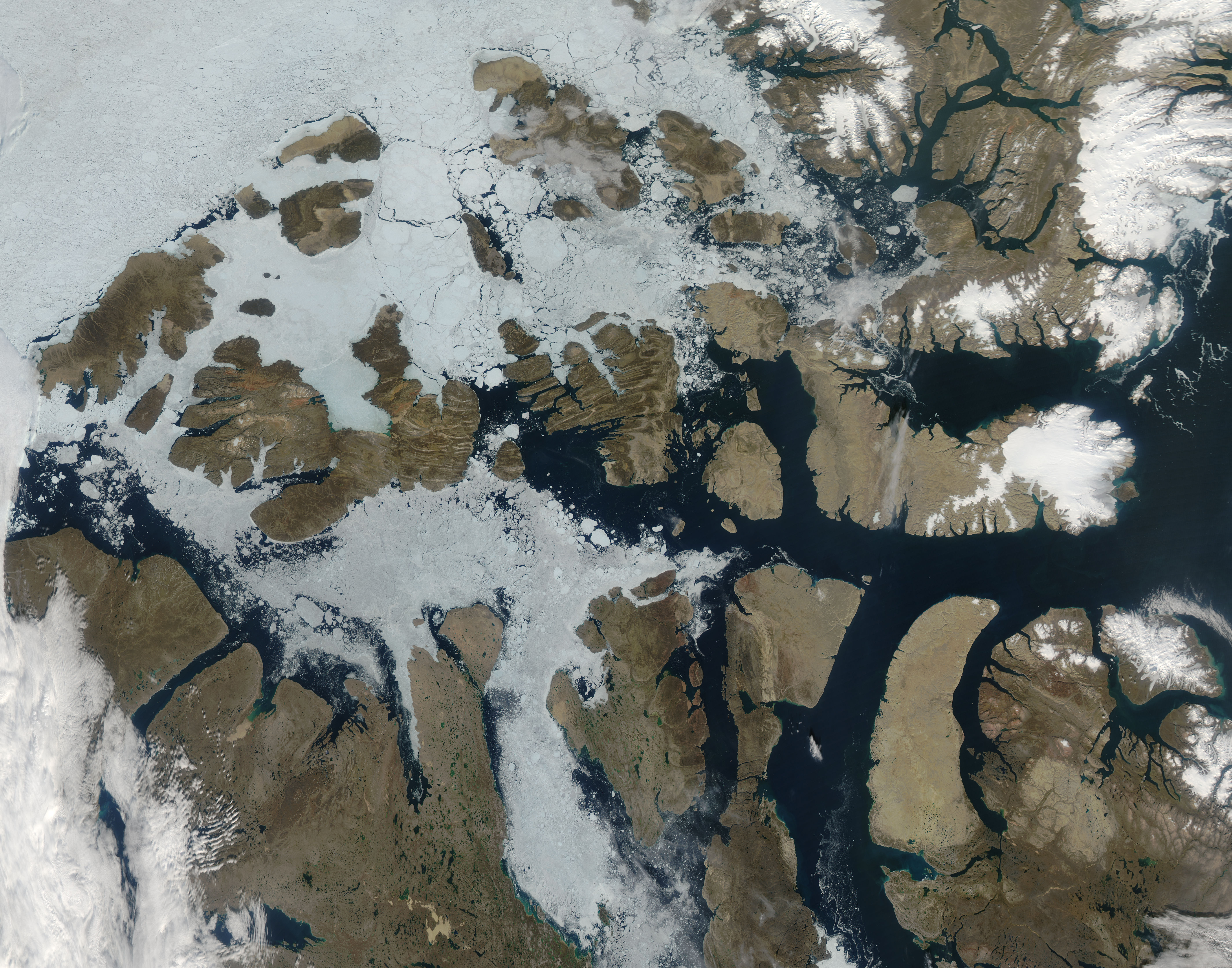
The fact that it is late summer is apparent in this image of the Queen Elizabeth Islands, located in northern Canada. This image was captured by the MODIS on the Aqua satellite on August 27, 2009. In past images of this region, captured in earlier months (i.e., May and June of 2001), the ice around the islands is shown just starting to break up. In this image from August, much of the ice is broken up and blue water is visible, as well as brown terrain. The Queen Elizabeth islands are the most northern group of islands in the Canadian Arctic Archipelago. This grouping used to be called the Parry Islands. After the name change in 1953, the Parry Islands only refers to the most southern part of the archipelago. The largest island is Ellesmere, located in the north, separated from Greenland by the Nares Strait. |
| ⧼wm-license-information-date⧽ | 2009 |
| ⧼wm-license-information-source⧽ | http://modis.gsfc.nasa.gov/gallery/individual.php?db_date=2009-09-08 |
| ⧼wm-license-information-author⧽ | Jeff Schmaltz MODIS Land Rapid Response Team, NASA GSFC |
| ⧼wm-license-information-permission⧽ (⧼wm-license-information-permission-reusing-text⧽) |
تاريخ الملف
اضغط على زمن/تاريخ لرؤية الملف كما بدا في هذا الزمن.
| زمن/تاريخ | صورة مصغرة | الأبعاد | مستخدم | تعليق | |
|---|---|---|---|---|---|
| حالي | ★ مراجعة معتمدة 12:18، 14 نوفمبر 2023 | | 5٬600 × 4٬400 (4٫33 ميجابايت) | Pastakhov (نقاش | مساهمات) | Upload https://upload.wikimedia.org/wikipedia/commons/f/f0/Queen_Elizabeth_Islands_2009-08-27_%28MODIS%29.jpg |
لا يمكنك استبدال هذا الملف.
وصلات
لا يوجد صفحات تصل لهذه الصورة.
.jpg&oldid=3524117)