ملف:Prairie D'Ane Battlefield Arkansas.jpg
الملف الأصلي (1٬060 × 810 بكسل حجم الملف: 453 كيلوبايت، نوع MIME: image/jpeg)
وصف قصير
| ⧼wm-license-information-description⧽ |
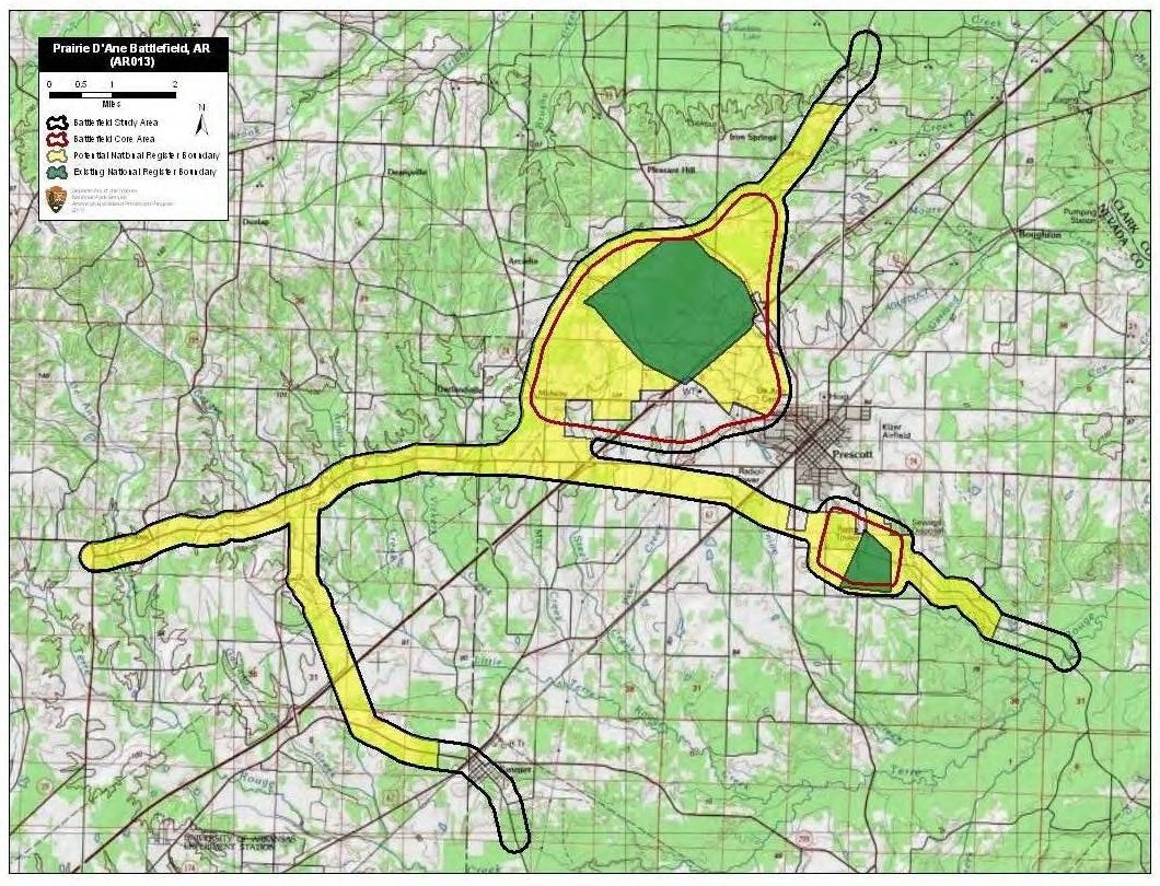
English: Map of battlefield core and study areas.
The ABPP revised the Study Area to reflect more accurately troop movements, lines of battle, locations of Confederate earthworks, approach and withdrawal routes, and the landscape of the Prairie D'Ane. Routes added include Steele's approach from the north from his encampment on the Cornelius Farm; Price's approach from the west from Washington (he also withdrew along this route); Steele's withdrawal to the east toward Camden; and Brigadier General John Marmaduke's withdrawal route to the south towards Prairie De Rohan. All routes saw skirmishing among various elements of both forces. The larger Core Area was shifted to the west along the historic road alignment. It was also widened to encompass lines of battle over several days as well as the Confederate earthworks near present day Midway. The smaller Core Area represents “The Battle of Moscow," a rearguard engagement around and in the town of Moscow. |
| ⧼wm-license-information-date⧽ | 2011 |
| ⧼wm-license-information-source⧽ | National Park Service |
| ⧼wm-license-information-author⧽ | American Battlefield Protection Program |
ترخيص
تاريخ الملف
اضغط على زمن/تاريخ لرؤية الملف كما بدا في هذا الزمن.
| زمن/تاريخ | صورة مصغرة | الأبعاد | مستخدم | تعليق | |
|---|---|---|---|---|---|
| حالي | ★ مراجعة معتمدة 16:26، 22 يناير 2024 | | 1٬060 × 810 (453 كيلوبايت) | Pastakhov (نقاش | مساهمات) | Upload https://upload.wikimedia.org/wikipedia/commons/1/1d/Prairie_D%27Ane_Battlefield_Arkansas.jpg |
لا يمكنك استبدال هذا الملف.
وصلات
لا يوجد صفحات تصل لهذه الصورة.