ملف:Plaque Telegraphe.jpg
حجم هذه المعاينة: 800 × 551 بكسل. البعدان الآخران: 2٬560 × 1٬763 بكسل | 3٬770 × 2٬597 بكسل.
الملف الأصلي (3٬770 × 2٬597 بكسل حجم الملف: 2٫2 ميجابايت، نوع MIME: image/jpeg)
وصف قصير
| ⧼wm-license-information-description⧽ |
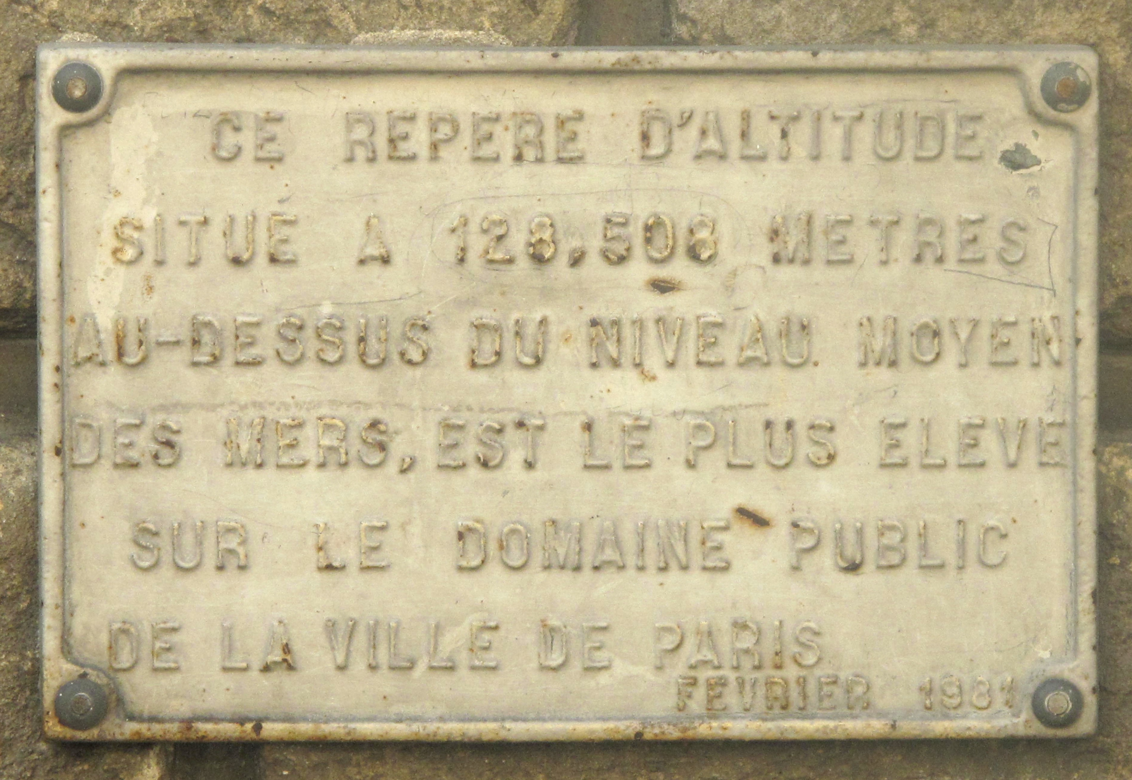
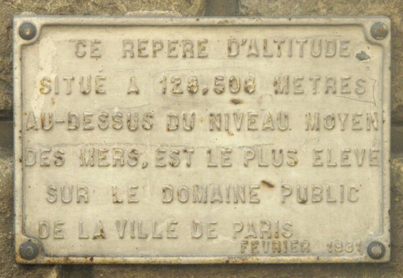
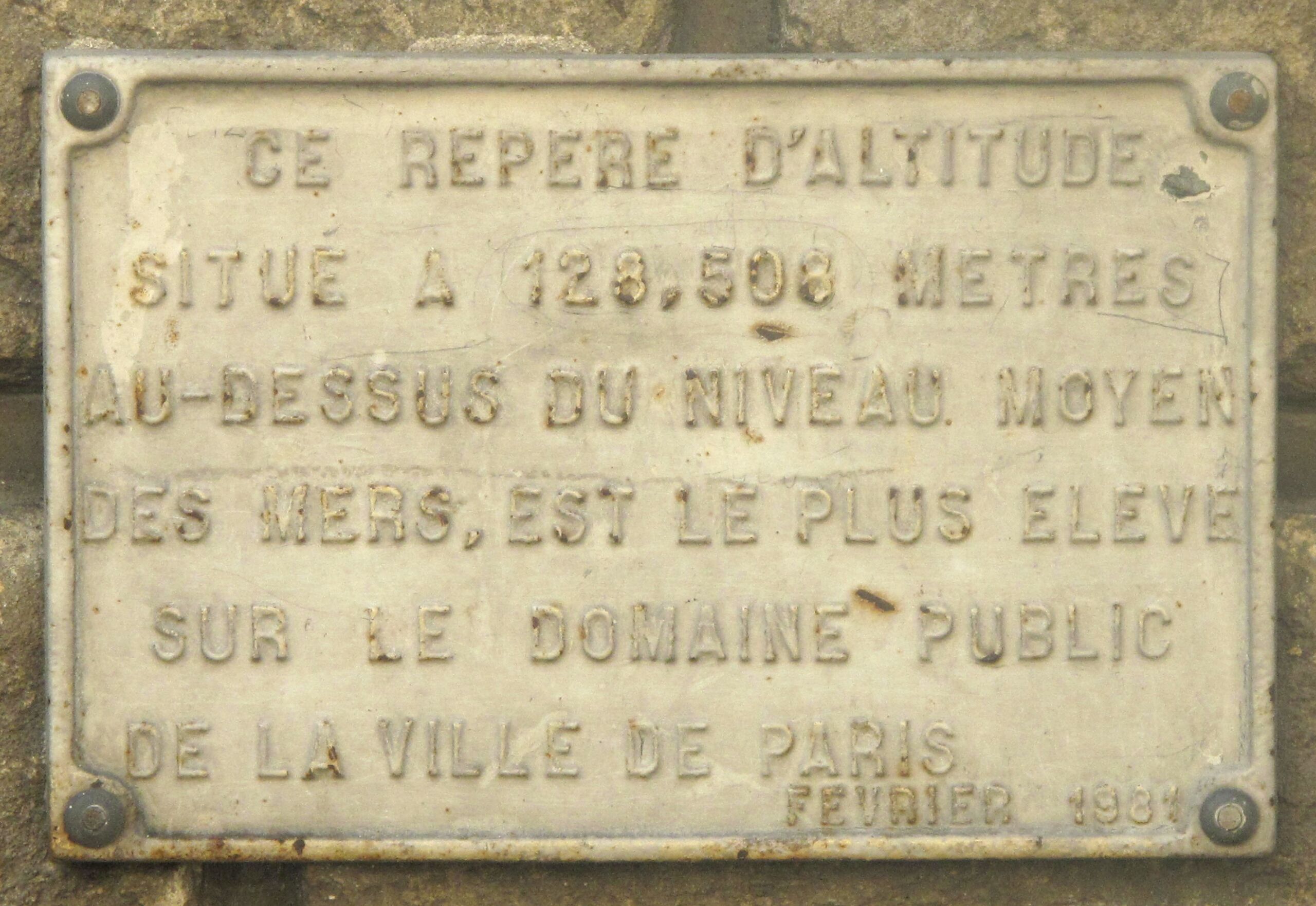
English: Plaque showing the highest ground in Paris : place du Télégraphe, Paris 20th arr.
The text is : This altitude mark at 128,508 m above sea level is the highest place on the public domain of the town of Paris. Français : Plaque signalant le point le plus élevé de Paris : place du Télégraphe, Paris 20e arr.
|
| ⧼wm-license-information-date⧽ | 2010 |
| ⧼wm-license-information-source⧽ | ⧼Wm-license-own-work⧽ |
| ⧼wm-license-information-author⧽ | Tangopaso |
48°52′27.87″N 2°23′57.07″E / 48.8744083°N 2.3991861°E
ترخيص
| [ This image has been (or is hereby) released into the public domain by its author, [[::User:Tangopaso|Tangopaso]] at the [[::Main Page|Commons]] project. This applies worldwide. In case this is not legally possible: Deutsch · Ελληνικά · English · Plattdüütsch · 中文(简体) · 中文(繁體) · +/− |
تاريخ الملف
اضغط على زمن/تاريخ لرؤية الملف كما بدا في هذا الزمن.
| زمن/تاريخ | صورة مصغرة | الأبعاد | مستخدم | تعليق | |
|---|---|---|---|---|---|
| حالي | ★ مراجعة معتمدة 20:58، 6 نوفمبر 2023 | | 3٬770 × 2٬597 (2٫2 ميجابايت) | Pastakhov (نقاش | مساهمات) | Upload https://upload.wikimedia.org/wikipedia/commons/4/45/Plaque_Telegraphe.jpg |
لا يمكنك استبدال هذا الملف.
وصلات
لا يوجد صفحات تصل لهذه الصورة.