ملف:Plaque, Barton Road - geograph.org.uk - 674119.jpg
حجم هذه المعاينة: 450 × 600 بكسل. البعد الآخر: 480 × 640 بكسل.
الملف الأصلي (480 × 640 بكسل حجم الملف: 156 كيلوبايت، نوع MIME: image/jpeg)
وصف قصير
| ⧼wm-license-information-description⧽ |
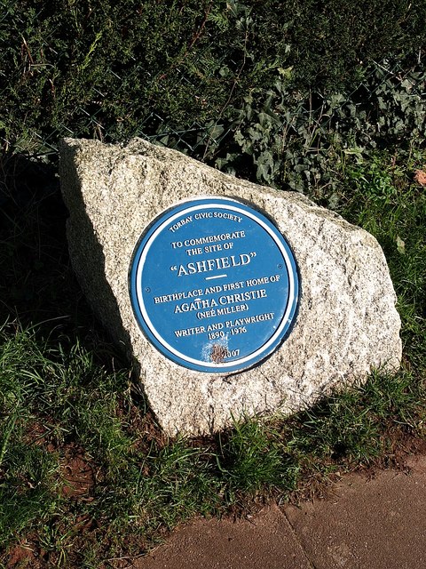
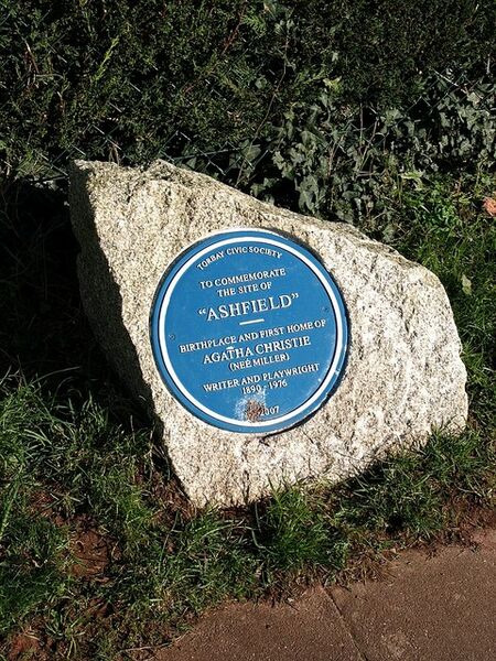
English: Plaque, Barton Road Eventual commemoration of the site of Agatha Christie's birthplace and childhood home, Ashfield, which was demolished in 1962. This spot does not feature on the Agatha Christie Mile Walk.
|
| ⧼wm-license-information-date⧽ | 2008 |
| ⧼wm-license-information-source⧽ | From geograph.org.uk |
| ⧼wm-license-information-author⧽ | Derek Harper |
| ⧼wm-license-cc-attribution⧽ (قالب:I18n/Credit line) |
Derek Harper / Plaque, Barton Road / |
50°28′28″N 3°32′36″W / 50.47453°N 3.5433°W قالب:Object location
_heading:90)
ترخيص
تاريخ الملف
اضغط على زمن/تاريخ لرؤية الملف كما بدا في هذا الزمن.
| زمن/تاريخ | صورة مصغرة | الأبعاد | مستخدم | تعليق | |
|---|---|---|---|---|---|
| حالي | ★ مراجعة معتمدة 13:54، 30 نوفمبر 2023 | | 480 × 640 (156 كيلوبايت) | Pastakhov (نقاش | مساهمات) | Upload https://upload.wikimedia.org/wikipedia/commons/0/06/Plaque%2C_Barton_Road_-_geograph.org.uk_-_674119.jpg |
لا يمكنك استبدال هذا الملف.
وصلات
لا يوجد صفحات تصل لهذه الصورة.
تصنيفات:
- Plaques in Torquay
- Here-was-born plaques in Devon
- Images by Derek Harper
- Torbay Civic Society blue plaques
- Ashfield, Torquay
- 1890 here-was-born plaques
- Plaques installed in 2007
- Plaques to Agatha Christie in the United Kingdom
- 2008 in Torquay
- United Kingdom photographs taken on 2008-01-26
- Blue plaques in Devon