ملف:Plan mur et tours Argentoratum.jpg
حجم هذه المعاينة: 698 × 599 بكسل. البعدان الآخران: 2٬385 × 2٬048 بكسل | 4٬864 × 4٬176 بكسل.
الملف الأصلي (4٬864 × 4٬176 بكسل حجم الملف: 5٫44 ميجابايت، نوع MIME: image/jpeg)
وصف قصير
| ⧼wm-license-information-description⧽ |
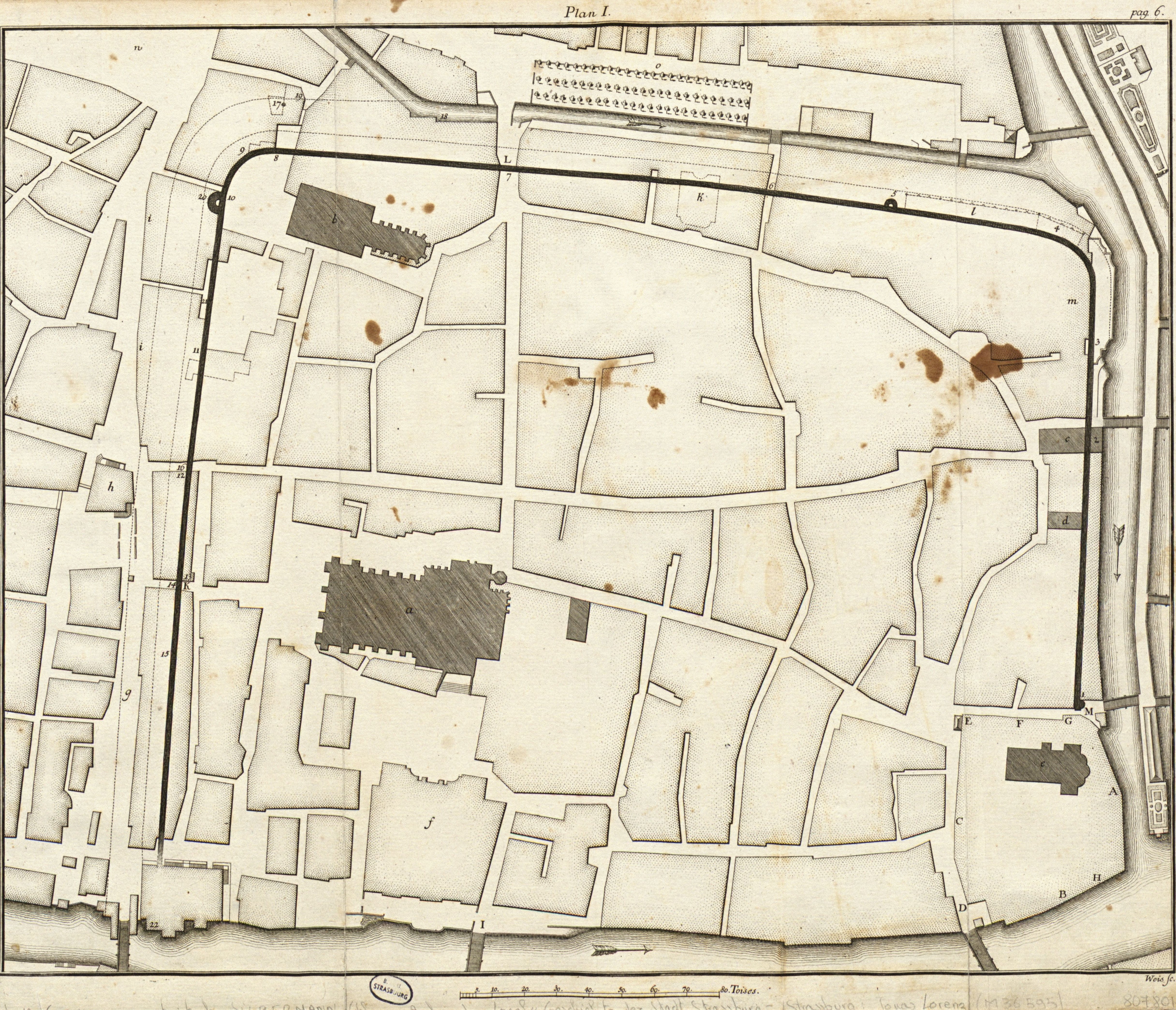
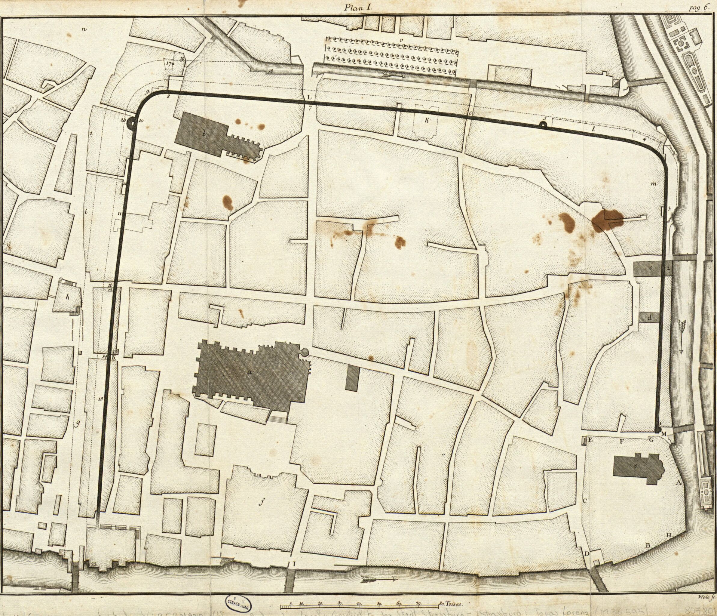
English: Map of the walls and towers of the Roman town of Argentoratum with the drawing of the streets today and the place of the cathedral
Français : Plan des murs et des tours d’Argentoratum faisant apparaître le tracé des rues actuelles et l'emplacement de la cathédrale
|
| ⧼wm-license-information-date⧽ | قالب:Otherdate |
| ⧼wm-license-information-source⧽ | Bibliothèque nationale et universitaire de Strasbourg (en ligne) |
| ⧼wm-license-information-author⧽ | صانع:Johann Martin Weiss |
ترخيص
تاريخ الملف
اضغط على زمن/تاريخ لرؤية الملف كما بدا في هذا الزمن.
| زمن/تاريخ | صورة مصغرة | الأبعاد | مستخدم | تعليق | |
|---|---|---|---|---|---|
| حالي | ★ مراجعة معتمدة 13:05، 4 ديسمبر 2023 | | 4٬864 × 4٬176 (5٫44 ميجابايت) | Pastakhov (نقاش | مساهمات) | Upload https://upload.wikimedia.org/wikipedia/commons/d/d8/Plan_mur_et_tours_Argentoratum.jpg |
لا يمكنك استبدال هذا الملف.
وصلات
لا يوجد صفحات تصل لهذه الصورة.