ملف:Pima County Incorporated and Unincorporated areas Sahuarita highlighted.svg

حجم معاينة PNG لذلك الملف ذي الامتداد SVG: 800 × 509 بكسل. البعد الآخر: 2٬560 × 1٬629 بكسل.
الملف الأصلي (ملف SVG، أبعاده 1٬100 × 700 بكسل، حجم الملف: 60 كيلوبايت)
وصف قصير
| ⧼wm-license-information-description⧽ |
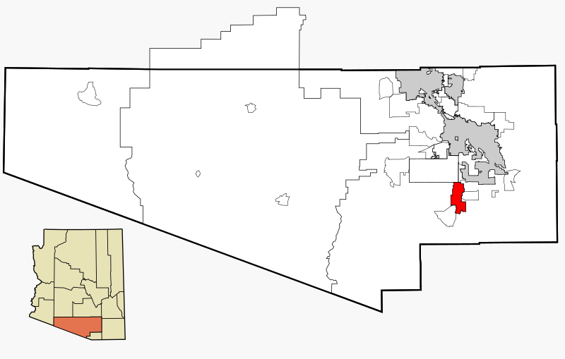
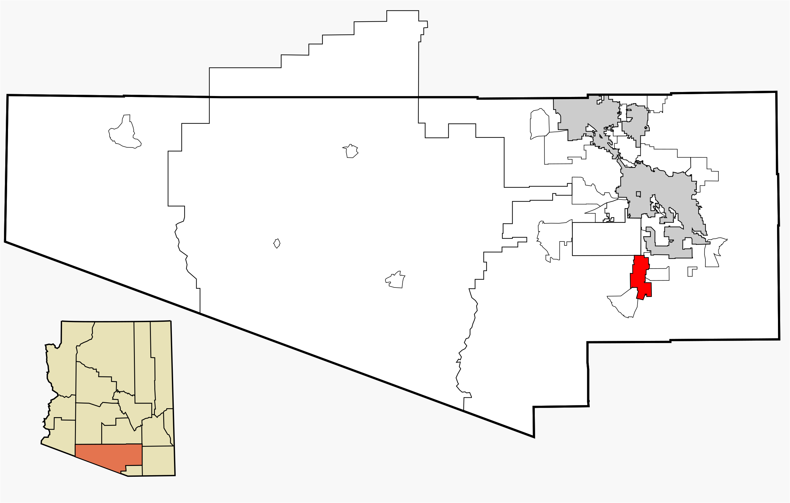
This map shows the incorporated areas and unincorporated areas in Pima County, Arizona. Incorporated cities are shown in gray and data for their borders and locations are based on the 2000/2030 PAG Transportation Analysis Zone Map. The Town of Sahuarita is highlighted in red. Information for unincorporated locations and borders are based on the Census 2000 Pima County Tract Outline Index Map (PDF). I created this map in w:Inkscape. |
| ⧼wm-license-information-date⧽ | 2007 |
| ⧼wm-license-information-source⧽ | My own work, based on public domain information |
| ⧼wm-license-information-author⧽ | Ixnayonthetimmay |
| ⧼wm-license-information-permission⧽ (⧼wm-license-information-permission-reusing-text⧽) |
Copyleft-type licensing. See below. |
| ⧼wm-license-information-other-versions⧽ |
See Category:Maps of Pima County for other versions of this image. |
ترخيص
|

تاريخ الملف
اضغط على زمن/تاريخ لرؤية الملف كما بدا في هذا الزمن.
| زمن/تاريخ | صورة مصغرة | الأبعاد | مستخدم | تعليق | |
|---|---|---|---|---|---|
| حالي | ★ مراجعة معتمدة 15:42، 25 ديسمبر 2023 | | 1٬100 × 700 (60 كيلوبايت) | Pastakhov (نقاش | مساهمات) | Upload https://upload.wikimedia.org/wikipedia/commons/8/8b/Pima_County_Incorporated_and_Unincorporated_areas_Sahuarita_highlighted.svg |
لا يمكنك استبدال هذا الملف.
وصلات
لا يوجد صفحات تصل لهذه الصورة.