ملف:Physiographic Provinces 48 Conterminous US-v1.svg

حجم معاينة PNG لذلك الملف ذي الامتداد SVG: 800 × 480 بكسل. البعد الآخر: 2٬560 × 1٬536 بكسل.
الملف الأصلي (ملف SVG، أبعاده 1٬000 × 600 بكسل، حجم الملف: 2٫05 ميجابايت)
وصف قصير
| ⧼wm-license-information-description⧽ |
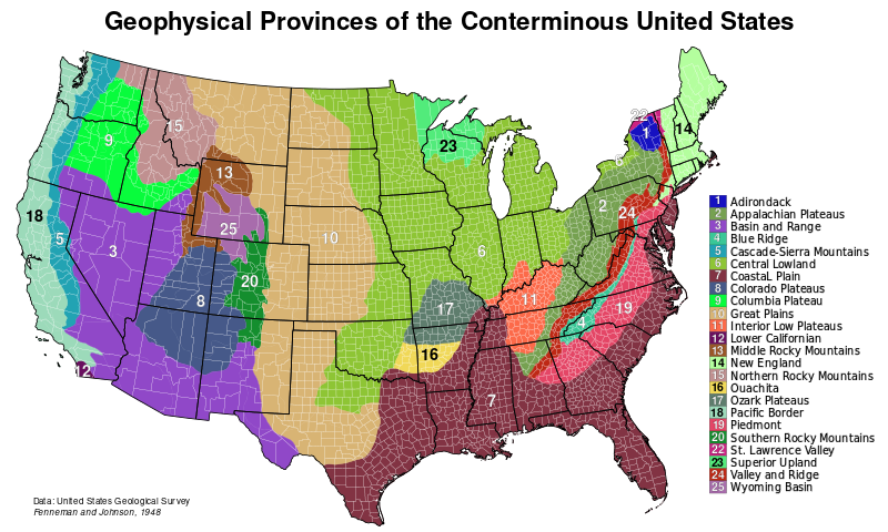
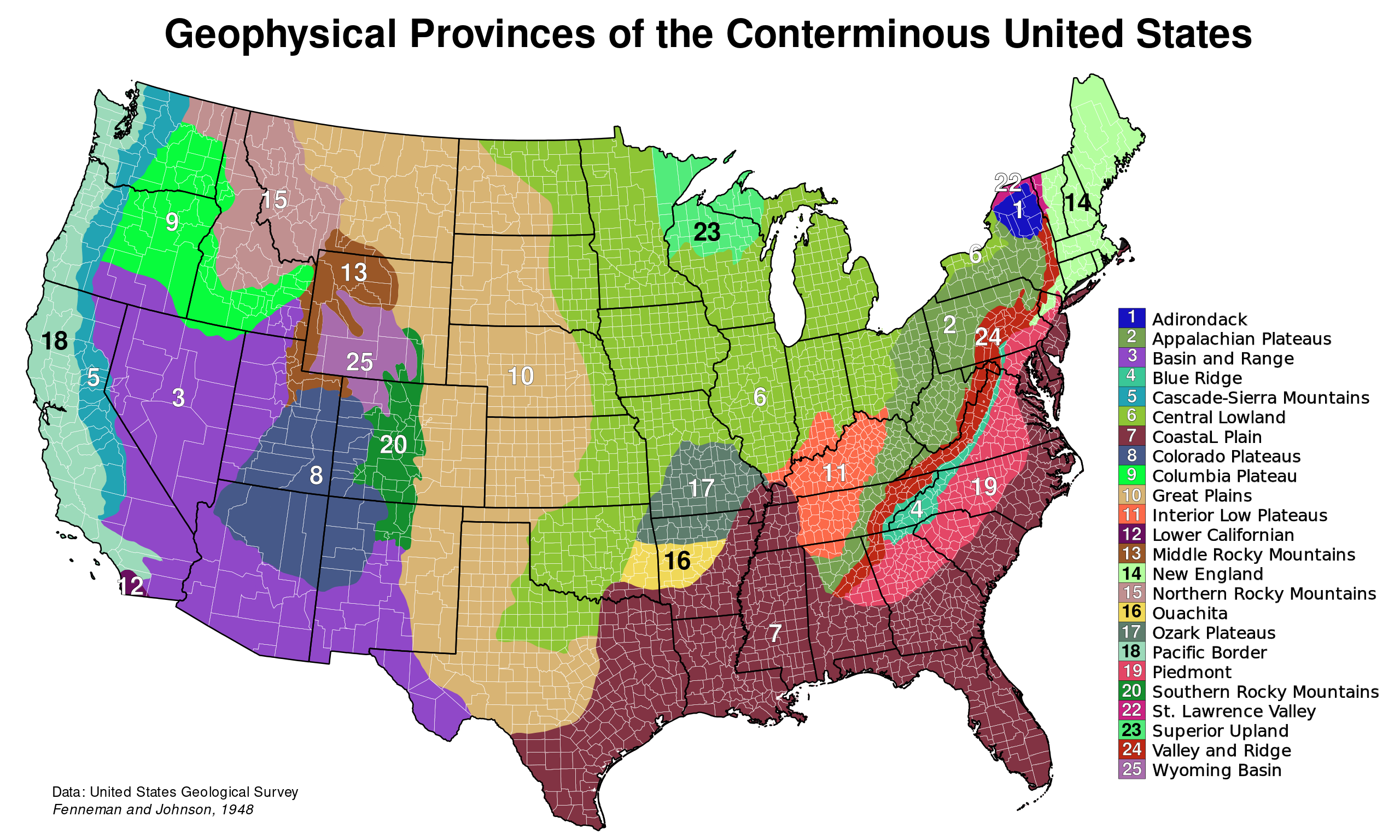
English: The major physiographic provinces of the 48 conterminous United States.
This map is based on public domain data from the USGS[1]
|
| ⧼wm-license-information-date⧽ | 2009 |
| ⧼wm-license-information-source⧽ | ⧼Wm-license-own-work⧽ |
| ⧼wm-license-information-author⧽ | Kbh3rd |
ترخيص
تاريخ الملف
اضغط على زمن/تاريخ لرؤية الملف كما بدا في هذا الزمن.
| زمن/تاريخ | صورة مصغرة | الأبعاد | مستخدم | تعليق | |
|---|---|---|---|---|---|
| حالي | ★ مراجعة معتمدة 08:36، 11 أكتوبر 2023 | | 1٬000 × 600 (2٫05 ميجابايت) | Pastakhov (نقاش | مساهمات) | Upload https://upload.wikimedia.org/wikipedia/commons/4/4d/Physiographic_Provinces_48_Conterminous_US-v1.svg |
لا يمكنك استبدال هذا الملف.
وصلات
لا يوجد صفحات تصل لهذه الصورة.