ملف:PetraMap.png
حجم هذه المعاينة: 800 × 568 بكسل. البعد الآخر: 951 × 675 بكسل.
الملف الأصلي (951 × 675 بكسل حجم الملف: 44 كيلوبايت، نوع MIME: image/png)
وصف قصير
| ⧼wm-license-information-description⧽ |
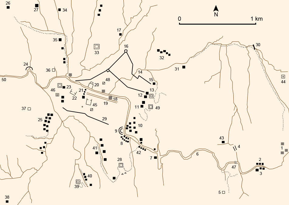
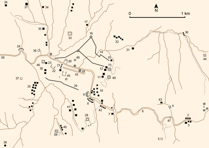
English: Petra
|
| ⧼wm-license-information-date⧽ | 2007-05-23 21:00 (UTC) |
| ⧼wm-license-information-source⧽ | Own work (using different GFDL maps so it may be not exactly right), a sketch map by Derek Kennet, Laïla Nehmé and the book : Christian Augé et Jean-Marie Dentzer, Pétra, la cité des caravanes, Gallimard, coll. « Découvertes Gallimard / Archéologie », Paris, avril 1999 (réimpr. 2001, 2004, 2006), 96 p. (ISBN 2-07-053428-6) |
| ⧼wm-license-information-author⧽ | Like tears in rain (Contact me for suggestions/corrections) |
| ⧼wm-license-information-other-versions⧽ |
French names:
- Chemin d'accès
- Anciens tombes rupestres ou temples
- Forteresse des Croisés
- Carré barré
- Fouille
|
|
|

|
[All images in this gallery should be recreated using vector graphics as an SVG file. This has several advantages; see Commons:Media for cleanup for more information. If an SVG form of this image is already available, please upload it. After uploading an SVG, replace this template with {{vector version available|new image name.svg}}.] Error: {{Lang}}: text has italic markup (help) |
|
العربية | български | català | čeština | dansk | Deutsch | English | Esperanto | español | français | galego | 한국어 | italiano | magyar | lietuvių | 日本語 | Plattdüütsch | Nederlands | norsk | polski | português | română | русский | suomi | svenska | Türkçe | українська | 中文(繁體) | 中文(简体) | +/− | |
ترخيص
|

تاريخ الملف
اضغط على زمن/تاريخ لرؤية الملف كما بدا في هذا الزمن.
| زمن/تاريخ | صورة مصغرة | الأبعاد | مستخدم | تعليق | |
|---|---|---|---|---|---|
| حالي | ★ مراجعة معتمدة 11:28، 3 نوفمبر 2023 | | 951 × 675 (44 كيلوبايت) | Pastakhov (نقاش | مساهمات) | Upload https://upload.wikimedia.org/wikipedia/commons/a/a3/PetraMap.png |
لا يمكنك استبدال هذا الملف.
وصلات
لا يوجد صفحات تصل لهذه الصورة.