ملف:Persepolis, Iran.jpg
حجم هذه المعاينة: 600 × 600 بكسل. البعدان الآخران: 2٬048 × 2٬048 بكسل | 3٬000 × 3٬000 بكسل.
الملف الأصلي (3٬000 × 3٬000 بكسل حجم الملف: 4٫09 ميجابايت، نوع MIME: image/jpeg)
وصف قصير
| ⧼wm-license-information-description⧽ |
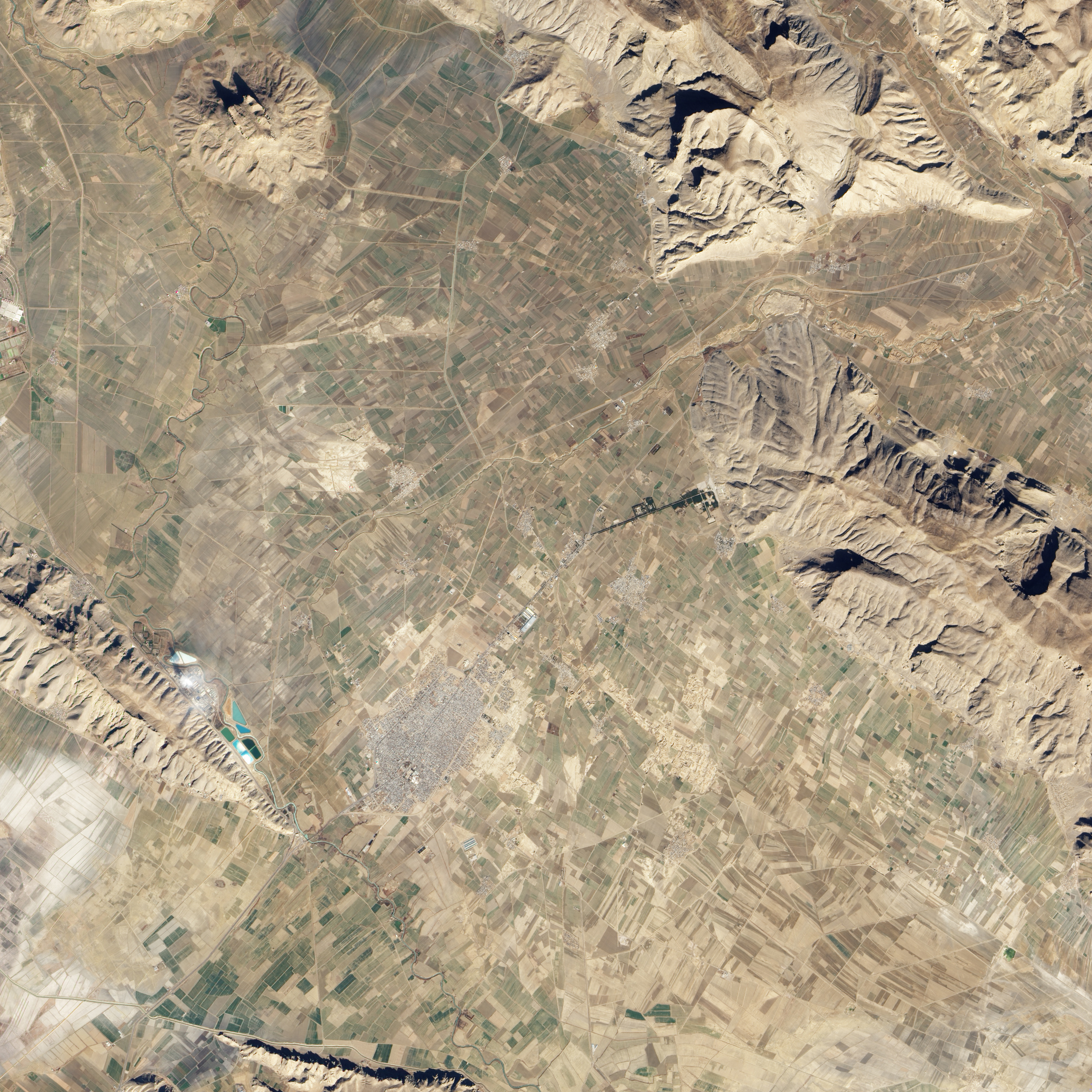
English: Natural-colour image of Persepolis and the surrounding region. The boundary between agricultural land and mountain runs roughly north-west to south-east. West of the boundary, the land appears as a patchwork of brown fallow fields and green growing crops. East of the boundary, mountain peaks on Kuh-i-Rahmat cast dark shadows to the north.
A tree-lined road leads to the site of Persepolis from the south-west. Persepolis itself is roughly rectangular, and rivals the size of nearby modern settlements. The L-shaped, off-white structure at Persepolis is a modern covering, providing some protection from the elements to part of the ancient complex.
|
| ⧼wm-license-information-date⧽ | 2010 |
| ⧼wm-license-information-source⧽ | NASA Earth Observatory |
| ⧼wm-license-information-author⧽ | Jesse Allen |
Image captured by the Advanced Land Imager (ALI) on NASA’s Earth Observing-1 (EO-1) satellite. ALI data provided courtesy of the NASA EO-1 team.
ترخيص
تاريخ الملف
اضغط على زمن/تاريخ لرؤية الملف كما بدا في هذا الزمن.
| زمن/تاريخ | صورة مصغرة | الأبعاد | مستخدم | تعليق | |
|---|---|---|---|---|---|
| حالي | ★ مراجعة معتمدة 12:41، 12 يناير 2024 | | 3٬000 × 3٬000 (4٫09 ميجابايت) | Pastakhov (نقاش | مساهمات) | Upload https://upload.wikimedia.org/wikipedia/commons/f/f3/Persepolis%2C_Iran.jpg |
لا يمكنك استبدال هذا الملف.
وصلات
لا يوجد صفحات تصل لهذه الصورة.