ملف:Pelee Island map.png
حجم هذه المعاينة: 552 × 599 بكسل. البعد الآخر: 600 × 651 بكسل.
الملف الأصلي (600 × 651 بكسل حجم الملف: 199 كيلوبايت، نوع MIME: image/png)
وصف قصير
| ⧼wm-license-information-description⧽ |
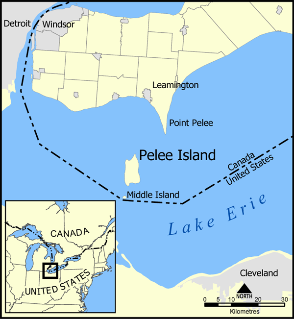
A map showing Pelee Island, Middle Island, and Point Pelee as well as the nearby communities of Leamington, Windsor, Detroit, and Cleveland. Created by NormanEinstein, May 11, 2005. |
| ⧼wm-license-information-date⧽ | قالب:Original upload date |
| ⧼wm-license-information-source⧽ | No machine-readable source provided. Own work assumed (based on copyright claims). |
| ⧼wm-license-information-author⧽ | No machine-readable author provided. NormanEinstein assumed (based on copyright claims). |
ترخيص
|

تاريخ الملف
اضغط على زمن/تاريخ لرؤية الملف كما بدا في هذا الزمن.
| زمن/تاريخ | صورة مصغرة | الأبعاد | مستخدم | تعليق | |
|---|---|---|---|---|---|
| حالي | ★ مراجعة معتمدة 04:32، 14 نوفمبر 2023 | | 600 × 651 (199 كيلوبايت) | Pastakhov (نقاش | مساهمات) | Upload https://upload.wikimedia.org/wikipedia/commons/c/c7/Pelee_Island_map.png |
لا يمكنك استبدال هذا الملف.
وصلات
لا يوجد صفحات تصل لهذه الصورة.