ملف:Partition of Austria-Hungary 1919 map.jpg
حجم هذه المعاينة: 800 × 489 بكسل. البعد الآخر: 2٬720 × 1٬664 بكسل.
الملف الأصلي (2٬720 × 1٬664 بكسل حجم الملف: 2٫74 ميجابايت، نوع MIME: image/jpeg)
وصف قصير
| ⧼wm-license-information-description⧽ |
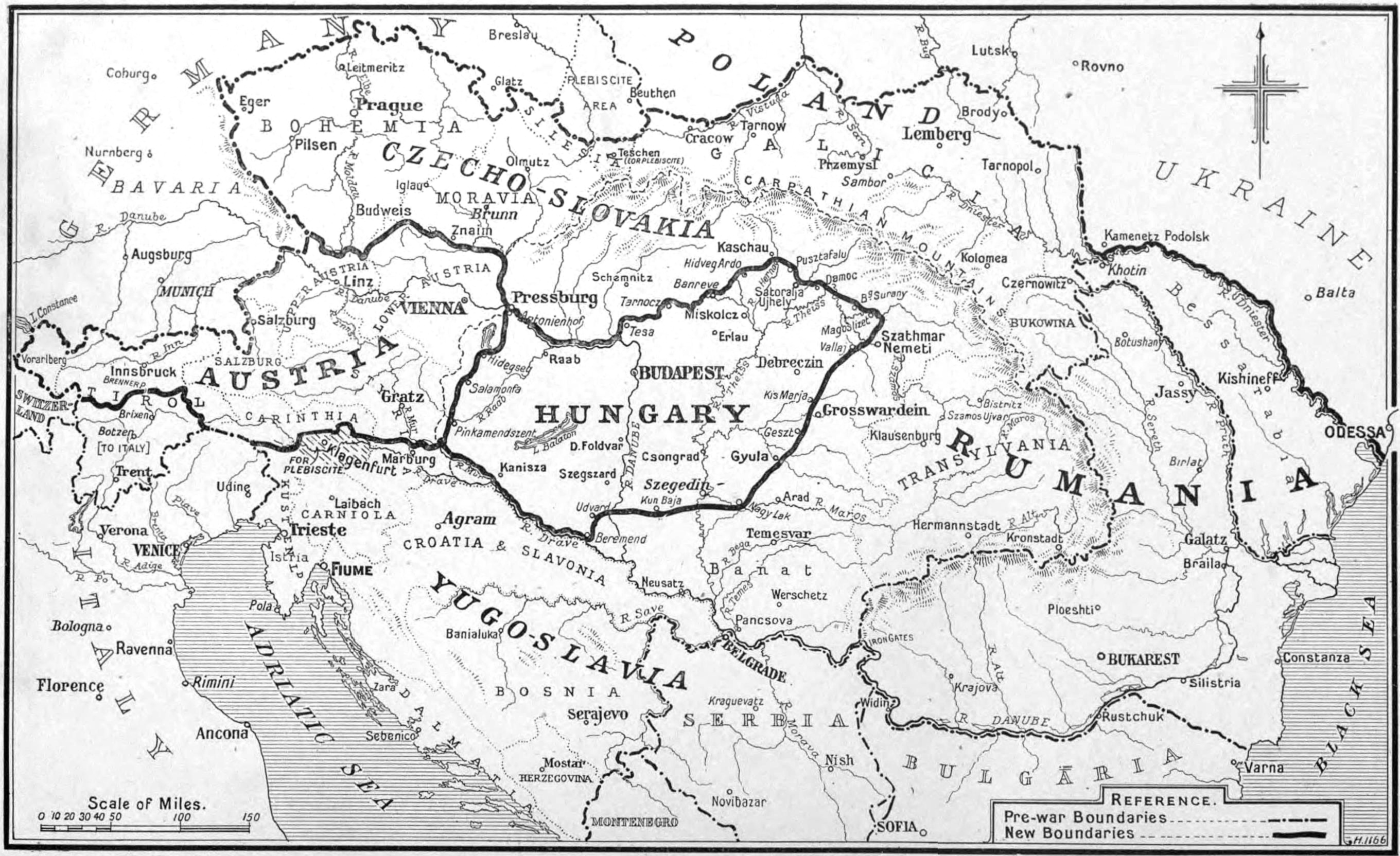
English: The partition of Austria-Hungary showing the boundaries as defined in the treaties
|
| ⧼wm-license-information-date⧽ | 1919 |
| ⧼wm-license-information-source⧽ | https://archive.org/details/timeshistoryofwa21londuoft |
| ⧼wm-license-information-author⧽ | style="background: #E4E4E4; color: black; vertical-align: middle; text-align: center; " class="unknown table-unknown"|author |
| ⧼wm-license-information-other-versions⧽ |
ترخيص
تاريخ الملف
اضغط على زمن/تاريخ لرؤية الملف كما بدا في هذا الزمن.
| زمن/تاريخ | صورة مصغرة | الأبعاد | مستخدم | تعليق | |
|---|---|---|---|---|---|
| حالي | ★ مراجعة معتمدة 14:58، 6 نوفمبر 2023 | | 2٬720 × 1٬664 (2٫74 ميجابايت) | Pastakhov (نقاش | مساهمات) | Upload https://upload.wikimedia.org/wikipedia/commons/c/c3/Partition_of_Austria-Hungary_1919_map.jpg |
لا يمكنك استبدال هذا الملف.
وصلات
لا يوجد صفحات تصل لهذه الصورة.