ملف:Pôle métropolitain (Auvergne-Rhône-Alpes) 2013.svg

حجم معاينة PNG لذلك الملف ذي الامتداد SVG: 103 × 78 بكسل. البعد الآخر: 2٬560 × 1٬939 بكسل.
الملف الأصلي (ملف SVG، أبعاده 103 × 78 بكسل، حجم الملف: 1٫03 ميجابايت)
وصف قصير
وصف قصير
| ⧼wm-license-information-description⧽ |
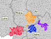
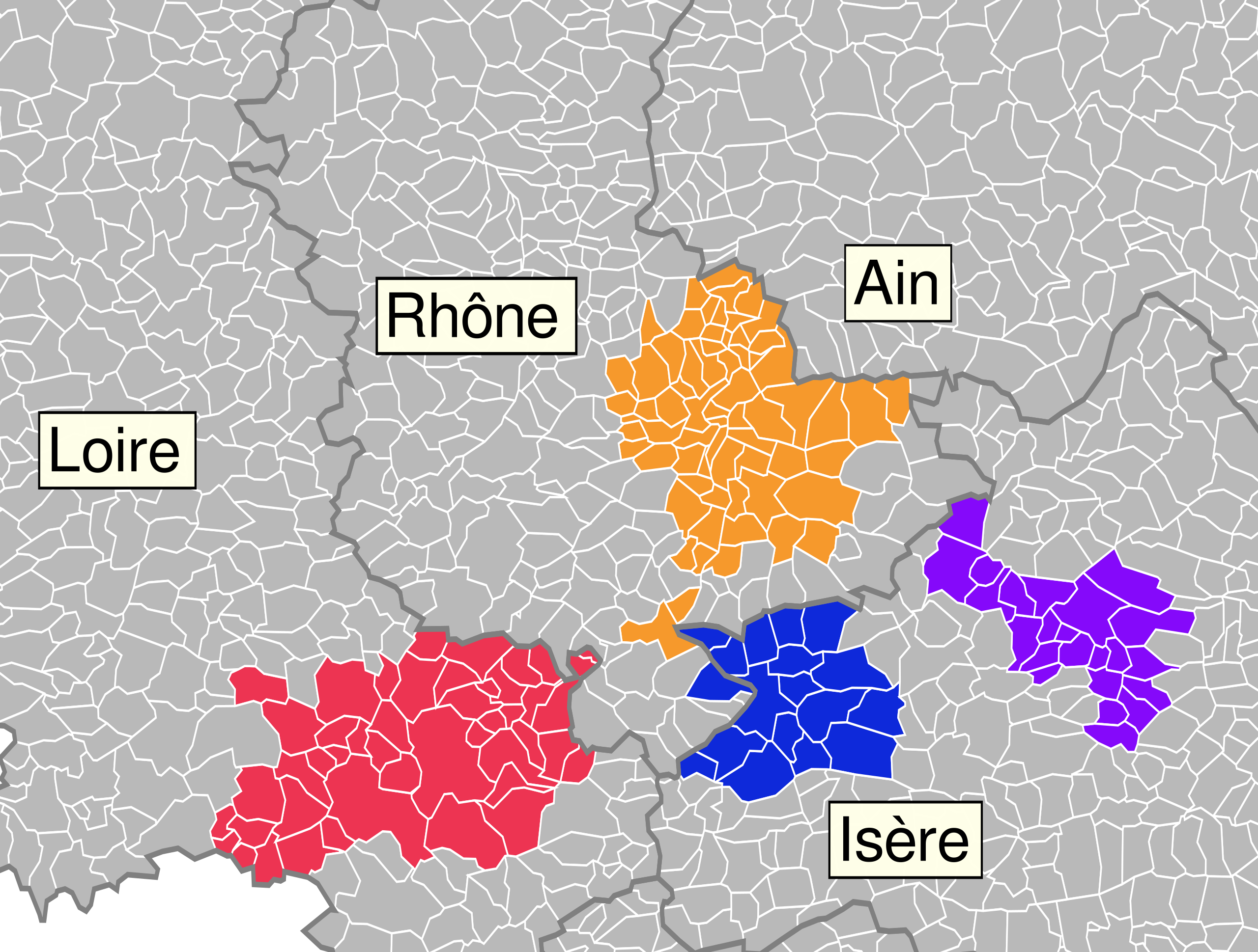
Français : Carte indiquant les différentes collectivités appartenant au Pôle métropolitain au 1er Janvier 2013. Apparaissent également les limites départementales et les communes.
|
| ⧼wm-license-information-date⧽ | 2018 |
| ⧼wm-license-information-source⧽ | |
| ⧼wm-license-information-author⧽ |
ترخيص
|
تاريخ الملف
اضغط على زمن/تاريخ لرؤية الملف كما بدا في هذا الزمن.
| زمن/تاريخ | صورة مصغرة | الأبعاد | مستخدم | تعليق | |
|---|---|---|---|---|---|
| حالي | ★ مراجعة معتمدة 07:37، 23 نوفمبر 2023 | | 103 × 78 (1٫03 ميجابايت) | Pastakhov (نقاش | مساهمات) | Upload https://upload.wikimedia.org/wikipedia/commons/2/21/P%C3%B4le_m%C3%A9tropolitain_%28Auvergne-Rh%C3%B4ne-Alpes%29_2013.svg |
لا يمكنك استبدال هذا الملف.
وصلات
لا يوجد صفحات تصل لهذه الصورة.
_2013.svg&oldid=3573675)