ملف:Ottawa River at Rimer, upstream during flooding.jpg
حجم هذه المعاينة: 800 × 532 بكسل. البعدان الآخران: 2٬560 × 1٬702 بكسل | 6٬016 × 4٬000 بكسل.
الملف الأصلي (6٬016 × 4٬000 بكسل حجم الملف: 6٫38 ميجابايت، نوع MIME: image/jpeg)
40°52′52″N 84°12′34″W / 40.88111°N 84.20944°W
| ⧼wm-license-information-description⧽ |
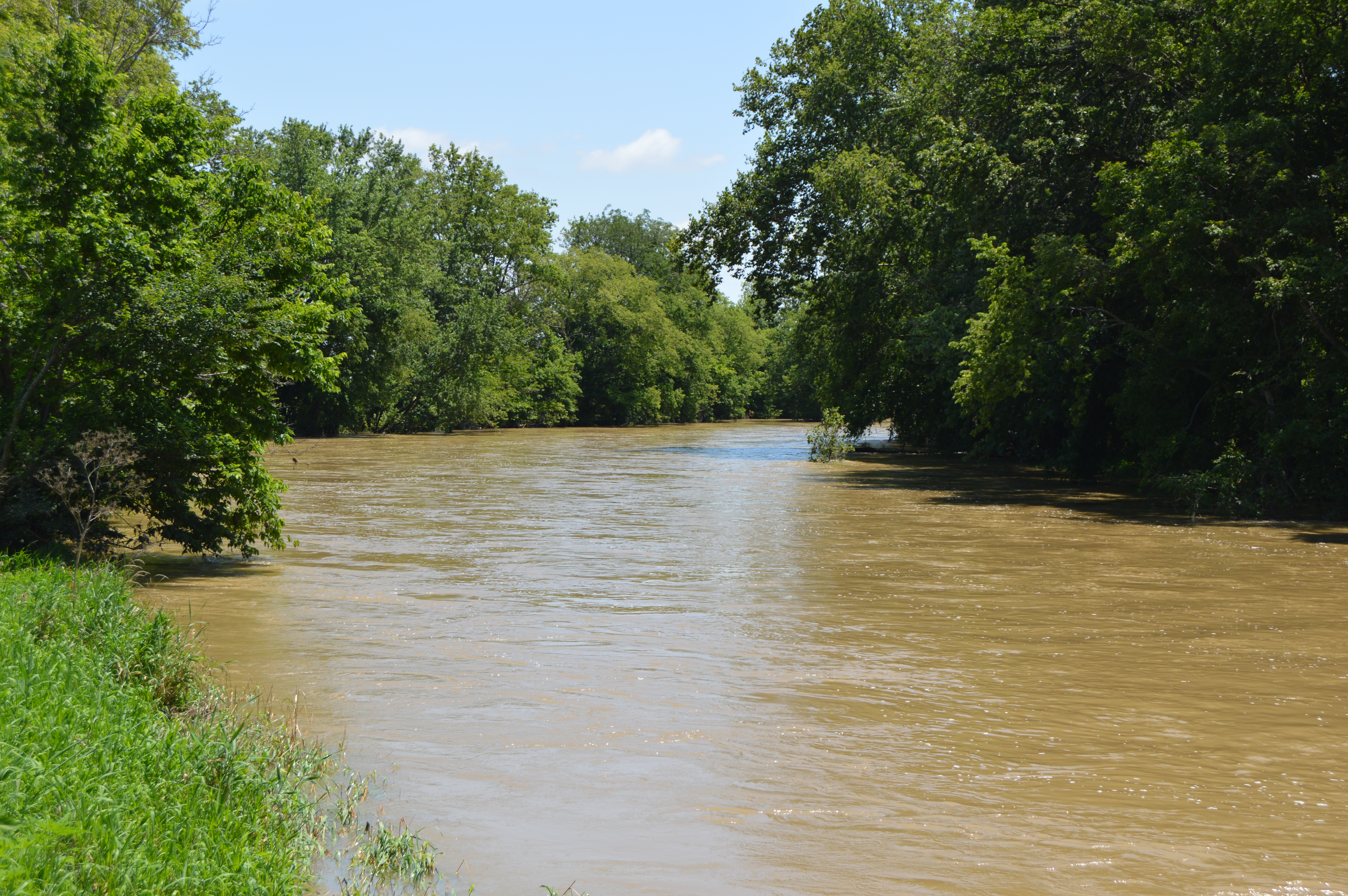
English: Looking southeast (upstream) along the Ottawa River from State Route 189 at Rimer in Sugar Creek Township, Putnam County, Ohio, United States. The river is experiencing flooding following weeks of sustained rainfall.
|
||
| ⧼wm-license-information-date⧽ | قالب:Taken on | ||
| ⧼wm-license-information-source⧽ | ⧼Wm-license-own-work⧽ | ||
| ⧼wm-license-information-author⧽ | Nyttend | ||
| ⧼wm-license-information-permission⧽ (⧼wm-license-information-permission-reusing-text⧽) |
|
تاريخ الملف
اضغط على زمن/تاريخ لرؤية الملف كما بدا في هذا الزمن.
| زمن/تاريخ | صورة مصغرة | الأبعاد | مستخدم | تعليق | |
|---|---|---|---|---|---|
| حالي | ★ مراجعة معتمدة 16:12، 30 أكتوبر 2023 | | 6٬016 × 4٬000 (6٫38 ميجابايت) | Pastakhov (نقاش | مساهمات) | Upload https://upload.wikimedia.org/wikipedia/commons/2/2a/Ottawa_River_at_Rimer%2C_upstream_during_flooding.jpg |
لا يمكنك استبدال هذا الملف.
وصلات
لا يوجد صفحات تصل لهذه الصورة.