ملف:Ogallala changes 1980-1995.svg

حجم معاينة PNG لذلك الملف ذي الامتداد SVG: 455 × 599 بكسل. البعد الآخر: 1٬555 × 2٬048 بكسل.
الملف الأصلي (ملف SVG، أبعاده 761 × 1٬002 بكسل، حجم الملف: 1٫74 ميجابايت)
وصف قصير
| ⧼wm-license-information-description⧽ |
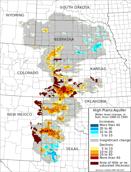
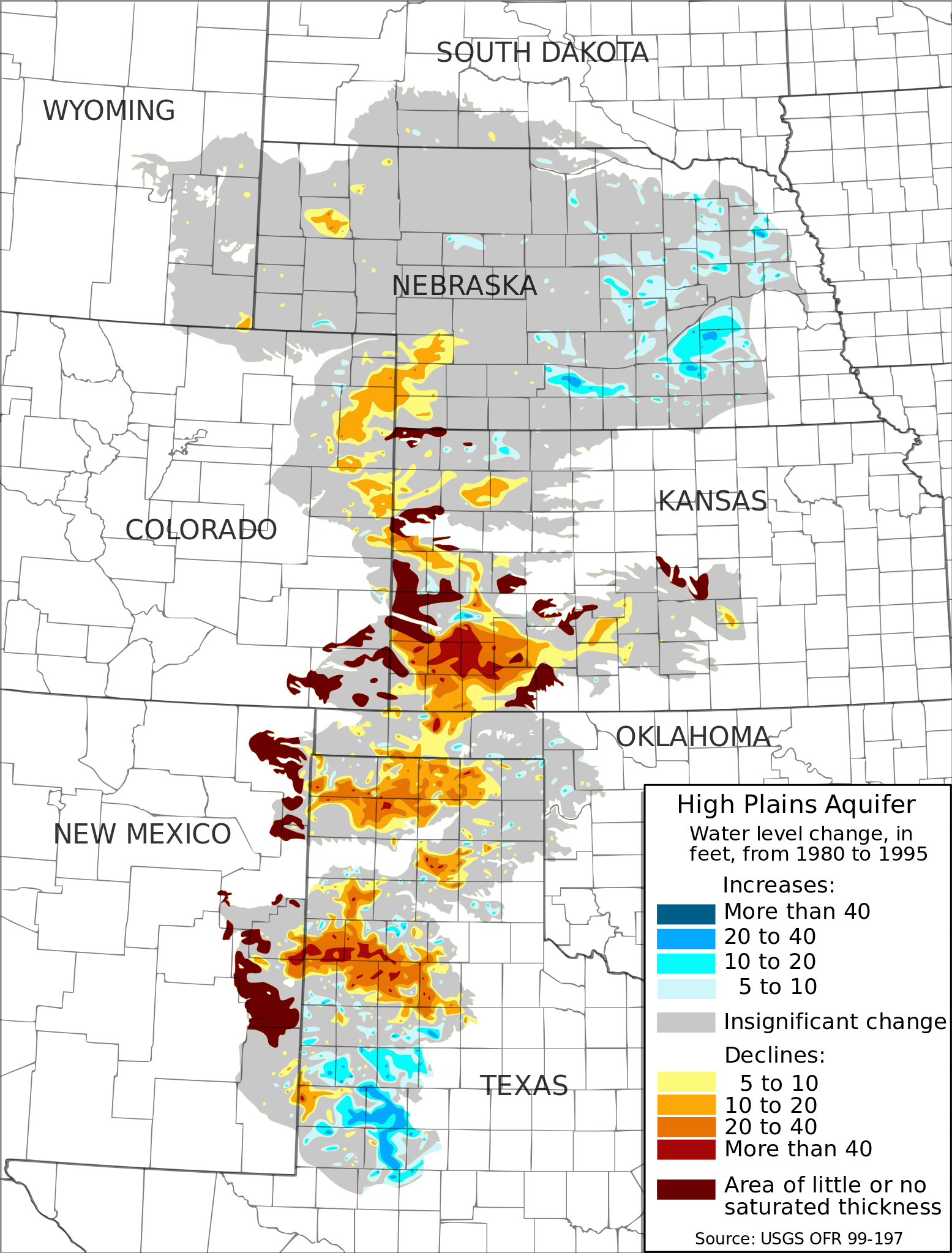
English: Map of water-level changes in the High Plains/Ogallala Aquifer in parts of Colorado, Kansas, Nebraska, New Mexico, Oklahoma, South Dakota, Texas, and Wyoming, 1980 to 1995. Created from public domain data produced by the USGS and made available in Open-File Report 99-197[1][2]. Authors: Fischer, Brian C.; McGuire, Virginia L.
|
| ⧼wm-license-information-date⧽ | 2009 |
| ⧼wm-license-information-source⧽ | ⧼Wm-license-own-work⧽ |
| ⧼wm-license-information-author⧽ | Kbh3rd |
| ⧼wm-license-information-other-versions⧽ |
ترخيص
|

تاريخ الملف
اضغط على زمن/تاريخ لرؤية الملف كما بدا في هذا الزمن.
| زمن/تاريخ | صورة مصغرة | الأبعاد | مستخدم | تعليق | |
|---|---|---|---|---|---|
| حالي | ★ مراجعة معتمدة 03:41، 4 ديسمبر 2023 | | 761 × 1٬002 (1٫74 ميجابايت) | Pastakhov (نقاش | مساهمات) | Upload https://upload.wikimedia.org/wikipedia/commons/e/e7/Ogallala_changes_1980-1995.svg |
لا يمكنك استبدال هذا الملف.
وصلات
لا يوجد صفحات تصل لهذه الصورة.