ملف:Obcine Slovenija 2006 Poljcane.svg

حجم معاينة PNG لذلك الملف ذي الامتداد SVG: 800 × 522 بكسل. البعد الآخر: 2٬560 × 1٬670 بكسل.
الملف الأصلي (ملف SVG، أبعاده 2٬613 × 1٬705 بكسل، حجم الملف: 5٫6 ميجابايت)
| ⧼wm-license-information-description⧽ |
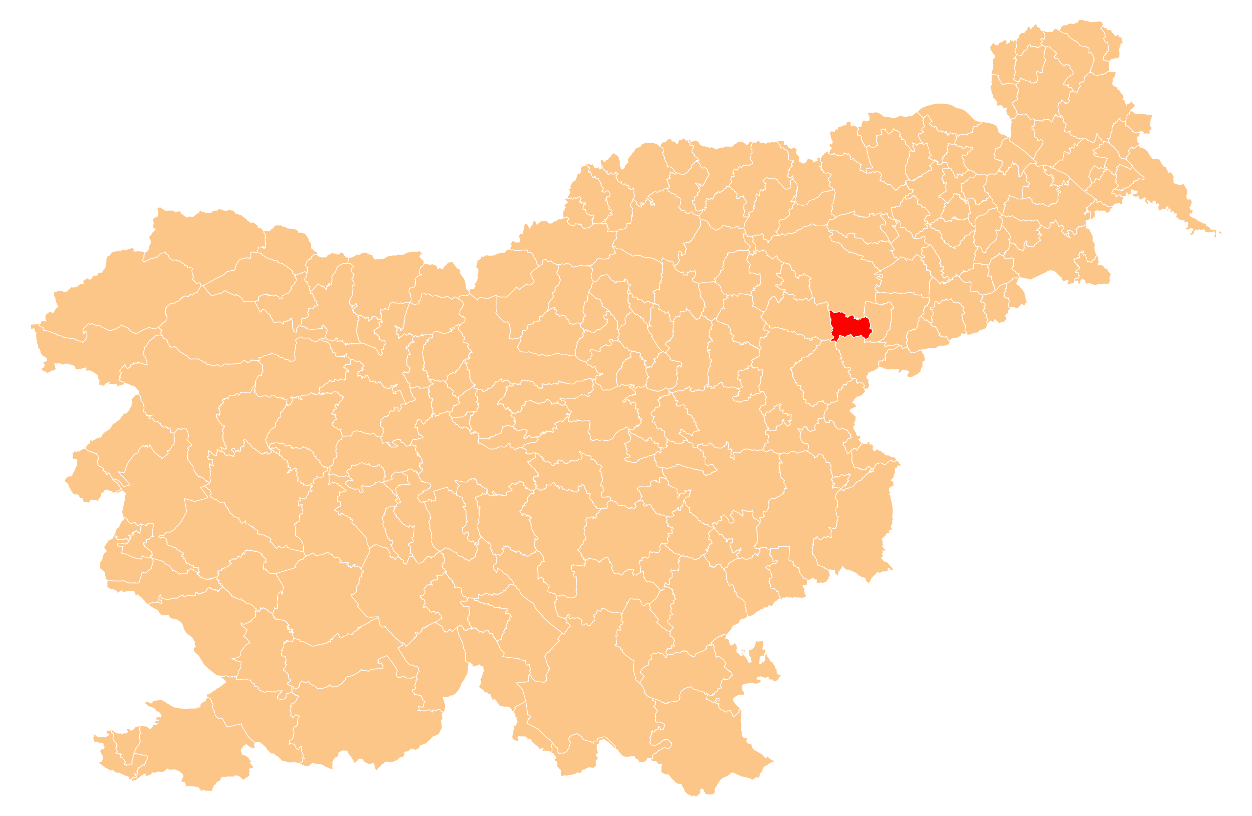
English: Občina Poljčane (marked red) on map of the municipalities (občine) of the Republic of Slovenia, as since May 2006 (210 units).
|
| ⧼wm-license-information-date⧽ | 2010-08-07 22:23 (UTC) |
| ⧼wm-license-information-source⧽ | |
| ⧼wm-license-information-author⧽ |
|
قالب:Original upload log
This image is a derivative work of the following images:
- File:Obcine_Slovenija_2006.svg licensed with PD-self
- 2008-11-03T21:32:24Z Romanm 2613x1705 (2471339 Bytes) fixed aspect ratio [[Category:Maps of administrative units of Slovenia]]
- 2008-11-03T21:21:03Z Romanm 200x200 (2471336 Bytes) {{Information |Description=Map of the municipalities (''občine'') of the Republic of Slovenia, as since May 2006 (211 units). |Source=Source of [http://www.gu.gov.si/si/delovnapodrocja_gu/podatki_gu/brezplani_podatki/brezpla
تاريخ الملف
اضغط على زمن/تاريخ لرؤية الملف كما بدا في هذا الزمن.
| زمن/تاريخ | صورة مصغرة | الأبعاد | مستخدم | تعليق | |
|---|---|---|---|---|---|
| حالي | ★ مراجعة معتمدة 22:36، 27 نوفمبر 2023 | | 2٬613 × 1٬705 (5٫6 ميجابايت) | Pastakhov (نقاش | مساهمات) | Upload https://upload.wikimedia.org/wikipedia/commons/c/c9/Obcine_Slovenija_2006_Poljcane.svg |
لا يمكنك استبدال هذا الملف.
وصلات
لا يوجد صفحات تصل لهذه الصورة.