ملف:OHjudicialdistrictsmap.png
حجم هذه المعاينة: 551 × 599 بكسل. البعد الآخر: 1٬000 × 1٬087 بكسل.
الملف الأصلي (1٬000 × 1٬087 بكسل حجم الملف: 139 كيلوبايت، نوع MIME: image/png)
وصف قصير
| ⧼wm-license-information-description⧽ |
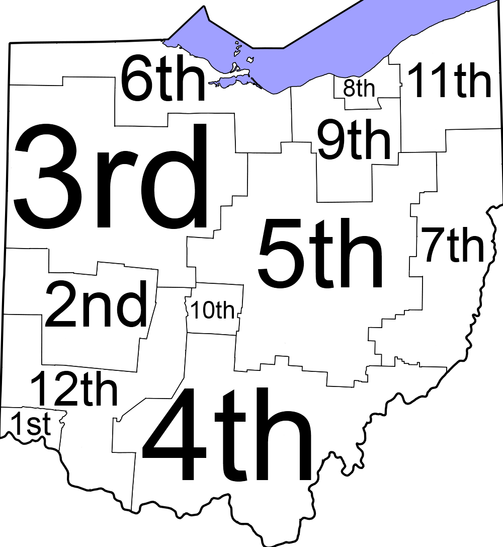
English: Map of Ohio judicial districts
|
| ⧼wm-license-information-date⧽ | 2012-05-19 14:45 (UTC) |
| ⧼wm-license-information-source⧽ | قالب:Derived from |
| ⧼wm-license-information-author⧽ |
|
| [This is a retouched picture, which means that it has been digitally altered from its original version. Modifications: Added numbers and removed lines and text. The original can be viewed here: Ohio_Counties_Labeled_White.svg. Modifications made by Presidentman.] Error: {{Lang}}: text has italic markup (help)
|
ترخيص
قالب:Original upload log
This image is a derivative work of the following images:
- File:Ohio_Counties_Labeled_White.svg licensed with PD-self
- 2009-08-19T06:57:44Z Ibagli 3675x3995 (157433 Bytes) Reverted to version as of 04:13, 19 August 2009
- 2009-08-19T04:22:31Z Ibagli 3675x3995 (158406 Bytes) font
- 2009-08-19T04:13:35Z Ibagli 3675x3995 (157433 Bytes) {{Information |Description={{en|1=Labeled counties of Ohio Uses SVG from [[:File:Map of Ohio highlighting Wood County.svg]]}} |Source=Own work by uploader |Author=[[User:Ibagli|Ibagli]] |Date=2009-08-19 |Permission= |other_ve
تاريخ الملف
اضغط على زمن/تاريخ لرؤية الملف كما بدا في هذا الزمن.
| زمن/تاريخ | صورة مصغرة | الأبعاد | مستخدم | تعليق | |
|---|---|---|---|---|---|
| حالي | ★ مراجعة معتمدة 02:05، 1 ديسمبر 2023 | | 1٬000 × 1٬087 (139 كيلوبايت) | Pastakhov (نقاش | مساهمات) | Upload https://upload.wikimedia.org/wikipedia/commons/3/30/OHjudicialdistrictsmap.png |
لا يمكنك استبدال هذا الملف.
وصلات
لا يوجد صفحات تصل لهذه الصورة.