ملف:Nylrivier, stroomop van bruggie, a.jpg
حجم هذه المعاينة: 800 × 533 بكسل. البعدان الآخران: 2٬560 × 1٬707 بكسل | 3٬888 × 2٬592 بكسل.
الملف الأصلي (3٬888 × 2٬592 بكسل حجم الملف: 4٫7 ميجابايت، نوع MIME: image/jpeg)
وصف قصير
| ⧼wm-license-information-description⧽ |
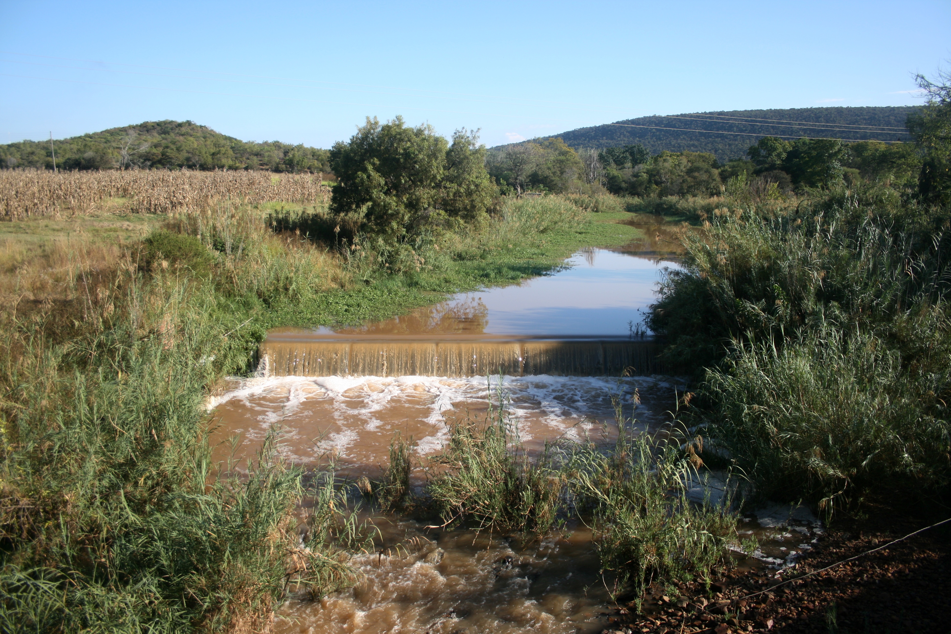
English: Upstream view of the Nyl River in its upper reaches, as seen from a small bridge. Water is pouring over a small weir after good early winter rains. The location is just downstream of the confluence of the Nyl River's two main tributaries, the Groot-Nylrivier and Klein-Nylrivier respectively.
|
| ⧼wm-license-information-date⧽ | 2023 |
| ⧼wm-license-information-source⧽ | ⧼Wm-license-own-work⧽ |
| ⧼wm-license-information-author⧽ | JMK |
24°41′03″S 28°30′23″E / 24.68417°S 28.50639°E
ترخيص
|
تاريخ الملف
اضغط على زمن/تاريخ لرؤية الملف كما بدا في هذا الزمن.
| زمن/تاريخ | صورة مصغرة | الأبعاد | مستخدم | تعليق | |
|---|---|---|---|---|---|
| حالي | ★ مراجعة معتمدة 11:56، 12 يناير 2024 | | 3٬888 × 2٬592 (4٫7 ميجابايت) | Pastakhov (نقاش | مساهمات) | Upload https://upload.wikimedia.org/wikipedia/commons/0/0e/Nylrivier%2C_stroomop_van_bruggie%2C_a.jpg |
لا يمكنك استبدال هذا الملف.
وصلات
لا يوجد صفحات تصل لهذه الصورة.