ملف:Nycolony.png
حجم هذه المعاينة: 668 × 599 بكسل. البعد الآخر: 1٬000 × 897 بكسل.
الملف الأصلي (1٬000 × 897 بكسل حجم الملف: 542 كيلوبايت، نوع MIME: image/png)
وصف قصير
| ⧼wm-license-information-description⧽ |
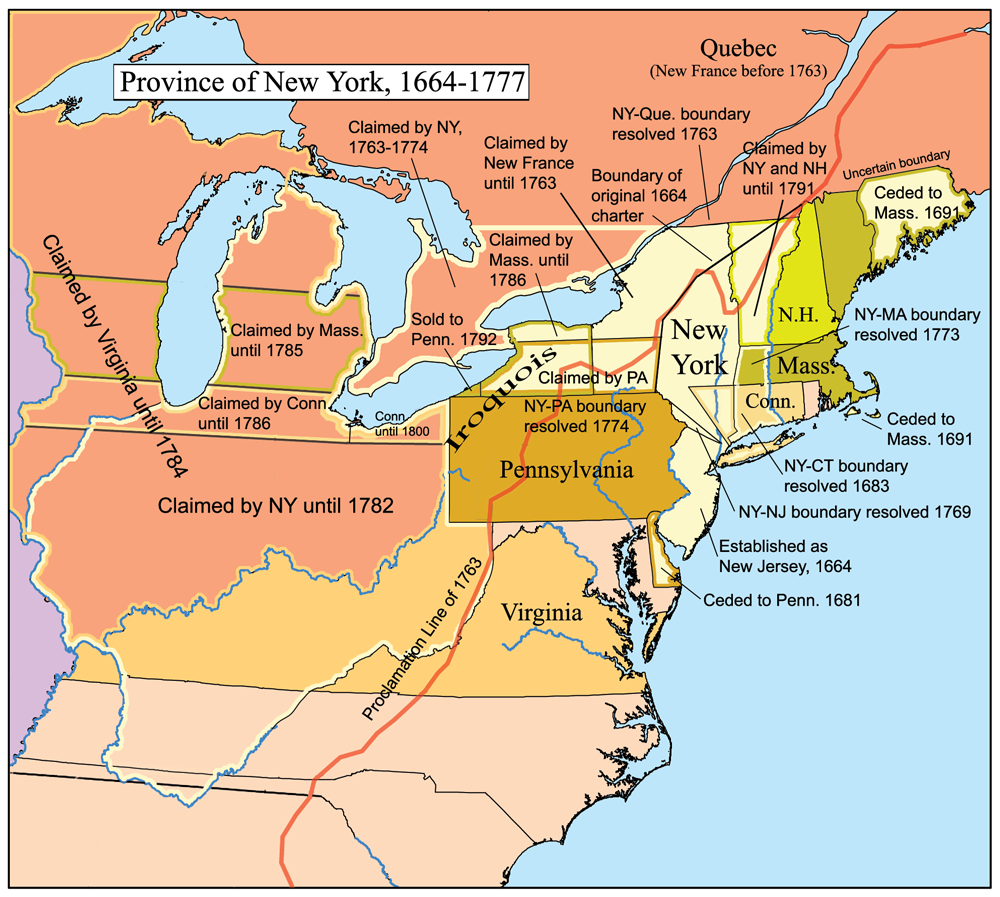
This is a map of the Province of New York that I made. Boundary disputes between colonies not involving New York are not shown. Based heavily on [1]. |
| ⧼wm-license-information-date⧽ | قالب:Original upload date |
| ⧼wm-license-information-source⧽ | No machine-readable source provided. Own work assumed (based on copyright claims). |
| ⧼wm-license-information-author⧽ | No machine-readable author provided. Kmusser assumed (based on copyright claims). |
ترخيص
تاريخ الملف
اضغط على زمن/تاريخ لرؤية الملف كما بدا في هذا الزمن.
| زمن/تاريخ | صورة مصغرة | الأبعاد | مستخدم | تعليق | |
|---|---|---|---|---|---|
| حالي | ★ مراجعة معتمدة 05:12، 16 أكتوبر 2023 | | 1٬000 × 897 (542 كيلوبايت) | Pastakhov (نقاش | مساهمات) | Upload https://upload.wikimedia.org/wikipedia/commons/9/9a/Nycolony.png |
لا يمكنك استبدال هذا الملف.
وصلات
لا يوجد صفحات تصل لهذه الصورة.