ملف:Nuremberg Map.png
حجم هذه المعاينة: 606 × 599 بكسل. البعد الآخر: 1٬702 × 1٬683 بكسل.
الملف الأصلي (1٬702 × 1٬683 بكسل حجم الملف: 1٫48 ميجابايت، نوع MIME: image/png)
وصف قصير
| ⧼wm-license-information-description⧽ |
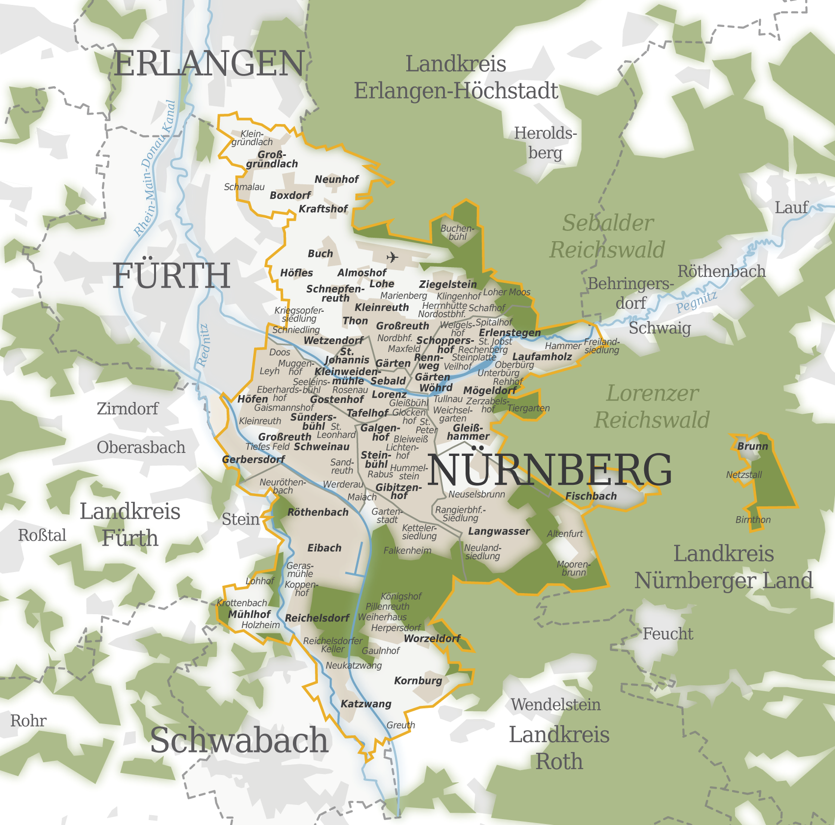
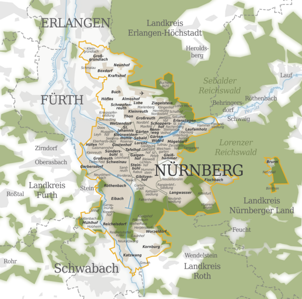
Deutsch: Karte der Nürnberger Stadtteile und Nachbarstädte; Gemarkungen im Stadtgebiet sind hervorgehoben
|
| ⧼wm-license-information-date⧽ | 2010 |
| ⧼wm-license-information-source⧽ | ⧼Wm-license-own-work⧽ |
| ⧼wm-license-information-author⧽ | Pirkheimer |
ترخيص
|
تاريخ الملف
اضغط على زمن/تاريخ لرؤية الملف كما بدا في هذا الزمن.
| زمن/تاريخ | صورة مصغرة | الأبعاد | مستخدم | تعليق | |
|---|---|---|---|---|---|
| حالي | ★ مراجعة معتمدة 18:01، 11 أكتوبر 2023 | | 1٬702 × 1٬683 (1٫48 ميجابايت) | Pastakhov (نقاش | مساهمات) | Upload https://upload.wikimedia.org/wikipedia/commons/a/ac/Nuremberg_Map.png |
لا يمكنك استبدال هذا الملف.
وصلات
لا يوجد صفحات تصل لهذه الصورة.