ملف:Nossage et benevent.jpg

حجم هذه المعاينة: 800 × 475 بكسل. البعد الآخر: 2٬197 × 1٬304 بكسل.
الملف الأصلي (2٬197 × 1٬304 بكسل حجم الملف: 1 ميجابايت، نوع MIME: image/jpeg)
وصف قصير
| ⧼wm-license-information-description⧽ |
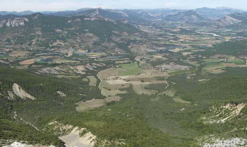
Français : Vue de la commune de Nossage-et-Bénévent depuis la montagne de Chabre. Le territoire communal se termine au niveau du torrent (le Céans) coulant de gauche à droite. A gauche, le haut des falaises d'Orpierre.
|
| ⧼wm-license-information-date⧽ | 2013, {{time}} – invalid date format 23 (help) |
| ⧼wm-license-information-source⧽ | ⧼Wm-license-own-work⧽ |
| ⧼wm-license-information-author⧽ | Etienne Baudon |
ترخيص
|
تاريخ الملف
اضغط على زمن/تاريخ لرؤية الملف كما بدا في هذا الزمن.
| زمن/تاريخ | صورة مصغرة | الأبعاد | مستخدم | تعليق | |
|---|---|---|---|---|---|
| حالي | ★ مراجعة معتمدة 21:02، 24 أكتوبر 2023 | | 2٬197 × 1٬304 (1 ميجابايت) | Pastakhov (نقاش | مساهمات) | Upload https://upload.wikimedia.org/wikipedia/commons/3/39/Nossage_et_benevent.jpg |
لا يمكنك استبدال هذا الملف.
وصلات
لا يوجد صفحات تصل لهذه الصورة.