ملف:North Wales Map.svg

حجم معاينة PNG لذلك الملف ذي الامتداد SVG: 501 × 599 بكسل. البعد الآخر: 1٬713 × 2٬048 بكسل.
الملف الأصلي (ملف SVG، أبعاده 512 × 612 بكسل، حجم الملف: 167 كيلوبايت)
وصف قصير
| ⧼wm-license-information-description⧽ |
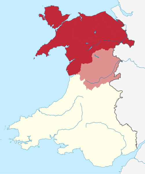
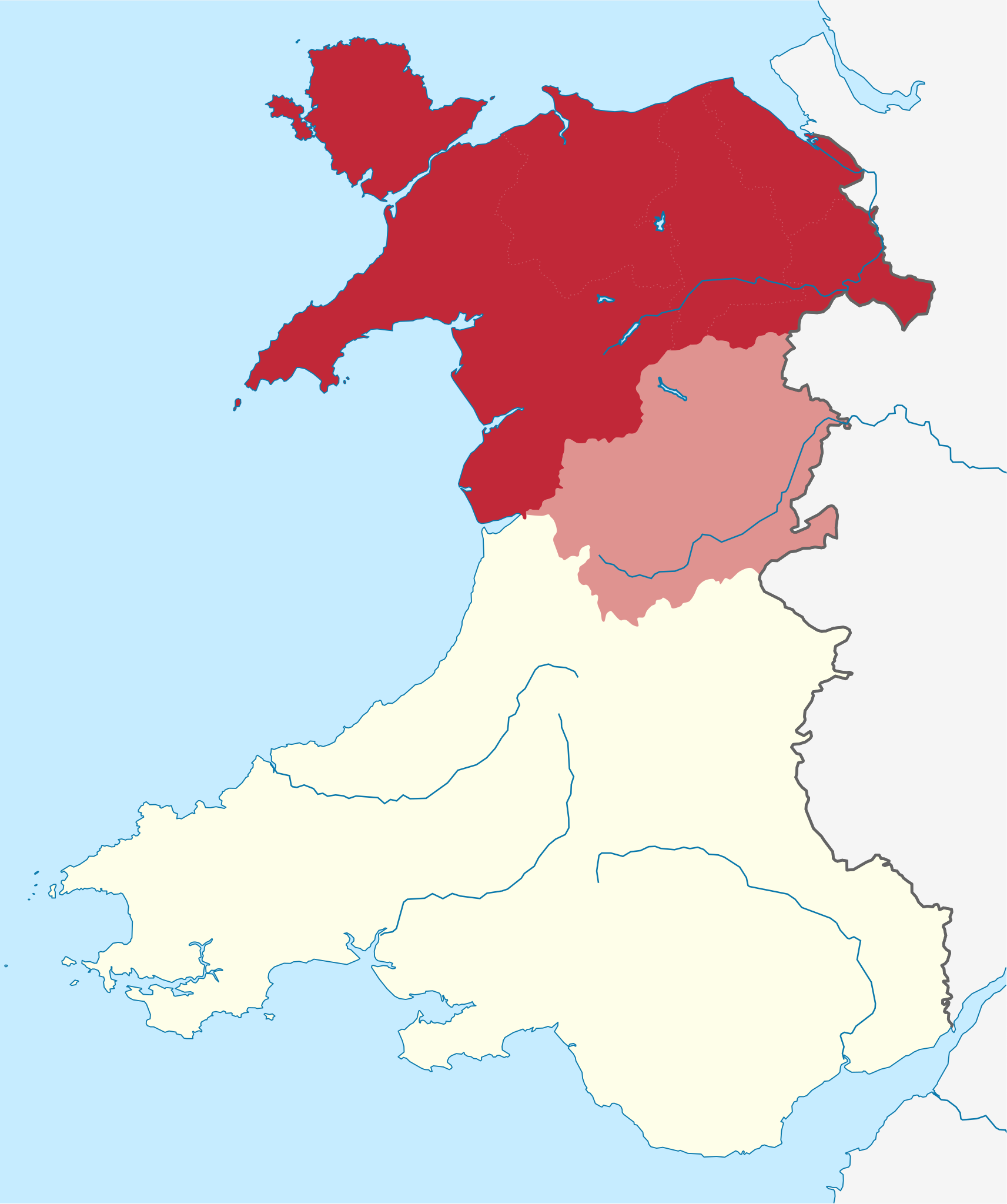
English: Map of the undefined region of North Wales, following the borders of the 6 Northern local authorities of Wales, Montgomeryshire (part of Powys, shaded in lighter tone) is sometimes considered North Wales due to historical definitions.
|
| ⧼wm-license-information-date⧽ | 2020 |
| ⧼wm-license-information-source⧽ | ⧼Wm-license-own-work⧽قالب:AttribSVGقالب:AttribSVGقالب:AttribSVG |
| ⧼wm-license-information-author⧽ | Dank · Jay |
ترخيص
|
تاريخ الملف
اضغط على زمن/تاريخ لرؤية الملف كما بدا في هذا الزمن.
| زمن/تاريخ | صورة مصغرة | الأبعاد | مستخدم | تعليق | |
|---|---|---|---|---|---|
| حالي | ★ مراجعة معتمدة 09:44، 25 ديسمبر 2023 | | 512 × 612 (167 كيلوبايت) | Pastakhov (نقاش | مساهمات) | Upload https://upload.wikimedia.org/wikipedia/commons/8/82/North_Wales_Map.svg |
لا يمكنك استبدال هذا الملف.
وصلات
لا يوجد صفحات تصل لهذه الصورة.