ملف:Newark Castle - geograph.org.uk - 1127867.jpg
لا توجد دقة أعلى متوفرة.
Newark_Castle_-_geograph.org.uk_-_1127867.jpg (629 × 438 بكسل حجم الملف: 157 كيلوبايت، نوع MIME: image/jpeg)
وصف قصير
| ⧼wm-license-information-description⧽ |
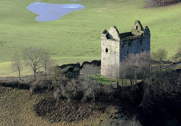
English: Newark Castle Newark Castle is a rectangular tower with 3m thick walls, first mentioned in 1423, and standing on a natural stronghold, reinforced by a 16th century barmkin. The castle was passed back to the Crown in 1445 from the Earls of Douglas and became one of only two royal castles in the Middle March, serving both as an estate centre for Ettrick Forest and a hunting retreat. In 1547-8, the English took the barmkin, burnt the stables, but could not take the house. They came back the next year and did so. In 1645, 100 prisoners from the battle of Philiphaugh were slaughtered in the courtyard, and Cromwells troops occupied it in 1650. (Source: Borders and Berwick, an Architectural Guide by Charles Alexander Strang).
|
| ⧼wm-license-information-date⧽ | 2009 |
| ⧼wm-license-information-source⧽ | From geograph.org.uk |
| ⧼wm-license-information-author⧽ | Walter Baxter |
| ⧼wm-license-cc-attribution⧽ (قالب:I18n/Credit line) |
Walter Baxter / Newark Castle / |
55°33′32″N 2°54′37″W / 55.55890°N 2.9102°W قالب:Object location
_heading:225)
ترخيص
تاريخ الملف
اضغط على زمن/تاريخ لرؤية الملف كما بدا في هذا الزمن.
| زمن/تاريخ | صورة مصغرة | الأبعاد | مستخدم | تعليق | |
|---|---|---|---|---|---|
| حالي | ★ مراجعة معتمدة 22:09، 26 أكتوبر 2023 | | 629 × 438 (157 كيلوبايت) | Pastakhov (نقاش | مساهمات) | Upload https://upload.wikimedia.org/wikipedia/commons/a/ac/Newark_Castle_-_geograph.org.uk_-_1127867.jpg |
لا يمكنك استبدال هذا الملف.
وصلات
لا يوجد صفحات تصل لهذه الصورة.