ملف:Neubaugebiet Rosenbühl HOF00178 RAW-Export cens.png

حجم هذه المعاينة: 800 × 486 بكسل. البعدان الآخران: 2٬560 × 1٬556 بكسل | 9٬228 × 5٬608 بكسل.
الملف الأصلي (9٬228 × 5٬608 بكسل حجم الملف: 80٫83 ميجابايت، نوع MIME: image/png)
وصف قصير
| ⧼wm-license-information-description⧽ |
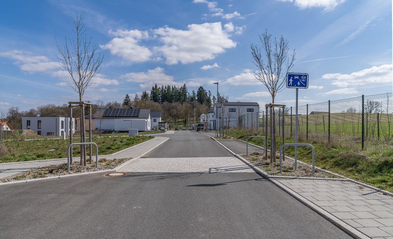
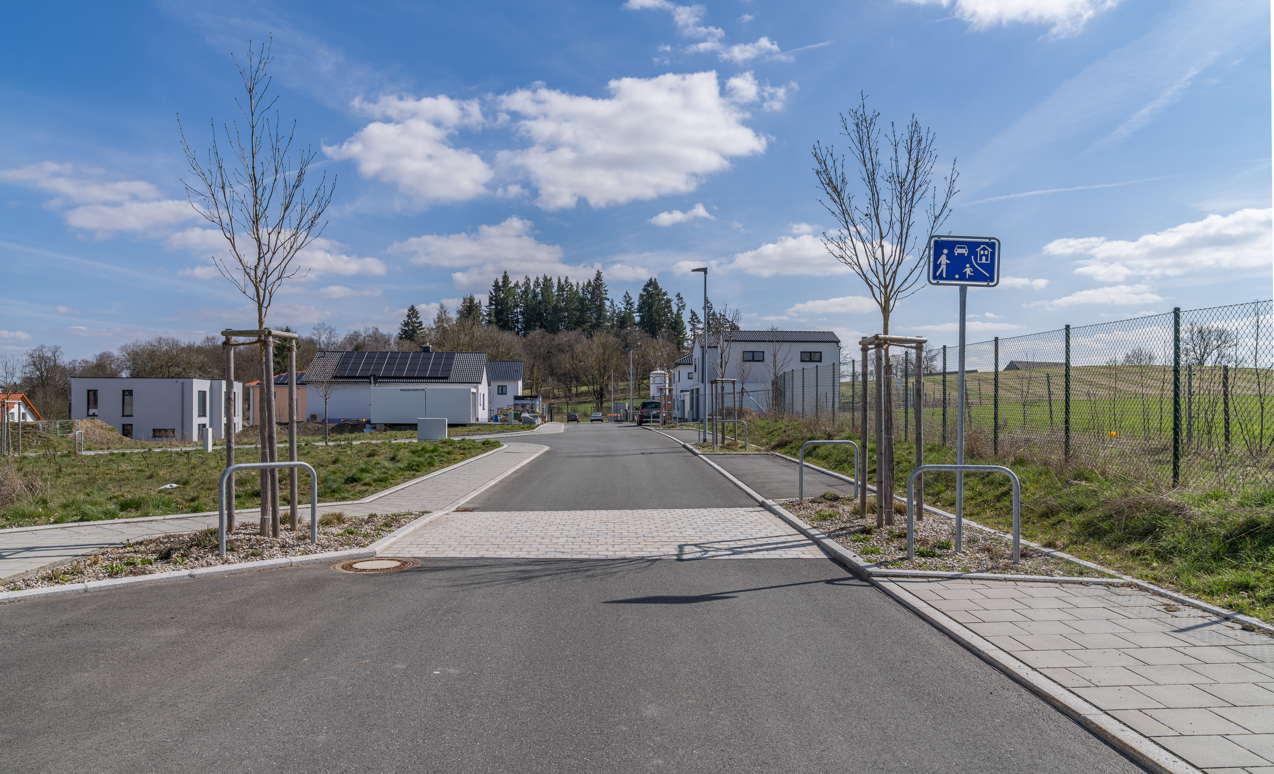
Deutsch: Ansicht des Komplexes des Neubaugebiets Rosenbühl, das etwa seit 2020 bis in 2023 hinein aufgebaut wird. Das Neubaugebiet liegt etwa zwischen dem Johann-Christian-Reinhart-Gymnasium Hof und dem Gut Geigen im Nordwesten. Zum Neubaugebiet zählen die Maria-Benda-Straße im Westen (sie ist auch ein verkehrsberuhigter Bereich), die Mendelssohn-Bartholdy-Straße, die Fanny-Hensel-Straße und die Emilie-Mayer-Straße im Osten. Hier sieht man die Maria-Benda-Straße. Die Ansicht ergibt sich, wenn man von der Carl-Orff-Straße kommt.
English: View of the complex of the Rosenbühl new development area, which has been under construction since about 2020 and into 2023. The new development area is located approximately between Johann-Christian-Reinhart-Gymnasium Hof and Gut Geigen in the northwest. The new development area includes Maria-Benda-Straße in the west (it is also a traffic-calmed area), Mendelssohn-Bartholdy-Straße, Fanny-Hensel-Straße and Emilie-Mayer-Straße in the east. Here you can see Maria-Benda-Straße. The view results when one comes from Carl-Orff-Straße.
|
| ⧼wm-license-information-date⧽ | 2023 |
| ⧼wm-license-information-source⧽ | ⧼Wm-license-own-work⧽ |
| ⧼wm-license-information-author⧽ | PantheraLeo1359531 |
50°18′28″N 11°53′32″E / 50.307912°N 11.892322°E
ترخيص
تاريخ الملف
اضغط على زمن/تاريخ لرؤية الملف كما بدا في هذا الزمن.
| زمن/تاريخ | صورة مصغرة | الأبعاد | مستخدم | تعليق | |
|---|---|---|---|---|---|
| حالي | ★ مراجعة معتمدة 19:46، 23 نوفمبر 2023 | | 9٬228 × 5٬608 (80٫83 ميجابايت) | Pastakhov (نقاش | مساهمات) | Upload https://upload.wikimedia.org/wikipedia/commons/1/1d/Neubaugebiet_Rosenb%C3%BChl_HOF00178_RAW-Export_cens.png |
لا يمكنك استبدال هذا الملف.
وصلات
لا يوجد صفحات تصل لهذه الصورة.
معلومات الصورة (ميتا)
تصنيفات:
- Photographs of Hof (Saale) by PantheraLeo1359531
- Hof (Saale) photographs taken on 2023-04-10
- Photographs created by PantheraLeo1359531 on 2023-04-10
- Photographs with aspect ratio of 3:2 by PantheraLeo1359531
- ISO speed rating 50 by PantheraLeo1359531
- Taken with Sony FE 24-70mm F2.8 GM by PantheraLeo1359531
- Taken with Sony ILCE-7RM4 by User:PantheraLeo1359531
- ISO speed rating 50
- Taken with Sony FE 24-70mm F2.8 GM
- Taken with Sony ILCE-7RM4
- Images of Hof (Saale) taken with Sony ILCE-7RM4
- Lossless compressed images of Hof (Saale)
- Self-published work
- Maria-Benda-Straße (Hof (Saale))