ملف:Netherlands, Kaag en Braassem, Googer polder, map of 1855.jpg
الملف الأصلي (4٬000 × 4٬590 بكسل حجم الملف: 8٫95 ميجابايت، نوع MIME: image/jpeg)
وصف قصير
| ⧼wm-license-information-description⧽ |
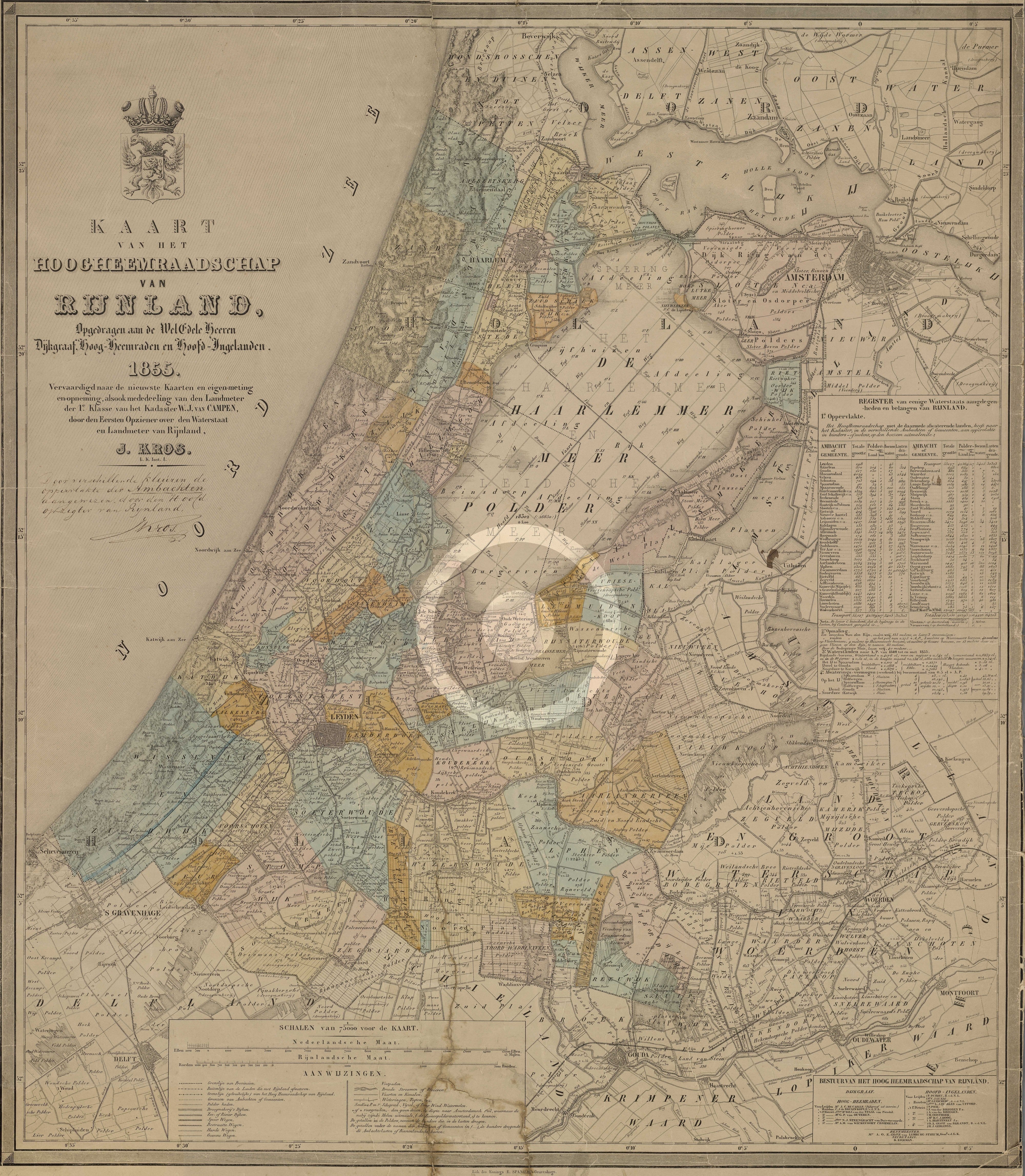
(Dutch) English: Locator map of the Googer Polder in the former municipality of Alkemade (Province of South Holland, Netherlands) in 1855. The polder currently is part of the municipality of Kaag en Braassem.
|
| ⧼wm-license-information-date⧽ | 1855 |
| ⧼wm-license-information-source⧽ | http://watwaswaar.nl/#Ke-Om-2-1-1v-1-2ZZA-27zk---l8Z |
| ⧼wm-license-information-author⧽ | J.Kros |
| ⧼wm-license-information-permission⧽ (⧼wm-license-information-permission-reusing-text⧽) |
This image from 1855 is in the public domain. [In the Netherlands copyright expires 70 years after the death of the author or 70 years after first publication in the case of anonymous or pseudonymous works or works published by a legal entity]. [Het auteursrecht in Nederland vervalt 70 jaar na de dood van de auteur of 70 jaar na de eerste openbaarmaking van het werk, indien het gaat om een anoniem of om een onder pseudoniem verschenen werk of werk van een rechtspersoon]. |
The center of the Googer polder is at: 52°12′33.25″N 4°37′58.07″E / 52.2092361°N 4.6327972°E
ترخيص
تاريخ الملف
اضغط على زمن/تاريخ لرؤية الملف كما بدا في هذا الزمن.
| زمن/تاريخ | صورة مصغرة | الأبعاد | مستخدم | تعليق | |
|---|---|---|---|---|---|
| حالي | ★ مراجعة معتمدة 19:02، 26 أكتوبر 2023 | | 4٬000 × 4٬590 (8٫95 ميجابايت) | Pastakhov (نقاش | مساهمات) | Upload https://upload.wikimedia.org/wikipedia/commons/6/60/Netherlands%2C_Kaag_en_Braassem%2C_Googer_polder%2C_map_of_1855.jpg |
لا يمكنك استبدال هذا الملف.
وصلات
لا يوجد صفحات تصل لهذه الصورة.