ملف:Navigation on St Clair River.jpg
حجم هذه المعاينة: 800 × 561 بكسل. البعد الآخر: 1٬500 × 1٬051 بكسل.
الملف الأصلي (1٬500 × 1٬051 بكسل حجم الملف: 641 كيلوبايت، نوع MIME: image/jpeg)
| ⧼wm-license-information-description⧽ |
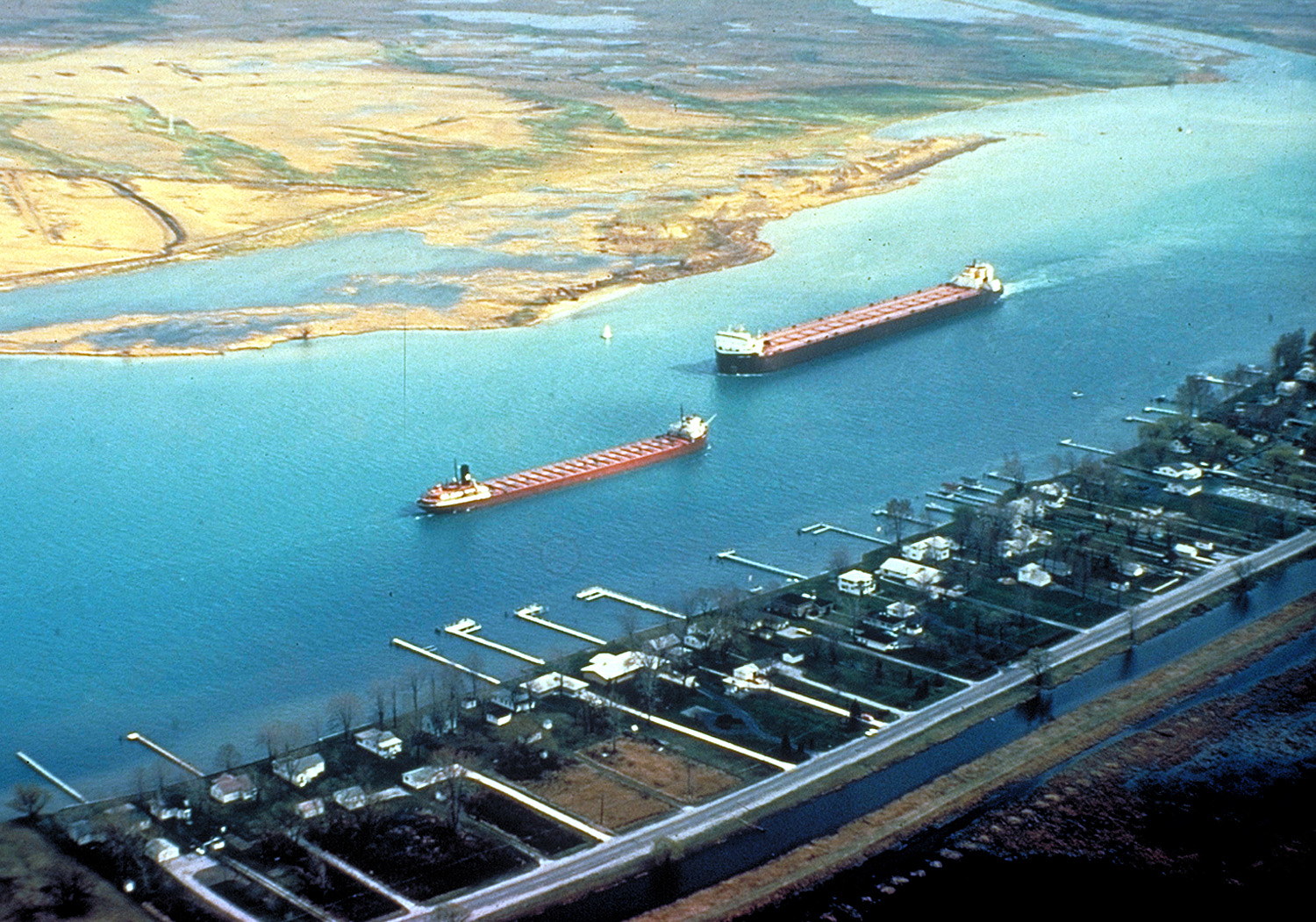
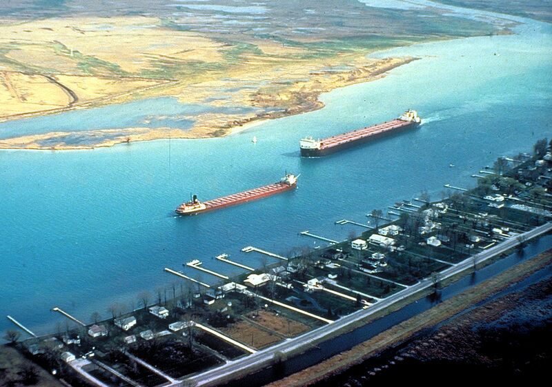
English: Great Lakes freighters navigating on the lower St. Clair River between Michigan, USA and Ontario, Canada. The view is from the American side looking across to Canada. The Walpole Island Indian Reserve is directly across on the Canadian side.
|
| ⧼wm-license-information-date⧽ | not specified or unknown |
| ⧼wm-license-information-source⧽ | U.S. Army Corps of Engineers Digital Visual Library Image page Image description page Digital Visual Library home page |
| ⧼wm-license-information-author⧽ | U.S. Army Corps of Engineers, photographer not specified or unknown |
| ⧼wm-license-information-permission⧽ (⧼wm-license-information-permission-reusing-text⧽) |
|
| قالب:Location/i18n | St. Clair River, east of Detroit, Michigan, USA |
تاريخ الملف
اضغط على زمن/تاريخ لرؤية الملف كما بدا في هذا الزمن.
| زمن/تاريخ | صورة مصغرة | الأبعاد | مستخدم | تعليق | |
|---|---|---|---|---|---|
| حالي | ★ مراجعة معتمدة 15:25، 22 نوفمبر 2023 | | 1٬500 × 1٬051 (641 كيلوبايت) | Pastakhov (نقاش | مساهمات) | Upload https://upload.wikimedia.org/wikipedia/commons/f/f0/Navigation_on_St_Clair_River.jpg |
لا يمكنك استبدال هذا الملف.
وصلات
لا يوجد صفحات تصل لهذه الصورة.