ملف:NOAA map of Duck Galloo Ridge (cropped) showing Timber, Swetman, Main Duck and Yorkshire islands, and some subsurface shoals.jpg
حجم هذه المعاينة: 800 × 488 بكسل. البعد الآخر: 1٬026 × 626 بكسل.
الملف الأصلي (1٬026 × 626 بكسل حجم الملف: 647 كيلوبايت، نوع MIME: image/jpeg)
| ⧼wm-license-information-description⧽ |
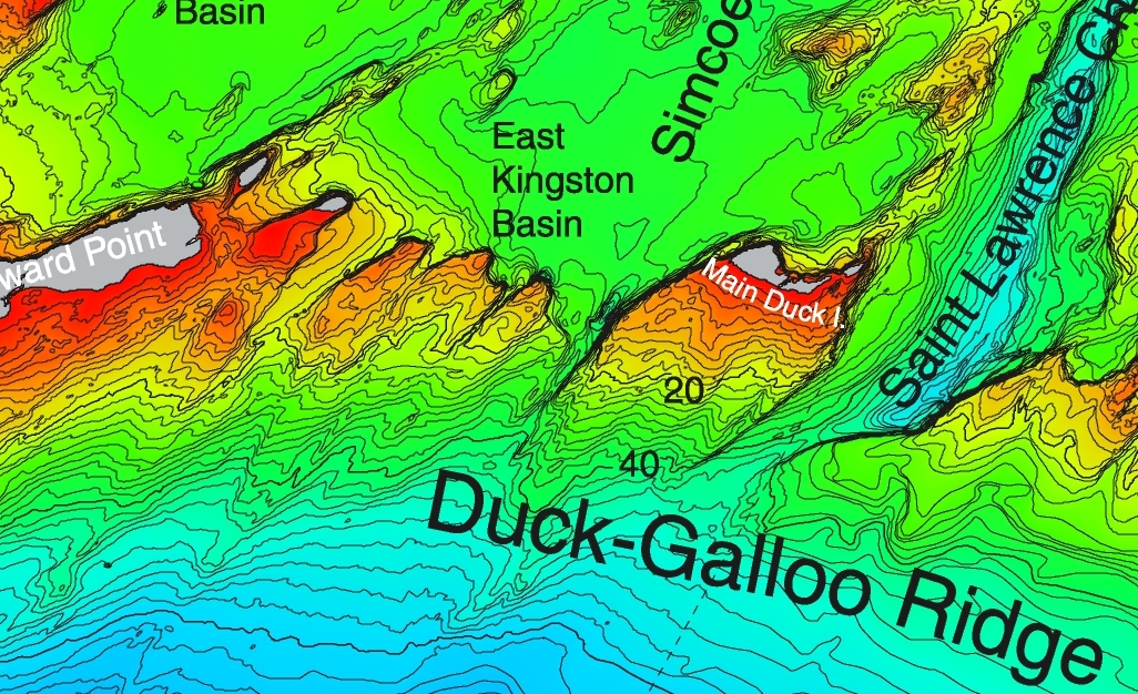
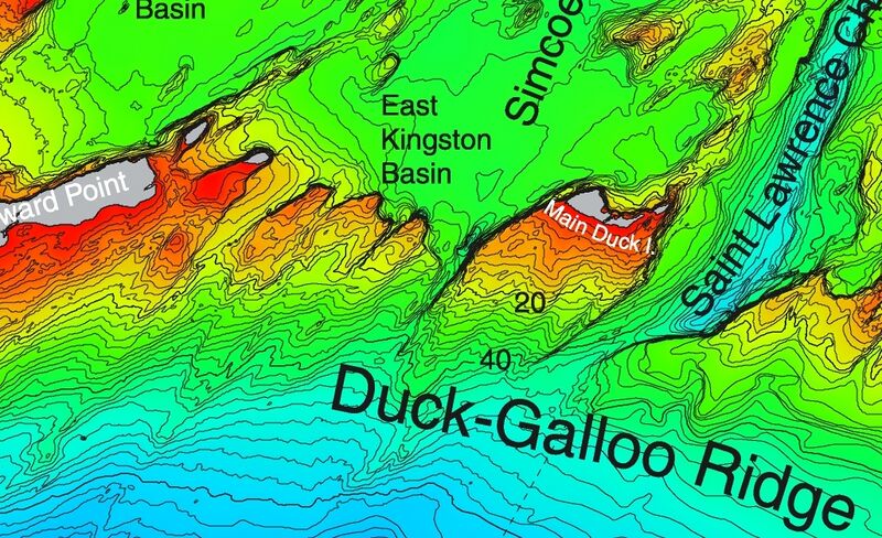
This detail from a NOAA map of Duck Galloo Ridge shows the Northeast corner of Lake Ontario. As lakes go Lake Ontario is relatively deep. The portion north of this ridge is significantly less deep. This detail shows Swetman Island, Timber Island, Main Duck Island, and Yorkshire Island, and some subsurface shoals. |
||
| ⧼wm-license-information-date⧽ | |||
| ⧼wm-license-information-source⧽ | https://ngdc.noaa.gov/mgg/greatlakes/lakeontario_cdrom/html/newnames.htm | ||
| ⧼wm-license-information-author⧽ | |||
| ⧼wm-license-information-permission⧽ (⧼wm-license-information-permission-reusing-text⧽) |
|
||
| ⧼wm-license-information-other-versions⧽ |

تاريخ الملف
اضغط على زمن/تاريخ لرؤية الملف كما بدا في هذا الزمن.
| زمن/تاريخ | صورة مصغرة | الأبعاد | مستخدم | تعليق | |
|---|---|---|---|---|---|
| حالي | ★ مراجعة معتمدة 13:30، 26 ديسمبر 2023 | | 1٬026 × 626 (647 كيلوبايت) | Pastakhov (نقاش | مساهمات) | Upload https://upload.wikimedia.org/wikipedia/commons/3/3f/NOAA_map_of_Duck_Galloo_Ridge_%28cropped%29_showing_Timber%2C_Swetman%2C_Main_Duck_and_Yorkshire_islands%2C_and_some_subsurface_shoals.jpg |
لا يمكنك استبدال هذا الملف.
وصلات
لا يوجد صفحات تصل لهذه الصورة.
_showing_Timber,_Swetman,_Main_Duck_and_Yorkshire_islands,_and_some_subsurface_shoals.jpg&oldid=3844261)