ملف:Mulanje ETM 26may02.jpg
الملف الأصلي (6٬400 × 4٬800 بكسل حجم الملف: 3٫66 ميجابايت، نوع MIME: image/jpeg)
وصف قصير
| ⧼wm-license-information-description⧽ |
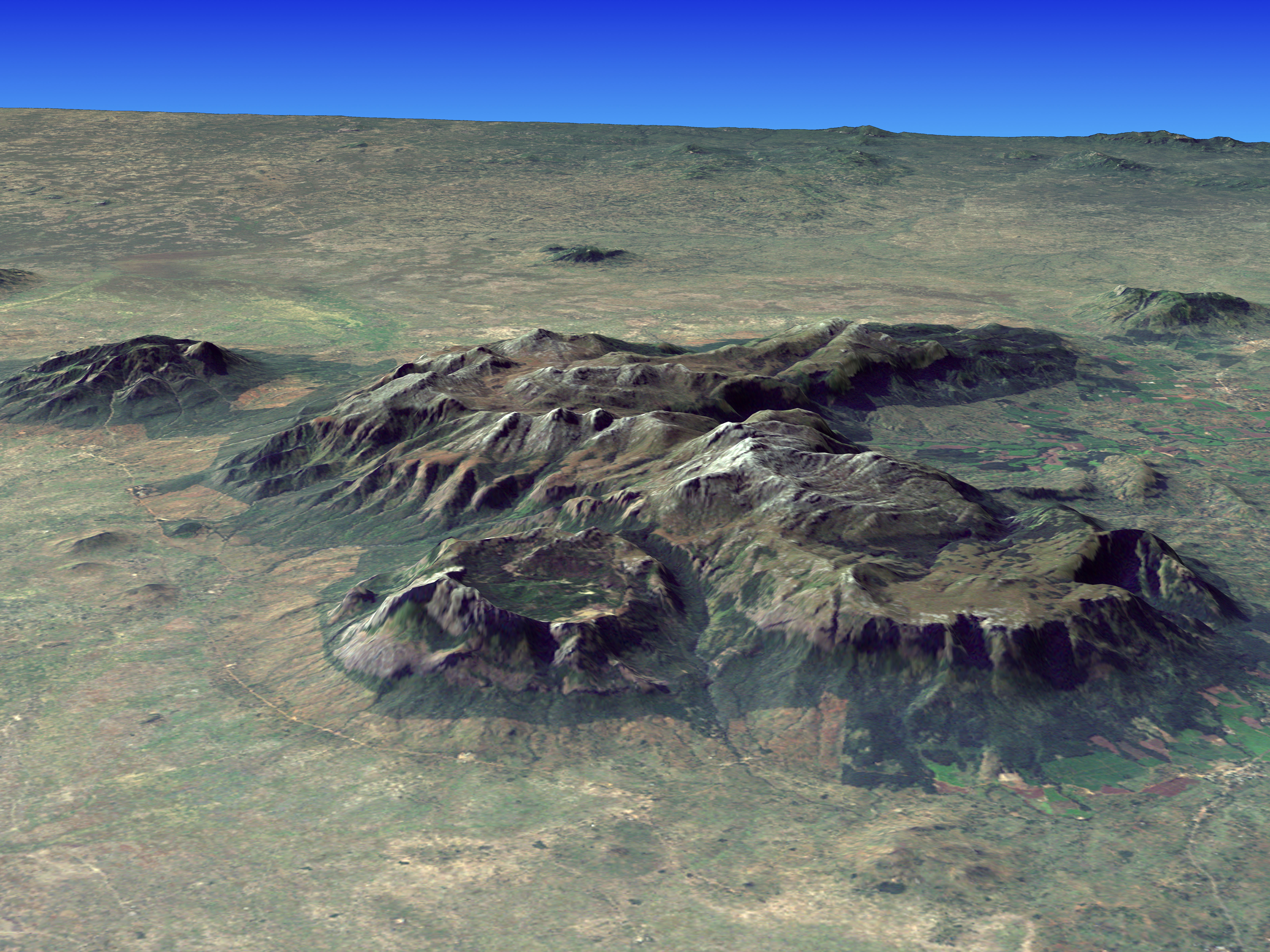
Composite image of w:Mount Mulanje, Malawi. The image was created by merging imagery from the Landsat 7 satellite’s Enhanced Thematic Mapper Plus (ETM+) instrument with elevation data from the Shuttle Radar Topography Mission (SRTM). This true-color image was created by combining the red, green, and blue wavelengths (ETM+ bands 3, 2, and 1). The resulting image was then draped over a visualization of the SRTM data with no vertical exaggeration. The ETM+ scene was acquired on May 26, 2002, while the elevation data were collected by the STRM instrument during its flight on the Space Shuttle Endeavour in February 2000. |
| ⧼wm-license-information-date⧽ | 2002 |
| ⧼wm-license-information-source⧽ | http://earthobservatory.nasa.gov/Newsroom/NewImages/images.php3?img_id=16662 |
| ⧼wm-license-information-author⧽ | Jesse Allen, NASA Earth Observatory, using Landsat data and SRTM data courtesy of the University of Maryland’s Global Land Cover Facility |
| ⧼wm-license-information-permission⧽ (⧼wm-license-information-permission-reusing-text⧽) |
Public domain |
ترخيص
تاريخ الملف
اضغط على زمن/تاريخ لرؤية الملف كما بدا في هذا الزمن.
| زمن/تاريخ | صورة مصغرة | الأبعاد | مستخدم | تعليق | |
|---|---|---|---|---|---|
| حالي | ★ مراجعة معتمدة 02:56، 25 أكتوبر 2023 | | 6٬400 × 4٬800 (3٫66 ميجابايت) | Pastakhov (نقاش | مساهمات) | Upload https://upload.wikimedia.org/wikipedia/commons/2/28/Mulanje_ETM_26may02.jpg |
لا يمكنك استبدال هذا الملف.
وصلات
لا يوجد صفحات تصل لهذه الصورة.